Ulapes elevation
Ulapes (La Rioja, Departamento de General San Martín), Argentina elevation is 411 meters and Ulapes elevation in feet is 1348 ft above sea level [src 1]. Ulapes is a seat of a second-order administrative division (feature code) with elevation that is 61 meters (200 ft) bigger than average city elevation in Argentina.
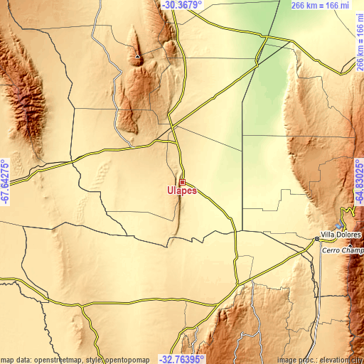
Below is the Elevation map of Ulapes, which displays elevation range with different colors. Scale of the first map is from 366 to 968 m (1201 to 3176 ft) with average elevation of 508.6 meters (=1669 ft) [note 1]
These maps also provides idea of topography and contour of this city, they are displayed at different zoom levels. More info about maps, scale and edge coordinates you can find below images.

| \ | Map #1 | Topo.Map |
| Scale [m] | 366..968 m | × |
| Scale [ft] | 1201..3176 ft | × |
| Average | 508.6 m = 1669 ft | × |
| Width | 8.33 km = 5.2 mi | 266.4 km = 165.5 mi |
| Height | 8.33 km = 5.2 mi | 266.4 km = 165.5 mi |
| ↑Max Latitude | -31.536172° | -30.3679° |
| Latitude at center | -31.57362° | -31.57362° |
| ↓Min Latitude | -31.611052° | -32.76395° |
| ← Min Longitude | -66.280445° | -67.64275° |
| Longitude center | -66.2365° | -66.2365° |
| →Max Longitude | -66.192555° | -64.83025° |
Nearby cities:
Cities around Ulapes sort by population:
• Villa Dolores elevation 523 m
107.3 km,  112°
112°
• Villa Cura Brochero 909 m
116.3 km,  97°
97°
• San Francisco del Monte de Oro 792 m
114.4 km,  174°
174°
• Candelaria 410 m
66.7 km,  144°
144°
• Luján 616 m
92.6 km,  162°
162°
• San Carlos 756 m
116.3 km,  67°
67°
• Salsacate 927 m
112.4 km,  75°
75°
• Libertador General San Martín 944 m
107 km,  150°
150°
• Olta 520 m
104.8 km,  358°
358°
• Malanzán 889 m
92.6 km,  337°
337°
• Milagro 377 m
67 km,  20°
20°
• Chepes 644 m
42.1 km,  307°
307°
Multilingual:
 En español:
Ulapes elevación 411 m.
 En France:
Ulapes élévation 411 m.


Sources and notes:
- [note 1] Map square and city borders are not equal. Map elevation data is calculated only from area inside that square.
- [src 1] Elevation data from geonames database provided with same terms of usage.
- [src 2] The elevation map of Ulapes is generated using elevation data from NASA's 3 arcsec (90m) resolution SRTM data.
- [src 3] Base (background) map © OpenStreetMap contributors tiles are generated by Geofabrik and OpenTopoMap.
Copyright & License:
This Ulapes Elevation Map is licensed under CC BY-SA. You may reuse any part from this page, if you give a proper credit by linking to this URL:
 More info on terms of use page.