Alvear elevation
Alvear (Corrientes, Departamento de General Alvear), Argentina elevation is 65 meters and Alvear elevation in feet is 213 ft above sea level [src 1]. Alvear is a seat of a second-order administrative division (feature code) with elevation that is 285 meters (935 ft) smaller than average city elevation in Argentina.
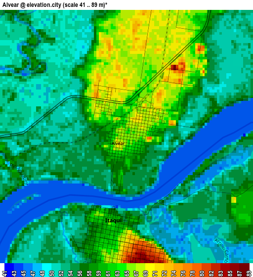
Below is the Elevation map of Alvear, which displays elevation range with different colors. Scale of the first map is from 41 to 89 m (135 to 292 ft) with average elevation of 55.9 meters (=183 ft) [note 1]
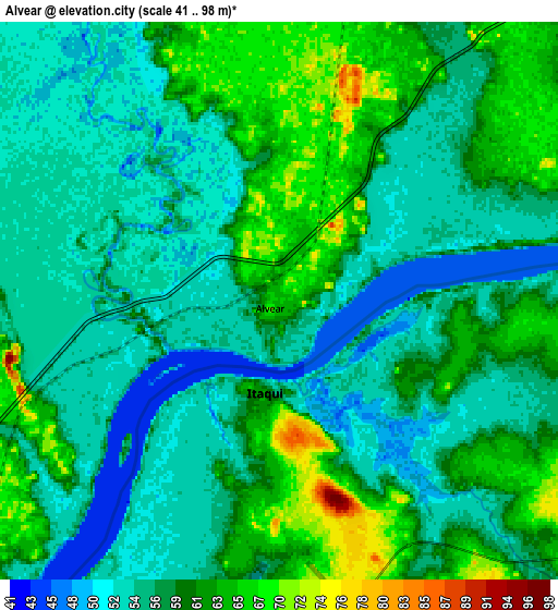
These maps also provides idea of topography and contour of this city, they are displayed at different zoom levels. More info about maps, scale and edge coordinates you can find below images.
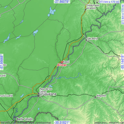
| \ | Map #1 | Map #2 | Topo.Map |
| Scale [m] | 41..89 m | 41..98 m | × |
| Scale [ft] | 135..292 ft | 135..322 ft | × |
| Average | 55.9 m = 183 ft | 57.9 m = 190 ft | × |
| Width | 8.54 km = 5.3 mi | 17.08 km = 10.6 mi | 273.2 km = 169.8 mi |
| Height | 8.54 km = 5.3 mi | 17.08 km = 10.6 mi | 273.2 km = 169.8 mi |
| ↑Max Latitude | -29.058423° | -29.020003° | -27.86078° |
| Latitude at center | -29.09683° | -29.09683° | -29.09683° |
| ↓Min Latitude | -29.135222° | -29.1736° | -30.31821° |
| ← Min Longitude | -56.594375° | -56.638321° | -57.95668° |
| Longitude center | -56.55043° | -56.55043° | -56.55043° |
| →Max Longitude | -56.506485° | -56.462539° | -55.14418° |
Nearby cities:
Cities around Alvear sort by population:
• Paso de los Libres elevation 73 m
86 km,  217°
217°
• Mercedes 96 m
148.4 km,  266°
266°
• Gobernador Virasora 133 m
126.9 km,  23°
23°
• Santo Tomé 81 m
78.5 km,  39°
39°
• La Cruz 69 m
12.5 km,  226°
226°
• Concepción 67 m
152.1 km,  301°
301°
• Azara 127 m
143.2 km, 36°
• Yapeyú 64 m
48.9 km,  212°
212°
• Tres Capones 157 m
152.4 km, 37°
• Garruchos 80 m
135 km, 40°
• Bonpland 75 m
116.9 km, 226°
• Apóstoles 179 m
152.8 km,  30°
30°
Multilingual:
 En español:
Alvear elevación 65 m.
 En France:
Alvear élévation 65 m.


Sources and notes:
- [note 1] Map square and city borders are not equal. Map elevation data is calculated only from area inside that square.
- [src 1] Elevation data from geonames database provided with same terms of usage.
- [src 2] The elevation map of Alvear is generated using elevation data from NASA's 3 arcsec (90m) resolution SRTM data.
- [src 3] Base (background) map © OpenStreetMap contributors tiles are generated by Geofabrik and OpenTopoMap.
Copyright & License:
This Alvear Elevation Map is licensed under CC BY-SA. You may reuse any part from this page, if you give a proper credit by linking to this URL:
 More info on terms of use page.