La Cruz elevation
La Cruz (Corrientes, Departamento de San Martín), Argentina elevation is 69 meters and La Cruz elevation in feet is 226 ft above sea level [src 1]. La Cruz is a seat of a second-order administrative division (feature code) with elevation that is 281 meters (922 ft) smaller than average city elevation in Argentina.
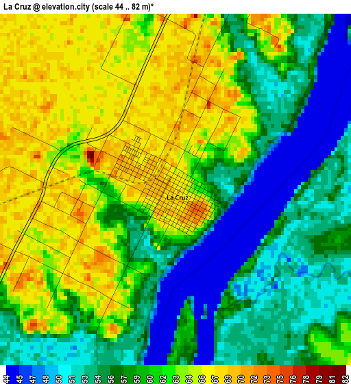
Below is the Elevation map of La Cruz, which displays elevation range with different colors. Scale of the first map is from 44 to 82 m (144 to 269 ft) with average elevation of 59.4 meters (=195 ft) [note 1]
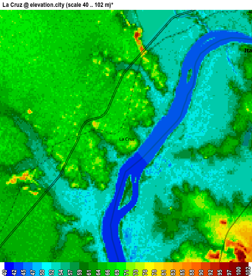
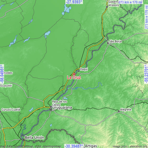
These maps also provides idea of topography and contour of this city, they are displayed at different zoom levels. More info about maps, scale and edge coordinates you can find below images.
| \ | Map #1 | Map #2 | Topo.Map |
| Scale [m] | 44..82 m | 40..102 m | × |
| Scale [ft] | 144..269 ft | 131..335 ft | × |
| Average | 59.4 m = 195 ft | 60.4 m = 198 ft | × |
| Width | 8.53 km = 5.3 mi | 17.07 km = 10.6 mi | 273 km = 169.6 mi |
| Height | 8.53 km = 5.3 mi | 17.07 km = 10.6 mi | 273 km = 169.6 mi |
| ↑Max Latitude | -29.136052° | -29.097661° | -27.9393° |
| Latitude at center | -29.17443° | -29.17443° | -29.17443° |
| ↓Min Latitude | -29.212793° | -29.251142° | -30.39487° |
| ← Min Longitude | -56.687205° | -56.731151° | -58.04951° |
| Longitude center | -56.64326° | -56.64326° | -56.64326° |
| →Max Longitude | -56.599315° | -56.555369° | -55.23701° |
Nearby cities:
Cities around La Cruz sort by population:
• Paso de los Libres elevation 73 m
73.7 km,  215°
215°
• Curuzú Cuatiá 79 m
152.9 km,  243°
243°
• Mercedes 96 m
139 km,  269°
269°
• Gobernador Virasora 133 m
138.5 km,  25°
25°
• Santo Tomé 81 m
91 km,  40°
40°
• Alvear 65 m
12.5 km,  46°
46°
• Concepción 67 m
149.3 km,  305°
305°
• Yapeyú 64 m
36.9 km,  207°
207°
• Mariano I. Loza 122 m
152.1 km,  261°
261°
• Libertad 85 m
149.2 km,  229°
229°
• Garruchos 80 m
147.4 km, 40°
• Bonpland 75 m
104.4 km, 226°
Multilingual:
 En español:
La Cruz elevación 69 m.
 En France:
La Cruz élévation 69 m.


Sources and notes:
- [note 1] Map square and city borders are not equal. Map elevation data is calculated only from area inside that square.
- [src 1] Elevation data from geonames database provided with same terms of usage.
- [src 2] The elevation map of La Cruz is generated using elevation data from NASA's 3 arcsec (90m) resolution SRTM data.
- [src 3] Base (background) map © OpenStreetMap contributors tiles are generated by Geofabrik and OpenTopoMap.
Copyright & License:
This La Cruz Elevation Map is licensed under CC BY-SA. You may reuse any part from this page, if you give a proper credit by linking to this URL:
 More info on terms of use page.