Gobernador Roca elevation
Gobernador Roca (Misiones, Departamento de San Ignacio), Argentina elevation is 185 meters and Gobernador Roca elevation in feet is 607 ft above sea level [src 1]. Gobernador Roca is a populated place (feature code) with elevation that is 165 meters (541 ft) smaller than average city elevation in Argentina.
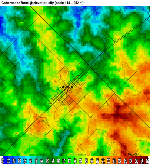
Below is the Elevation map of Gobernador Roca, which displays elevation range with different colors. Scale of the first map is from 114 to 252 m (374 to 827 ft) with average elevation of 179.3 meters (=588 ft) [note 1]
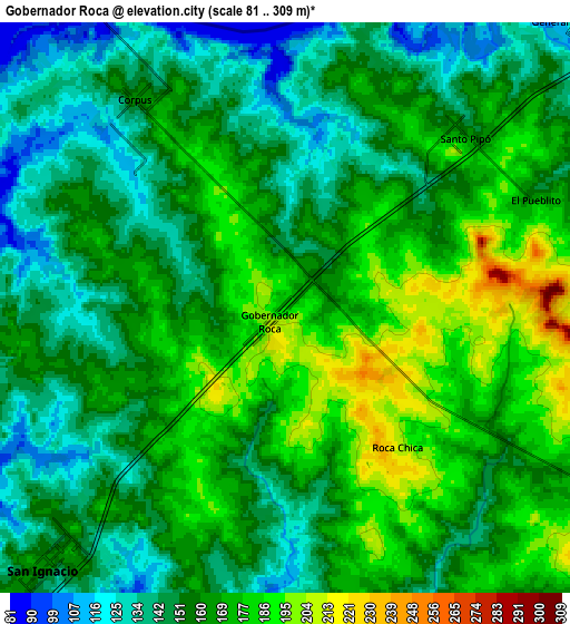
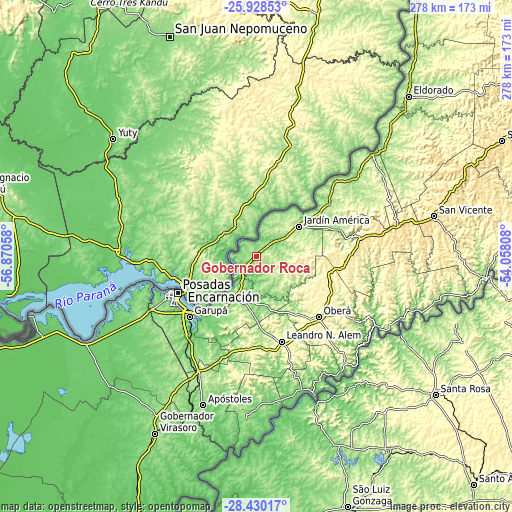
These maps also provides idea of topography and contour of this city, they are displayed at different zoom levels. More info about maps, scale and edge coordinates you can find below images.
| \ | Map #1 | Map #2 | Topo.Map |
| Scale [m] | 114..252 m | 81..309 m | × |
| Scale [ft] | 374..827 ft | 266..1014 ft | × |
| Average | 179.3 m = 588 ft | 160.4 m = 526 ft | × |
| Width | 8.69 km = 5.4 mi | 17.39 km = 10.8 mi | 278.2 km = 172.9 mi |
| Height | 8.69 km = 5.4 mi | 17.39 km = 10.8 mi | 278.2 km = 172.9 mi |
| ↑Max Latitude | -27.147263° | -27.108152° | -25.92853° |
| Latitude at center | -27.18636° | -27.18636° | -27.18636° |
| ↓Min Latitude | -27.225444° | -27.264514° | -28.43017° |
| ← Min Longitude | -55.508275° | -55.552221° | -56.87058° |
| Longitude center | -55.46433° | -55.46433° | -55.46433° |
| →Max Longitude | -55.420385° | -55.376439° | -54.05808° |
Nearby cities:
Cities around Gobernador Roca sort by population:
• Jardín América elevation 227 m
28.4 km,  55°
55°
• Candelaria 119 m
41.1 km,  222°
222°
• Santo Pipó 174 m
7.4 km,  47°
47°
• Puerto Leoni 95 m
36.9 km, 53°
• Bonpland 187 m
32.9 km,  182°
182°
• General Alvear 290 m
39.5 km,  132°
132°
• Loreto 173 m
17.2 km,  200°
200°
• Cerro Corá 161 m
39 km, 201°
• Mártires 171 m
27.7 km,  161°
161°
• Almafuerte 328 m
36.3 km,  170°
170°
• Santa Ana 164 m
23.2 km,  209°
209°
• San Ignacio 161 m
10.3 km, 221°
Multilingual:
 En español:
Gobernador Roca elevación 185 m.
 En France:
Gobernador Roca élévation 185 m.
 Auf Deutsch:
Gobernador Roca höhe über dem Meeresspiegel ist 185 m.

Sources and notes:
- [note 1] Map square and city borders are not equal. Map elevation data is calculated only from area inside that square.
- [src 1] Elevation data from geonames database provided with same terms of usage.
- [src 2] The elevation map of Gobernador Roca is generated using elevation data from NASA's 3 arcsec (90m) resolution SRTM data.
- [src 3] Base (background) map © OpenStreetMap contributors tiles are generated by Geofabrik and OpenTopoMap.
Copyright & License:
This Gobernador Roca Elevation Map is licensed under CC BY-SA. You may reuse any part from this page, if you give a proper credit by linking to this URL:
 More info on terms of use page.