Candelaria elevation
Candelaria (Misiones, Departamento de Candelaria), Argentina elevation is 119 meters and Candelaria elevation in feet is 390 ft above sea level [src 1]. Candelaria is a populated place (feature code) with elevation that is 231 meters (758 ft) smaller than average city elevation in Argentina.
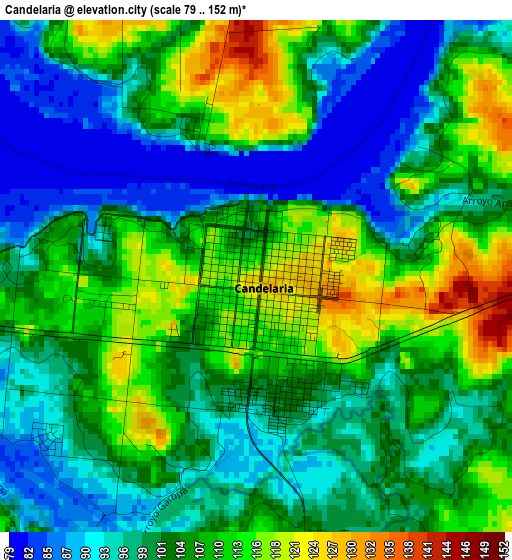
Below is the Elevation map of Candelaria, which displays elevation range with different colors. Scale of the first map is from 79 to 152 m (259 to 499 ft) with average elevation of 103.5 meters (=340 ft) [note 1]
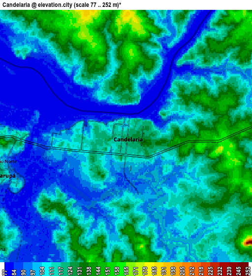
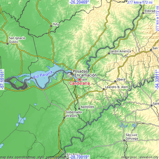
These maps also provides idea of topography and contour of this city, they are displayed at different zoom levels. More info about maps, scale and edge coordinates you can find below images.
| \ | Map #1 | Map #2 | Topo.Map |
| Scale [m] | 79..152 m | 77..252 m | × |
| Scale [ft] | 259..499 ft | 253..827 ft | × |
| Average | 103.5 m = 340 ft | 111.6 m = 366 ft | × |
| Width | 8.67 km = 5.4 mi | 17.34 km = 10.8 mi | 277.5 km = 172.4 mi |
| Height | 8.67 km = 5.4 mi | 17.34 km = 10.8 mi | 277.5 km = 172.4 mi |
| ↑Max Latitude | -27.420499° | -27.381484° | -26.20469° |
| Latitude at center | -27.4595° | -27.4595° | -27.4595° |
| ↓Min Latitude | -27.498487° | -27.537461° | -28.70019° |
| ← Min Longitude | -55.789305° | -55.833251° | -57.15161° |
| Longitude center | -55.74536° | -55.74536° | -55.74536° |
| →Max Longitude | -55.701415° | -55.657469° | -54.33911° |
Nearby cities:
Cities around Candelaria sort by population:
• Posadas elevation 127 m
18.1 km,  304°
304°
• Garupá 108 m
8.6 km,  253°
253°
• San José 169 m
34.7 km,  186°
186°
• Cerro Azul 263 m
31.2 km,  128°
128°
• San Carlos 205 m
35.2 km,  205°
205°
• Bonpland 187 m
26.5 km,  95°
95°
• Loreto 173 m
26 km,  56°
56°
• Cerro Corá 161 m
14.7 km,  113°
113°
• Mártires 171 m
36.6 km,  83°
83°
• Almafuerte 328 m
34.2 km, 99°
• San Ignacio 161 m
30.8 km,  42°
42°
• Santa Ana 164 m
19.2 km, 57°
Multilingual:
 En español:
Candelaria elevación 119 m.
 En France:
Candelaria élévation 119 m.
 Auf Deutsch:
Candelaria höhe über dem Meeresspiegel ist 119 m.

Sources and notes:
- [note 1] Map square and city borders are not equal. Map elevation data is calculated only from area inside that square.
- [src 1] Elevation data from geonames database provided with same terms of usage.
- [src 2] The elevation map of Candelaria is generated using elevation data from NASA's 3 arcsec (90m) resolution SRTM data.
- [src 3] Base (background) map © OpenStreetMap contributors tiles are generated by Geofabrik and OpenTopoMap.
Copyright & License:
This Candelaria Elevation Map is licensed under CC BY-SA. You may reuse any part from this page, if you give a proper credit by linking to this URL:
 More info on terms of use page.