Gualeguaychú elevation
Gualeguaychú (Entre Rios, Departamento de Gualeguaychú), Argentina elevation is 14 meters and Gualeguaychú elevation in feet is 46 ft above sea level [src 1]. Gualeguaychú is a seat of a second-order administrative division (feature code) with elevation that is 336 meters (1102 ft) smaller than average city elevation in Argentina.
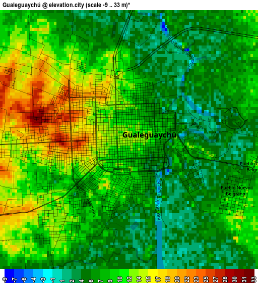
Below is the Elevation map of Gualeguaychú, which displays elevation range with different colors. Scale of the first map is from -9 to 33 m (-30 to 108 ft) with average elevation of 8.9 meters (=29 ft) [note 1]
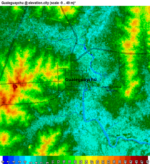
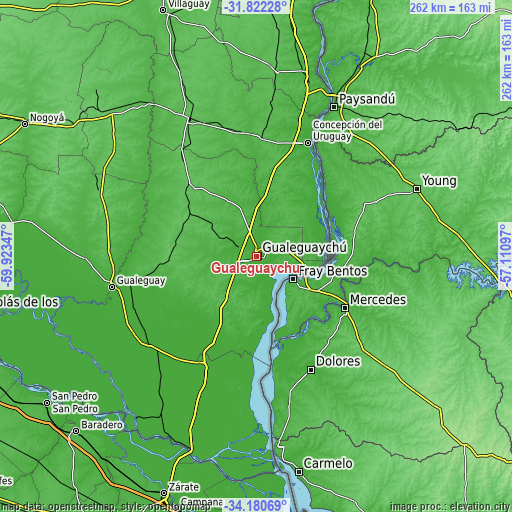
These maps also provides idea of topography and contour of this city, they are displayed at different zoom levels. More info about maps, scale and edge coordinates you can find below images.
| \ | Map #1 | Map #2 | Topo.Map |
| Scale [m] | -9..33 m | -9..49 m | × |
| Scale [ft] | -30..108 ft | -30..161 ft | × |
| Average | 8.9 m = 29 ft | 11.4 m = 37 ft | × |
| Width | 8.19 km = 5.1 mi | 16.39 km = 10.2 mi | 262.2 km = 162.9 mi |
| Height | 8.2 km = 5.1 mi | 16.39 km = 10.2 mi | 262.2 km = 162.9 mi |
| ↑Max Latitude | -32.972511° | -32.935636° | -31.82228° |
| Latitude at center | -33.00937° | -33.00937° | -33.00937° |
| ↓Min Latitude | -33.046214° | -33.083043° | -34.18069° |
| ← Min Longitude | -58.561165° | -58.605111° | -59.92347° |
| Longitude center | -58.51722° | -58.51722° | -58.51722° |
| →Max Longitude | -58.473275° | -58.429329° | -57.11097° |
Nearby cities:
Cities around Gualeguaychú sort by population:
• Concepción del Uruguay elevation 9 m
64.1 km,  24°
24°
• Gualeguay 14 m
75.3 km,  258°
258°
• Urdinarrain 68 m
50.3 km,  315°
315°
• Larroque 54 m
45.2 km,  266°
266°
• Caseros 51 m
60.8 km,  3°
3°
• Colonia Elía 35 m
41.6 km,  25°
25°
• Herrera 51 m
64.9 km,  350°
350°
• Villa Mantero 46 m
71.3 km,  342°
342°
• San Justo 44 m
63 km,  6°
6°
• Ceibas 7 m
51.9 km,  204°
204°
• Pronunciamiento 47 m
74.2 km, 5°
• Aldea San Antonio 39 m
46.4 km, 337°
Multilingual:
 En español:
Gualeguaychú elevación 14 m.
 En France:
Gualeguaychú élévation 14 m.
 Auf Deutsch:
Gualeguaychú höhe über dem Meeresspiegel ist 14 m.

Sources and notes:
- [note 1] Map square and city borders are not equal. Map elevation data is calculated only from area inside that square.
- [src 1] Elevation data from geonames database provided with same terms of usage.
- [src 2] The elevation map of Gualeguaychú is generated using elevation data from NASA's 3 arcsec (90m) resolution SRTM data.
- [src 3] Base (background) map © OpenStreetMap contributors tiles are generated by Geofabrik and OpenTopoMap.
Copyright & License:
This Gualeguaychú Elevation Map is licensed under CC BY-SA. You may reuse any part from this page, if you give a proper credit by linking to this URL:
 More info on terms of use page.