Itatí elevation
Itatí (Corrientes, Departamento de Itatí), Argentina elevation is 65 meters and Itatí elevation in feet is 213 ft above sea level [src 1]. Itatí is a seat of a second-order administrative division (feature code) with elevation that is 285 meters (935 ft) smaller than average city elevation in Argentina.
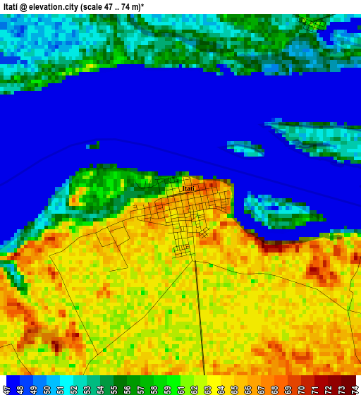
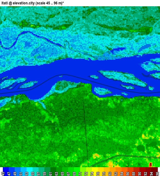
Below is the Elevation map of Itatí, which displays elevation range with different colors. Scale of the first map is from 47 to 74 m (154 to 243 ft) with average elevation of 56.5 meters (=185 ft) [note 1]
These maps also provides idea of topography and contour of this city, they are displayed at different zoom levels. More info about maps, scale and edge coordinates you can find below images.
| \ | Map #1 | Map #2 | Topo.Map |
| Scale [m] | 47..74 m | 45..96 m | × |
| Scale [ft] | 154..243 ft | 148..315 ft | × |
| Average | 56.5 m = 185 ft | 58.5 m = 192 ft | × |
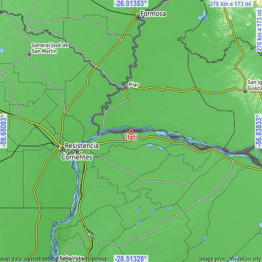
| Width | 8.69 km = 5.4 mi | 17.37 km = 10.8 mi | 277.9 km = 172.7 mi |
| Height | 8.69 km = 5.4 mi | 17.37 km = 10.8 mi | 278 km = 172.7 mi |
| ↑Max Latitude | -27.231362° | -27.192281° | -26.01353° |
| Latitude at center | -27.27043° | -27.27043° | -27.27043° |
| ↓Min Latitude | -27.309484° | -27.348524° | -28.51328° |
| ← Min Longitude | -58.288525° | -58.332471° | -59.65083° |
| Longitude center | -58.24458° | -58.24458° | -58.24458° |
| →Max Longitude | -58.200635° | -58.156689° | -56.83833° |
Nearby cities:
Cities around Itatí sort by population:
• Corrientes elevation 53 m
62.2 km,  249°
249°
• San Luis del Palmar 62 m
40.4 km,  229°
229°
• La Leonesa 60 m
52.2 km,  299°
299°
• Paso de la Patria 56 m
32.8 km,  260°
260°
• Margarita Belén 58 m
71.9 km,  270°
270°
• San Cosme 72 m
28.7 km, 247°
• Riachuelo 57 m
60.3 km, 234°
• Colonia Benítez 54 m
69.7 km, 264°
• General Vedia 58 m
55.6 km,  312°
312°
• Puerto Bermejo 54 m
46.3 km,  325°
325°
• Lomas de Vallejos 71 m
60.8 km,  148°
148°
• Herlitzka 66 m
32.8 km,  181°
181°
Multilingual:
 En español:
Itatí elevación 65 m.
 En France:
Itatí élévation 65 m.


Sources and notes:
- [note 1] Map square and city borders are not equal. Map elevation data is calculated only from area inside that square.
- [src 1] Elevation data from geonames database provided with same terms of usage.
- [src 2] The elevation map of Itatí is generated using elevation data from NASA's 3 arcsec (90m) resolution SRTM data.
- [src 3] Base (background) map © OpenStreetMap contributors tiles are generated by Geofabrik and OpenTopoMap.
Copyright & License:
This Itatí Elevation Map is licensed under CC BY-SA. You may reuse any part from this page, if you give a proper credit by linking to this URL:
 More info on terms of use page.