N'zeto elevation
N'zeto (Zaire), Angola elevation is 19 meters and N'zeto elevation in feet is 62 ft above sea level [src 1]. N'zeto is a populated place (feature code) with elevation that is 950 meters (3117 ft) smaller than average city elevation in Angola.
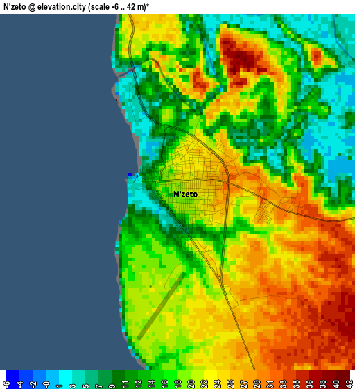
Below is the Elevation map of N'zeto, which displays elevation range with different colors. Scale of the first map is from -6 to 42 m (-20 to 138 ft) with average elevation of 19.2 meters (=63 ft) [note 1]
These maps also provides idea of topography and contour of this city, they are displayed at different zoom levels. More info about maps, scale and edge coordinates you can find below images.
| \ | Map #1 | Map #2 | Topo.Map |
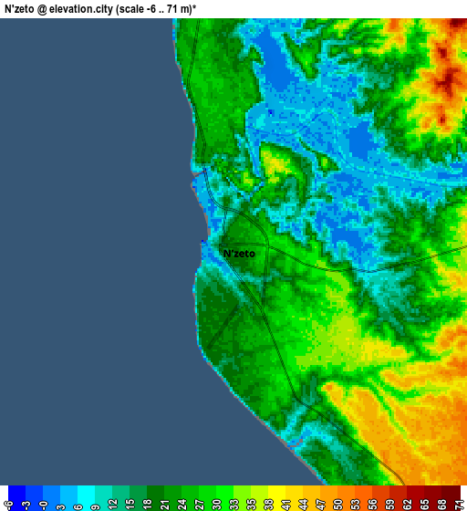
| Scale [m] | -6..42 m | -6..71 m | × |
| Scale [ft] | -20..138 ft | -20..233 ft | × |
| Average | 19.2 m = 63 ft | 22.8 m = 75 ft | × |
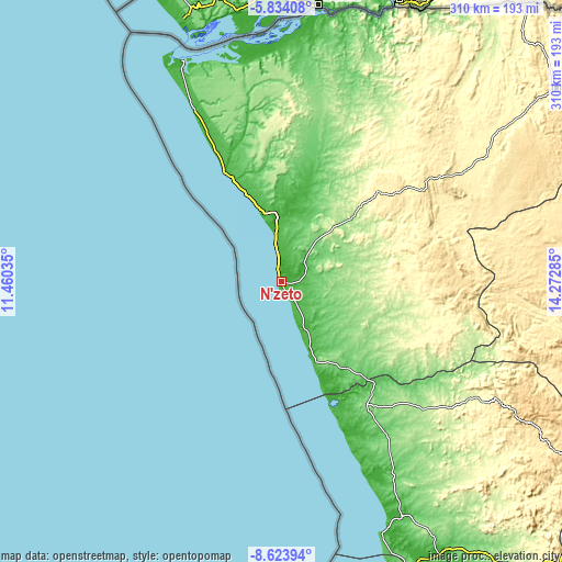
| Width | 9.69 km = 6 mi | 19.39 km = 12 mi | 310.2 km = 192.7 mi |
| Height | 9.69 km = 6 mi | 19.39 km = 12 mi | 310.2 km = 192.7 mi |
| ↑Max Latitude | -7.187562° | -7.14396° | -5.83408° |
| Latitude at center | -7.23116° | -7.23116° | -7.23116° |
| ↓Min Latitude | -7.274754° | -7.318343° | -8.62394° |
| ← Min Longitude | 12.822655° | 12.778709° | 11.46035° |
| Longitude center | 12.8666° | 12.8666° | 12.8666° |
| →Max Longitude | 12.910545° | 12.954491° | 14.27285° |
Nearby cities:
Cities around N'zeto sort by population:
• Luanda elevation 73 m
183.1 km,  167°
167°
• N’dalatando 795 m
321.6 km,  135°
135°
• Soio 10 m
133.7 km,  335°
335°
• Cabinda 1 m
200.9 km, 338°
• Uíge 825 m
245.6 km,  99°
99°
• Caxito 20 m
173.7 km,  149°
149°
• Mbanza Congo 544 m
185.7 km,  54°
54°
• Camabatela 1237 m
296.2 km,  111°
111°
Multilingual:
 En español:
N'zeto elevación 19 m.
 En France:
N'zeto élévation 19 m.


Sources and notes:
- [note 1] Map square and city borders are not equal. Map elevation data is calculated only from area inside that square.
- [src 1] Elevation data from geonames database provided with same terms of usage.
- [src 2] The elevation map of N'zeto is generated using elevation data from NASA's 3 arcsec (90m) resolution SRTM data.
- [src 3] Base (background) map © OpenStreetMap contributors tiles are generated by Geofabrik and OpenTopoMap.
Copyright & License:
This N'zeto Elevation Map is licensed under CC BY-SA. You may reuse any part from this page, if you give a proper credit by linking to this URL:
 More info on terms of use page.