Burrel elevation
Burrel (Dibër, Rrethi i Matit), Albania elevation is 315 meters and Burrel elevation in feet is 1033 ft above sea level [src 1]. Burrel is a seat of a second-order administrative division (feature code) with elevation that is 59 meters (194 ft) smaller than average city elevation in Albania.
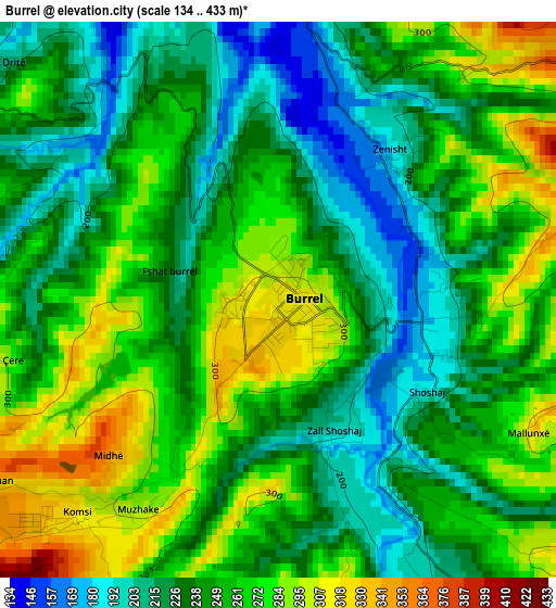
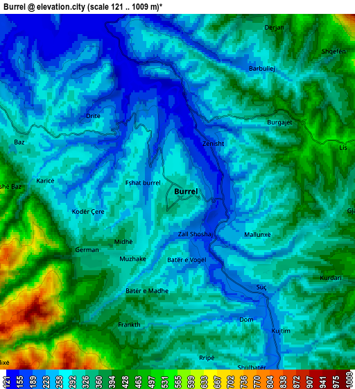
Below is the Elevation map of Burrel, which displays elevation range with different colors. Scale of the first map is from 134 to 433 m (440 to 1421 ft) with average elevation of 249 meters (=817 ft) [note 1]
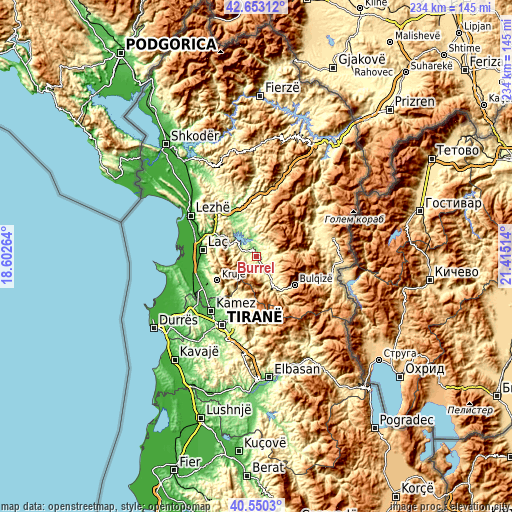
These maps also provides idea of topography and contour of this city, they are displayed at different zoom levels. More info about maps, scale and edge coordinates you can find below images.
| \ | Map #1 | Map #2 | Topo.Map |
| Scale [m] | 134..433 m | 121..1009 m | × |
| Scale [ft] | 440..1421 ft | 397..3310 ft | × |
| Average | 249 m = 817 ft | 325 m = 1066 ft | × |
| Width | 7.31 km = 4.5 mi | 14.61 km = 9.1 mi | 233.8 km = 145.3 mi |
| Height | 7.31 km = 4.5 mi | 14.61 km = 9.1 mi | 233.8 km = 145.3 mi |
| ↑Max Latitude | 41.643129° | 41.67596° | 42.65312° |
| Latitude at center | 41.61028° | 41.61028° | 41.61028° |
| ↓Min Latitude | 41.577415° | 41.544533° | 40.5503° |
| ← Min Longitude | 19.964945° | 19.920999° | 18.60264° |
| Longitude center | 20.00889° | 20.00889° | 20.00889° |
| →Max Longitude | 20.052835° | 20.096781° | 21.41514° |
Nearby cities:
Cities around Burrel sort by population:
• Klos elevation 257 m
13.2 km,  150°
150°
• Ulëz 162 m
12.5 km,  310°
310°
• Cudhi Zall 746 m
17.6 km,  230°
230°
• Xibër-Murrizë 842 m
17.4 km,  175°
175°
• Macukull 1062 m
12.1 km,  44°
44°
• Gurra e Vogël 512 m
8.4 km,  190°
190°
• Derjan 477 m
8.2 km,  30°
30°
• Rukaj 332 m
8.2 km,  5°
5°
• Baz 319 m
7.1 km,  289°
289°
• Lis 491 m
6.6 km,  73°
73°
• Suç 281 m
5.1 km,  136°
136°
• Kombësi 317 m
3.7 km,  211°
211°
Multilingual:
 En español:
Burrel elevación 315 m.
 En France:
Burrel élévation 315 m.


Sources and notes:
- [note 1] Map square and city borders are not equal. Map elevation data is calculated only from area inside that square.
- [src 1] Elevation data from geonames database provided with same terms of usage.
- [src 2] The elevation map of Burrel is generated using elevation data from NASA's 3 arcsec (90m) resolution SRTM data.
- [src 3] Base (background) map © OpenStreetMap contributors tiles are generated by Geofabrik and OpenTopoMap.
Copyright & License:
This Burrel Elevation Map is licensed under CC BY-SA. You may reuse any part from this page, if you give a proper credit by linking to this URL:
 More info on terms of use page.