Memaliaj elevation
Memaliaj (Gjirokastër, Rrethi i Tepelenës), Albania elevation is 115 meters and Memaliaj elevation in feet is 377 ft above sea level [src 1]. Memaliaj is a seat of a third-order administrative division (feature code) with elevation that is 259 meters (850 ft) smaller than average city elevation in Albania.
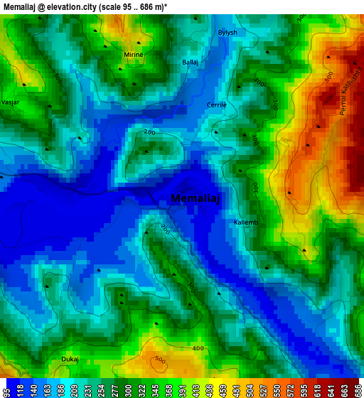
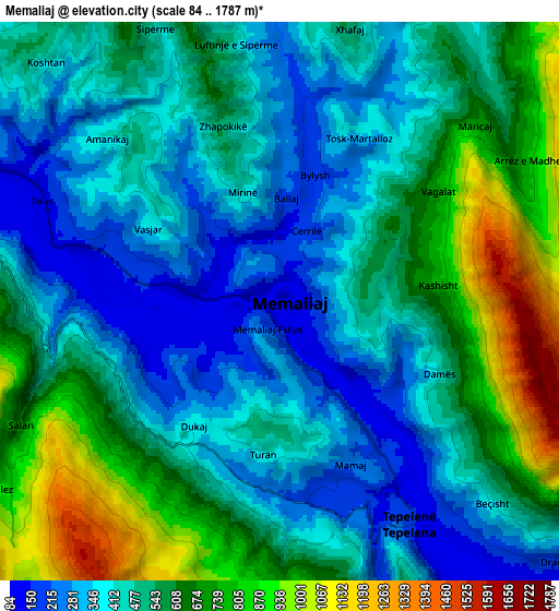
Below is the Elevation map of Memaliaj, which displays elevation range with different colors. Scale of the first map is from 95 to 686 m (312 to 2251 ft) with average elevation of 270.9 meters (=889 ft) [note 1]
These maps also provides idea of topography and contour of this city, they are displayed at different zoom levels. More info about maps, scale and edge coordinates you can find below images.
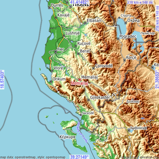
| \ | Map #1 | Map #2 | Topo.Map |
| Scale [m] | 95..686 m | 84..1787 m | × |
| Scale [ft] | 312..2251 ft | 276..5863 ft | × |
| Average | 270.9 m = 889 ft | 514.3 m = 1687 ft | × |
| Width | 7.45 km = 4.6 mi | 14.9 km = 9.3 mi | 238.3 km = 148.1 mi |
| Height | 7.45 km = 4.6 mi | 14.89 km = 9.3 mi | 238.3 km = 148.1 mi |
| ↑Max Latitude | 40.385152° | 40.418617° | 41.41482° |
| Latitude at center | 40.35167° | 40.35167° | 40.35167° |
| ↓Min Latitude | 40.318172° | 40.284657° | 39.27149° |
| ← Min Longitude | 19.936335° | 19.892389° | 18.57403° |
| Longitude center | 19.98028° | 19.98028° | 19.98028° |
| →Max Longitude | 20.024225° | 20.068171° | 21.38653° |
Nearby cities:
Cities around Memaliaj sort by population:
• Tepelenë elevation 212 m
7 km,  152°
152°
• Këlcyrë 178 m
18.2 km,  103°
103°
• Vendresha e Vogël 679 m
21.7 km,  37°
37°
• Fratar 288 m
21.5 km,  319°
319°
• Picar 295 m
21.4 km,  164°
164°
• Topojan 648 m
19.9 km,  81°
81°
• Progonat 926 m
15.7 km,  191°
191°
• Krahës 209 m
15 km,  310°
310°
• Sukë 259 m
15 km, 79°
• Ballaban 322 m
14.9 km,  61°
61°
• Buz 747 m
10.6 km,  11°
11°
• Luftinjë 432 m
10.4 km,  347°
347°
Multilingual:
 En español:
Memaliaj elevación 115 m.
 En France:
Memaliaj élévation 115 m.
 Auf Deutsch:
Memaliaj höhe über dem Meeresspiegel ist 115 m.

Sources and notes:
- [note 1] Map square and city borders are not equal. Map elevation data is calculated only from area inside that square.
- [src 1] Elevation data from geonames database provided with same terms of usage.
- [src 2] The elevation map of Memaliaj is generated using elevation data from NASA's 3 arcsec (90m) resolution SRTM data.
- [src 3] Base (background) map © OpenStreetMap contributors tiles are generated by Geofabrik and OpenTopoMap.
Copyright & License:
This Memaliaj Elevation Map is licensed under CC BY-SA. You may reuse any part from this page, if you give a proper credit by linking to this URL:
 More info on terms of use page.