Asadābād elevation
Asadābād (Kunar), Afghanistan elevation is 837 meters and Asadābād elevation in feet is 2746 ft above sea level [src 1]. Asadābād is a seat of a first-order administrative division (feature code) with elevation that is 582 meters (1909 ft) smaller than average city elevation in Afghanistan.
Below is the Elevation map of Asadābād, which displays elevation range with different colors. Scale of the first map is from 793 to 1801 m (2602 to 5909 ft) with average elevation of 1090.7 meters (=3578 ft) [note 1]
These maps also provides idea of topography and contour of this city, they are displayed at different zoom levels. More info about maps, scale and edge coordinates you can find below images.
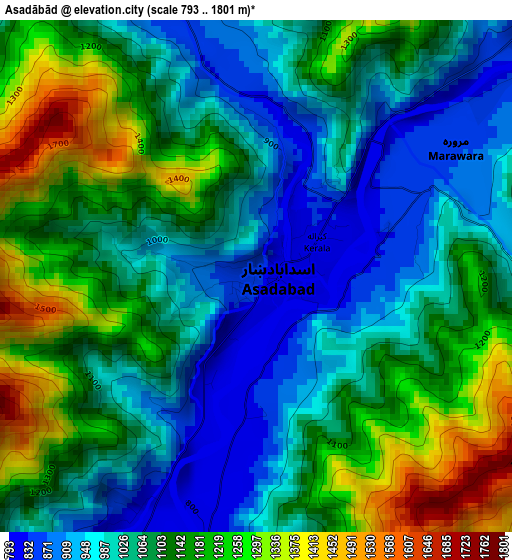
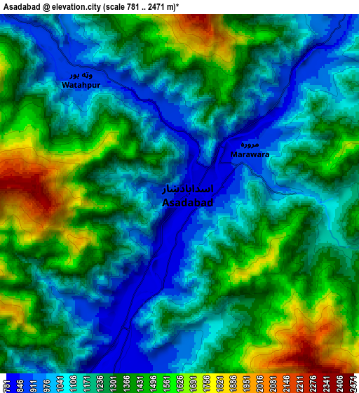
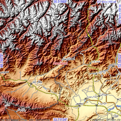
| \ | Map #1 | Map #2 | Topo.Map |
| Scale [m] | 793..1801 m | 781..2471 m | × |
| Scale [ft] | 2602..5909 ft | 2562..8107 ft | × |
| Average | 1090.7 m = 3578 ft | 1268.5 m = 4162 ft | × |
| Width | 8.02 km = 5 mi | 16.04 km = 10 mi | 256.6 km = 159.4 mi |
| Height | 8.02 km = 5 mi | 16.04 km = 10 mi | 256.6 km = 159.4 mi |
| ↑Max Latitude | 34.909156° | 34.945186° | 36.01869° |
| Latitude at center | 34.87311° | 34.87311° | 34.87311° |
| ↓Min Latitude | 34.837048° | 34.800971° | 33.71134° |
| ← Min Longitude | 71.103025° | 71.059079° | 69.74072° |
| Longitude center | 71.14697° | 71.14697° | 71.14697° |
| →Max Longitude | 71.190915° | 71.234861° | 72.55322° |
Nearby cities:
Cities around Asadābād sort by population:
• Āsmār elevation 913 m
26.2 km,  47°
47°
• Qal‘ah-ye Shāhī 894 m
56.5 km,  243°
243°
• Nāṟay 1098 m
51.6 km,  41°
41°
• Nūrgal 679 m
45.3 km,  230°
230°
• Kanḏay 1222 m
34.7 km,  284°
284°
• Tsowkêy 725 m
28.4 km, 225°
• Dāngām 1250 m
28.2 km,  61°
61°
• Manogay 1042 m
25 km,  301°
301°
• Karbori 884 m
15.6 km, 48°
• Narang 779 m
15.5 km,  215°
215°
• Sar Kāṉī 792 m
9.8 km,  200°
200°
• Wuṯahpūr 872 m
6.8 km,  319°
319°
Multilingual:
 En español:
Asadābād elevación 837 m.
 En France:
Asadābād élévation 837 m.
 Auf Deutsch:
Asadābād höhe über dem Meeresspiegel ist 837 m.

Sources and notes:
- [note 1] Map square and city borders are not equal. Map elevation data is calculated only from area inside that square.
- [src 1] Elevation data from geonames database provided with same terms of usage.
- [src 2] The elevation map of Asadābād is generated using elevation data from NASA's 3 arcsec (90m) resolution SRTM data.
- [src 3] Base (background) map © OpenStreetMap contributors tiles are generated by Geofabrik and OpenTopoMap.
Copyright & License:
This Asadābād Elevation Map is licensed under CC BY-SA. You may reuse any part from this page, if you give a proper credit by linking to this URL:
 More info on terms of use page.