Tīr Pul elevation
Tīr Pul (Herat, Kuhsān), Afghanistan elevation is 751 meters and Tīr Pul elevation in feet is 2464 ft above sea level [src 1]. Tīr Pul is a populated place (feature code) with elevation that is 668 meters (2192 ft) smaller than average city elevation in Afghanistan.
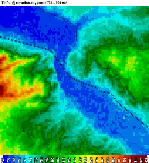
Below is the Elevation map of Tīr Pul, which displays elevation range with different colors. Scale of the first map is from 731 to 929 m (2398 to 3048 ft) with average elevation of 782.5 meters (=2567 ft) [note 1]
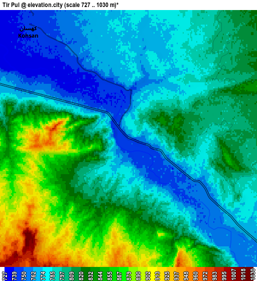
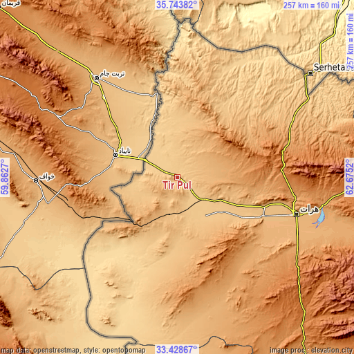
These maps also provides idea of topography and contour of this city, they are displayed at different zoom levels. More info about maps, scale and edge coordinates you can find below images.
| \ | Map #1 | Map #2 | Topo.Map |
| Scale [m] | 731..929 m | 727..1030 m | × |
| Scale [ft] | 2398..3048 ft | 2385..3379 ft | × |
| Average | 782.5 m = 2567 ft | 809.7 m = 2656 ft | × |
| Width | 8.04 km = 5 mi | 16.09 km = 10 mi | 257.4 km = 159.9 mi |
| Height | 8.04 km = 5 mi | 16.09 km = 10 mi | 257.4 km = 159.9 mi |
| ↑Max Latitude | 34.630478° | 34.666629° | 35.74382° |
| Latitude at center | 34.59431° | 34.59431° | 34.59431° |
| ↓Min Latitude | 34.558127° | 34.521928° | 33.42867° |
| ← Min Longitude | 61.225005° | 61.181059° | 59.8627° |
| Longitude center | 61.26895° | 61.26895° | 61.26895° |
| →Max Longitude | 61.312895° | 61.356841° | 62.6752° |
Nearby cities:
Cities around Tīr Pul sort by population:
• Herāt elevation 927 m
89.6 km,  107°
107°
• Kafir Qala 726 m
20.2 km,  293°
293°
• Karukh 1340 m
121.3 km,  95°
95°
• Qarah Bāgh 952 m
60.2 km,  50°
50°
• Kuhsān 740 m
9.3 km,  315°
315°
• Chahār Burj 943 m
93.1 km, 114°
• Zindah Jān 834 m
52 km,  122°
122°
• Kushk-e Kuhnah 1076 m
120.8 km,  75°
75°
• Guz̄arah 983 m
96.4 km, 116°
• Injīl 937 m
95.4 km, 109°
• Rabāţ-e Sangī-ye Pā’īn 1192 m
82.8 km,  73°
73°
• Ghōriyān 796 m
34.5 km,  143°
143°
Multilingual:
 En español:
Tīr Pul elevación 751 m.
 En France:
Tīr Pul élévation 751 m.


Sources and notes:
- [note 1] Map square and city borders are not equal. Map elevation data is calculated only from area inside that square.
- [src 1] Elevation data from geonames database provided with same terms of usage.
- [src 2] The elevation map of Tīr Pul is generated using elevation data from NASA's 3 arcsec (90m) resolution SRTM data.
- [src 3] Base (background) map © OpenStreetMap contributors tiles are generated by Geofabrik and OpenTopoMap.
Copyright & License:
This Tīr Pul Elevation Map is licensed under CC BY-SA. You may reuse any part from this page, if you give a proper credit by linking to this URL:
 More info on terms of use page.