Al Shamkhah City elevation
Al Shamkhah City (Abu Dhabi), United Arab Emirates elevation is 18 meters and Al Shamkhah City elevation in feet is 59 ft above sea level [src 1]. Al Shamkhah City is a populated place (feature code) with elevation that is 30 meters (98 ft) smaller than average city elevation in United Arab Emirates.
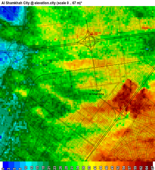
Below is the Elevation map of Al Shamkhah City, which displays elevation range with different colors. Scale of the first map is from 0 to 67 m (0 to 220 ft) with average elevation of 33.6 meters (=110 ft) [note 1]
These maps also provides idea of topography and contour of this city, they are displayed at different zoom levels. More info about maps, scale and edge coordinates you can find below images.
| \ | Map #1 | Map #2 | Topo.Map |
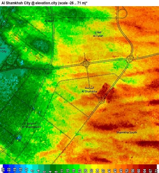
| Scale [m] | 0..67 m | -26..71 m | × |
| Scale [ft] | 0..220 ft | -85..233 ft | × |
| Average | 33.6 m = 110 ft | 30.5 m = 100 ft | × |
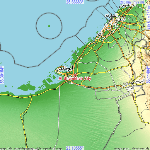
| Width | 8.9 km = 5.5 mi | 17.8 km = 11.1 mi | 284.8 km = 177 mi |
| Height | 8.9 km = 5.5 mi | 17.8 km = 11.1 mi | 284.8 km = 177 mi |
| ↑Max Latitude | 24.432696° | 24.4727° | 25.66683° |
| Latitude at center | 24.39268° | 24.39268° | 24.39268° |
| ↓Min Latitude | 24.352651° | 24.312609° | 23.10555° |
| ← Min Longitude | 54.663845° | 54.619899° | 53.30154° |
| Longitude center | 54.70779° | 54.70779° | 54.70779° |
| →Max Longitude | 54.751735° | 54.795681° | 56.11404° |
Nearby cities:
Cities around Al Shamkhah City sort by population:
• Dubai elevation 24 m
97.4 km,  38°
38°
• Sharjah 6 m
126.8 km,  34°
34°
• Abu Dhabi 13 m
32.1 km,  281°
281°
• Ajman City 16 m
136.5 km, 34°
• Musaffah 10 m
23.1 km,  260°
260°
• Khalifah A City 1 m
11 km,  289°
289°
• Bani Yas City 16 m
12.2 km,  220°
220°
• Zayed City 124 m
130.8 km,  231°
231°
• Umm Al Quwain City 2 m
155.8 km, 33°
• Al Ain City 275 m
109 km,  101°
101°
• Adh Dhayd 114 m
154.7 km,  49°
49°
• Muzayri‘ 123 m
167.5 km,  213°
213°
Multilingual:
 En español:
Al Shamkhah City elevación 18 m.
 En France:
Al Shamkhah City élévation 18 m.
 Auf Deutsch:
Al Shamkhah City höhe über dem Meeresspiegel ist 18 m.

Sources and notes:
- [note 1] Map square and city borders are not equal. Map elevation data is calculated only from area inside that square.
- [src 1] Elevation data from geonames database provided with same terms of usage.
- [src 2] The elevation map of Al Shamkhah City is generated using elevation data from NASA's 3 arcsec (90m) resolution SRTM data.
- [src 3] Base (background) map © OpenStreetMap contributors tiles are generated by Geofabrik and OpenTopoMap.
Copyright & License:
This Al Shamkhah City Elevation Map is licensed under CC BY-SA. You may reuse any part from this page, if you give a proper credit by linking to this URL:
 More info on terms of use page.