Dubai elevation
Dubai, United Arab Emirates elevation is 24 meters and Dubai elevation in feet is 79 ft above sea level [src 1]. Dubai is a seat of a first-order administrative division (feature code) with elevation that is 24 meters (79 ft) smaller than average city elevation in United Arab Emirates.
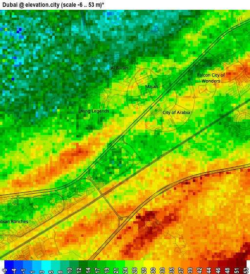
Below is the Elevation map of Dubai, which displays elevation range with different colors. Scale of the first map is from -6 to 53 m (-20 to 174 ft) with average elevation of 24.4 meters (=80 ft) [note 1]
These maps also provides idea of topography and contour of this city, they are displayed at different zoom levels. More info about maps, scale and edge coordinates you can find below images.
| \ | Map #1 | Map #2 | Topo.Map |
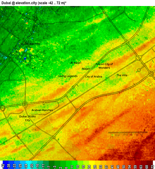
| Scale [m] | -6..53 m | -42..72 m | × |
| Scale [ft] | -20..174 ft | -138..236 ft | × |
| Average | 24.4 m = 80 ft | 23.6 m = 77 ft | × |
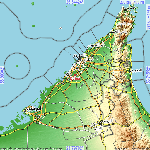
| Width | 8.85 km = 5.5 mi | 17.7 km = 11 mi | 283.2 km = 176 mi |
| Height | 8.85 km = 5.5 mi | 17.7 km = 11 mi | 283.2 km = 176 mi |
| ↑Max Latitude | 25.117046° | 25.15683° | 26.34424° |
| Latitude at center | 25.07725° | 25.07725° | 25.07725° |
| ↓Min Latitude | 25.037441° | 24.997618° | 23.79702° |
| ← Min Longitude | 55.265325° | 55.221379° | 53.90302° |
| Longitude center | 55.30927° | 55.30927° | 55.30927° |
| →Max Longitude | 55.353215° | 55.397161° | 56.71552° |
Nearby cities:
Cities around Dubai sort by population:
• Sharjah elevation 6 m
30.7 km,  19°
19°
• Ajman City 16 m
39.9 km,  25°
25°
• Ras Al Khaimah City 2 m
101.6 km,  38°
38°
• Al Fujairah City 15 m
104 km,  87°
87°
• Khalifah A City 1 m
101.5 km,  224°
224°
• Reef Al Fujairah City 187 m
94.8 km, 85°
• Umm Al Quwain City 2 m
59.6 km, 24°
• Al Shamkhah City 18 m
97.4 km, 218°
• Al Ain City 275 m
108.5 km,  155°
155°
• Khawr Fakkān 20 m
107.7 km,  74°
74°
• Adh Dhayd 114 m
62.2 km, 67°
• Murbaḩ 15 m
108.3 km,  78°
78°
Multilingual:
 En español:
Dubái elevación 24 m.
 En France:
Dubaï élévation 24 m.


Sources and notes:
- [note 1] Map square and city borders are not equal. Map elevation data is calculated only from area inside that square.
- [src 1] Elevation data from geonames database provided with same terms of usage.
- [src 2] The elevation map of Dubai is generated using elevation data from NASA's 3 arcsec (90m) resolution SRTM data.
- [src 3] Base (background) map © OpenStreetMap contributors tiles are generated by Geofabrik and OpenTopoMap.
Copyright & License:
This Dubai Elevation Map is licensed under CC BY-SA. You may reuse any part from this page, if you give a proper credit by linking to this URL:
 More info on terms of use page.