Andorra la Vella elevation
Andorra la Vella, Andorra elevation is 1037 meters and Andorra la Vella elevation in feet is 3402 ft above sea level [src 1]. Andorra la Vella is a capital of a political entity (feature code) with elevation that is 327 meters (1073 ft) smaller than average city elevation in Andorra.
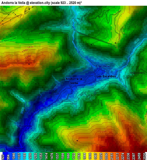
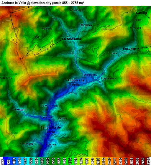
Below is the Elevation map of Andorra la Vella, which displays elevation range with different colors. Scale of the first map is from 923 to 2520 m (3028 to 8268 ft) with average elevation of 1559.9 meters (=5118 ft) [note 1]
These maps also provides idea of topography and contour of this city, they are displayed at different zoom levels. More info about maps, scale and edge coordinates you can find below images.
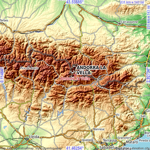
| \ | Map #1 | Map #2 | Topo.Map |
| Scale [m] | 923..2520 m | 855..2755 m | × |
| Scale [ft] | 3028..8268 ft | 2805..9039 ft | × |
| Average | 1559.9 m = 5118 ft | 1770.1 m = 5807 ft | × |
| Width | 7.2 km = 4.5 mi | 14.41 km = 9 mi | 230.5 km = 143.2 mi |
| Height | 7.2 km = 4.5 mi | 14.41 km = 9 mi | 230.5 km = 143.2 mi |
| ↑Max Latitude | 42.540177° | 42.572548° | 43.53585° |
| Latitude at center | 42.50779° | 42.50779° | 42.50779° |
| ↓Min Latitude | 42.475386° | 42.442965° | 41.46254° |
| ← Min Longitude | 1.477145° | 1.433199° | 0.11484° |
| Longitude center | 1.52109° | 1.52109° | 1.52109° |
| →Max Longitude | 1.565035° | 1.608981° | 2.92734° |
Nearby cities:
Cities around Andorra la Vella sort by population:
• les Escaldes elevation 1033 m
1.1 km,  92°
92°
• Encamp 1257 m
5.7 km,  58°
58°
• Sant Julià de Lòria 921 m
5.5 km,  206°
206°
• la Massana 1245 m
4.2 km,  352°
352°
• Canillo 1561 m
9.1 km,  43°
43°
• Ordino 1296 m
5.5 km,  10°
10°
• Pas de la Casa 2106 m
17.8 km,  77°
77°
• Arinsal 1465 m
7.7 km,  337°
337°
• El Tarter 1721 m
13.5 km,  53°
53°
Multilingual:
 En español:
Andorra la Vella elevación 1037 m.
 En France:
Andorre-la-Vieille élévation 1037 m.
 Auf Deutsch:
Andorra la Vella höhe über dem Meeresspiegel ist 1037 m.

Sources and notes:
- [note 1] Map square and city borders are not equal. Map elevation data is calculated only from area inside that square.
- [src 1] Elevation data from geonames database provided with same terms of usage.
- [src 2] The elevation map of Andorra la Vella is generated using elevation data from NASA's 3 arcsec (90m) resolution SRTM data.
- [src 3] Base (background) map © OpenStreetMap contributors tiles are generated by Geofabrik and OpenTopoMap.
Copyright & License:
This Andorra la Vella Elevation Map is licensed under CC BY-SA. You may reuse any part from this page, if you give a proper credit by linking to this URL:
 More info on terms of use page.