Mount Darwin elevation
Mount Darwin (Mashonaland Central), Zimbabwe elevation is 955 meters and Mount Darwin elevation in feet is 3133 ft above sea level [src 1]. Mount Darwin is a populated place (feature code) with elevation that is 245 meters (804 ft) smaller than average city elevation in Zimbabwe.
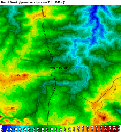
Below is the Elevation map of Mount Darwin, which displays elevation range with different colors. Scale of the first map is from 901 to 1061 m (2956 to 3481 ft) with average elevation of 964.9 meters (=3166 ft) [note 1]
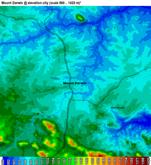
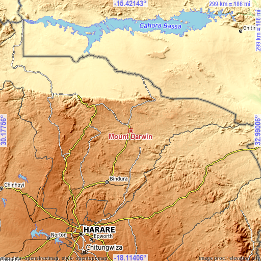
These maps also provides idea of topography and contour of this city, they are displayed at different zoom levels. More info about maps, scale and edge coordinates you can find below images.
| \ | Map #1 | Map #2 | Topo.Map |
| Scale [m] | 901..1061 m | 860..1420 m | × |
| Scale [ft] | 2956..3481 ft | 2822..4659 ft | × |
| Average | 964.9 m = 3166 ft | 976.9 m = 3205 ft | × |
| Width | 9.36 km = 5.8 mi | 18.71 km = 11.6 mi | 299.4 km = 186 mi |
| Height | 9.36 km = 5.8 mi | 18.71 km = 11.6 mi | 299.4 km = 186 mi |
| ↑Max Latitude | -16.73043° | -16.68834° | -15.42143° |
| Latitude at center | -16.77251° | -16.77251° | -16.77251° |
| ↓Min Latitude | -16.814581° | -16.856643° | -18.11406° |
| ← Min Longitude | 31.539865° | 31.495919° | 30.17756° |
| Longitude center | 31.58381° | 31.58381° | 31.58381° |
| →Max Longitude | 31.627755° | 31.671701° | 32.99006° |
Nearby cities:
Cities around Mount Darwin sort by population:
• Harare elevation 1494 m
130.1 km,  205°
205°
• Bindura 1118 m
64.7 km,  204°
204°
• Ruwa 1562 m
129.3 km, 196°
• Shamva 947 m
59.9 km,  180°
180°
• Mazowe 1249 m
104 km,  218°
218°
• Glendale 1143 m
84.9 km, 220°
• Mutoko 1285 m
97.4 km,  135°
135°
• Murehwa 1365 m
99.1 km,  167°
167°
• Mvurwi 1495 m
83.3 km,  249°
249°
• Concession 1331 m
95.7 km, 224°
• Centenary 1186 m
50.3 km,  276°
276°
• Raffingora 1160 m
125.8 km,  256°
256°
Multilingual:
 En español:
Mount Darwin elevación 955 m.
 En France:
Mount Darwin élévation 955 m.
 Auf Deutsch:
Mount Darwin höhe über dem Meeresspiegel ist 955 m.

Sources and notes:
- [note 1] Map square and city borders are not equal. Map elevation data is calculated only from area inside that square.
- [src 1] Elevation data from geonames database provided with same terms of usage.
- [src 2] The elevation map of Mount Darwin is generated using elevation data from NASA's 3 arcsec (90m) resolution SRTM data.
- [src 3] Base (background) map © OpenStreetMap contributors tiles are generated by Geofabrik and OpenTopoMap.
Copyright & License:
This Mount Darwin Elevation Map is licensed under CC BY-SA. You may reuse any part from this page, if you give a proper credit by linking to this URL:
 More info on terms of use page.