Ladismith elevation
Ladismith (Western Cape, Eden District Municipality), South Africa elevation is 544 meters and Ladismith elevation in feet is 1785 ft above sea level [src 1]. Ladismith is a seat of a third-order administrative division (feature code) with elevation that is 428 meters (1404 ft) smaller than average city elevation in South Africa.
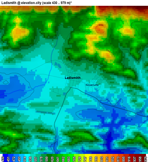
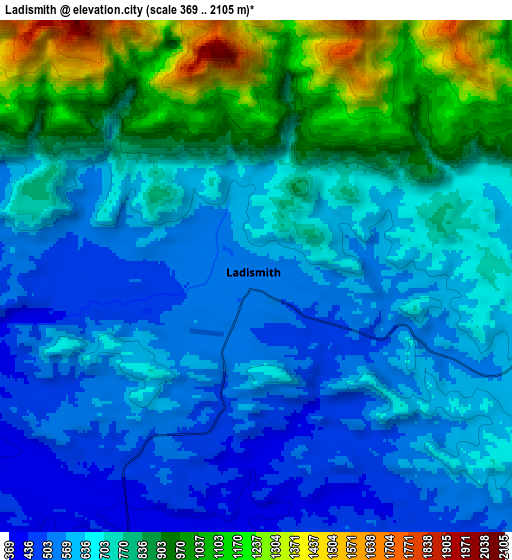
Below is the Elevation map of Ladismith, which displays elevation range with different colors. Scale of the first map is from 430 to 979 m (1411 to 3212 ft) with average elevation of 586.2 meters (=1923 ft) [note 1]
These maps also provides idea of topography and contour of this city, they are displayed at different zoom levels. More info about maps, scale and edge coordinates you can find below images.
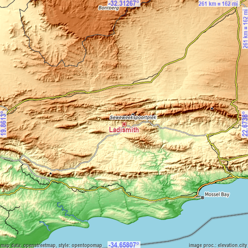
| \ | Map #1 | Map #2 | Topo.Map |
| Scale [m] | 430..979 m | 369..2105 m | × |
| Scale [ft] | 1411..3212 ft | 1211..6906 ft | × |
| Average | 586.2 m = 1923 ft | 727.6 m = 2387 ft | × |
| Width | 8.15 km = 5.1 mi | 16.3 km = 10.1 mi | 260.8 km = 162.1 mi |
| Height | 8.15 km = 5.1 mi | 16.3 km = 10.1 mi | 260.8 km = 162.1 mi |
| ↑Max Latitude | -33.456654° | -33.419983° | -32.31267° |
| Latitude at center | -33.49331° | -33.49331° | -33.49331° |
| ↓Min Latitude | -33.52995° | -33.566575° | -34.65807° |
| ← Min Longitude | 21.223605° | 21.179659° | 19.8613° |
| Longitude center | 21.26755° | 21.26755° | 21.26755° |
| →Max Longitude | 21.311495° | 21.355441° | 22.6738° |
Nearby cities:
Cities around Ladismith sort by population:
• Oudtshoorn elevation 319 m
87.2 km,  97°
97°
• Mossel Bay 43 m
111.6 km,  133°
133°
• Riversdale 121 m
66.7 km,  180°
180°
• Montagu 228 m
111 km,  252°
252°
• Swellendam 128 m
96.4 km,  232°
232°
• Prince Albert 633 m
76.6 km,  67°
67°
• Hardys Memories of Africa 383 m
68.5 km, 228°
• Albertina 183 m
84.3 km,  159°
159°
• Zoar 504 m
16.3 km,  90°
90°
• Calitzdorp 260 m
38.1 km, 95°
• De Rust 475 m
117.5 km, 89°
• Laingsburg 654 m
50.4 km,  311°
311°
Multilingual:
 En español:
Ladismith elevación 544 m.
 En France:
Ladismith élévation 544 m.
 Auf Deutsch:
Ladismith höhe über dem Meeresspiegel ist 544 m.

Sources and notes:
- [note 1] Map square and city borders are not equal. Map elevation data is calculated only from area inside that square.
- [src 1] Elevation data from geonames database provided with same terms of usage.
- [src 2] The elevation map of Ladismith is generated using elevation data from NASA's 3 arcsec (90m) resolution SRTM data.
- [src 3] Base (background) map © OpenStreetMap contributors tiles are generated by Geofabrik and OpenTopoMap.
Copyright & License:
This Ladismith Elevation Map is licensed under CC BY-SA. You may reuse any part from this page, if you give a proper credit by linking to this URL:
 More info on terms of use page.