Robertson elevation
Robertson (Western Cape, Cape Winelands District Municipality), South Africa elevation is 187 meters and Robertson elevation in feet is 614 ft above sea level [src 1]. Robertson is a populated place (feature code) with elevation that is 785 meters (2575 ft) smaller than average city elevation in South Africa.
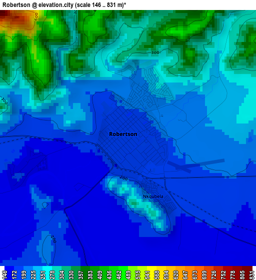
Below is the Elevation map of Robertson, which displays elevation range with different colors. Scale of the first map is from 146 to 831 m (479 to 2726 ft) with average elevation of 234.5 meters (=769 ft) [note 1]
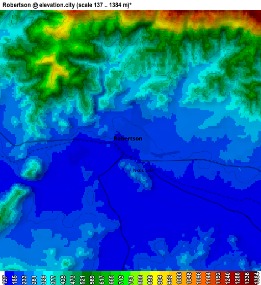
These maps also provides idea of topography and contour of this city, they are displayed at different zoom levels. More info about maps, scale and edge coordinates you can find below images.
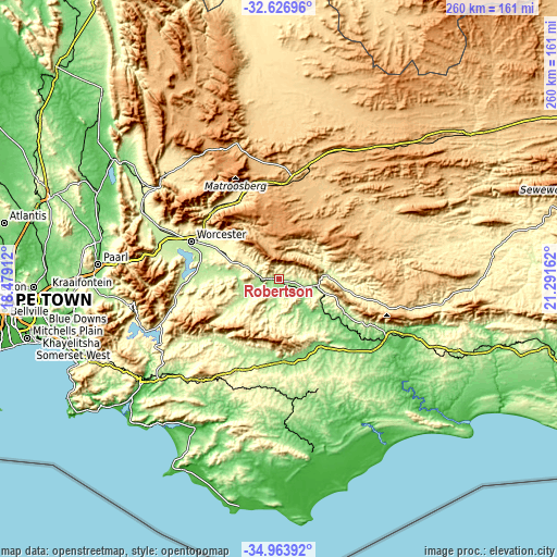
| \ | Map #1 | Map #2 | Topo.Map |
| Scale [m] | 146..831 m | 137..1384 m | × |
| Scale [ft] | 479..2726 ft | 449..4541 ft | × |
| Average | 234.5 m = 769 ft | 334.9 m = 1099 ft | × |
| Width | 8.12 km = 5 mi | 16.24 km = 10.1 mi | 259.8 km = 161.4 mi |
| Height | 8.12 km = 5 mi | 16.24 km = 10.1 mi | 259.8 km = 161.4 mi |
| ↑Max Latitude | -33.766896° | -33.730356° | -32.62696° |
| Latitude at center | -33.80342° | -33.80342° | -33.80342° |
| ↓Min Latitude | -33.839929° | -33.876422° | -34.96392° |
| ← Min Longitude | 19.841425° | 19.797479° | 18.47912° |
| Longitude center | 19.88537° | 19.88537° | 19.88537° |
| →Max Longitude | 19.929315° | 19.973261° | 21.29162° |
Nearby cities:
Cities around Robertson sort by population:
• Paarl elevation 107 m
84.5 km,  275°
275°
• Worcester 234 m
44 km,  293°
293°
• Wellington 127 m
82.9 km, 282°
• Ceres 457 m
71.9 km,  312°
312°
• Grabouw 332 m
89.1 km,  244°
244°
• Hermanus 27 m
90.9 km,  221°
221°
• Montagu 228 m
21.9 km,  85°
85°
• Bredasdorp 84 m
82.3 km,  170°
170°
• Swellendam 128 m
56.8 km,  115°
115°
• Hardys Memories of Africa 383 m
77.6 km,  98°
98°
• Caledon 260 m
63.5 km, 221°
• Ashton 185 m
16.1 km, 101°
Multilingual:
 En español:
Robertson elevación 187 m.
 En France:
Robertson élévation 187 m.
 Auf Deutsch:
Robertson höhe über dem Meeresspiegel ist 187 m.

Sources and notes:
- [note 1] Map square and city borders are not equal. Map elevation data is calculated only from area inside that square.
- [src 1] Elevation data from geonames database provided with same terms of usage.
- [src 2] The elevation map of Robertson is generated using elevation data from NASA's 3 arcsec (90m) resolution SRTM data.
- [src 3] Base (background) map © OpenStreetMap contributors tiles are generated by Geofabrik and OpenTopoMap.
Copyright & License:
This Robertson Elevation Map is licensed under CC BY-SA. You may reuse any part from this page, if you give a proper credit by linking to this URL:
 More info on terms of use page.