Laḩij elevation
Laḩij, Yemen elevation is 136 meters and Laḩij elevation in feet is 446 ft above sea level [src 1]. Laḩij is a seat of a first-order administrative division (feature code) with elevation that is 1176 meters (3858 ft) smaller than average city elevation in Yemen.
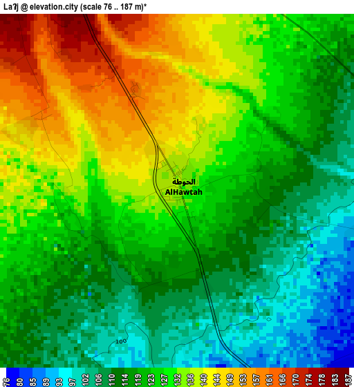
Below is the Elevation map of Laḩij, which displays elevation range with different colors. Scale of the first map is from 76 to 187 m (249 to 614 ft) with average elevation of 124.7 meters (=409 ft) [note 1]
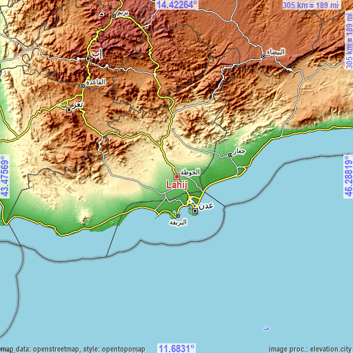
These maps also provides idea of topography and contour of this city, they are displayed at different zoom levels. More info about maps, scale and edge coordinates you can find below images.
| \ | Map #1 | Map #2 | Topo.Map |
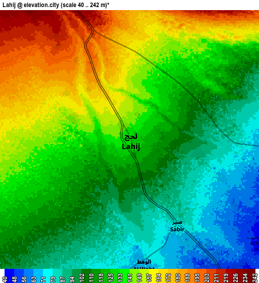
| Scale [m] | 76..187 m | 40..242 m | × |
| Scale [ft] | 249..614 ft | 131..794 ft | × |
| Average | 124.7 m = 409 ft | 125.7 m = 412 ft | × |
| Width | 9.52 km = 5.9 mi | 19.04 km = 11.8 mi | 304.6 km = 189.3 mi |
| Height | 9.52 km = 5.9 mi | 19.04 km = 11.8 mi | 304.6 km = 189.3 mi |
| ↑Max Latitude | 13.099475° | 13.142274° | 14.42264° |
| Latitude at center | 13.05667° | 13.05667° | 13.05667° |
| ↓Min Latitude | 13.013857° | 12.971037° | 11.6831° |
| ← Min Longitude | 44.837995° | 44.794049° | 43.47569° |
| Longitude center | 44.88194° | 44.88194° | 44.88194° |
| →Max Longitude | 44.925885° | 44.969831° | 46.28819° |
Nearby cities:
Cities around Laḩij sort by population:
• Aden elevation 16 m
35.1 km,  151°
151°
• Al Musaymīr 639 m
51.8 km,  326°
326°
• Al Ḩabīlayn 630 m
51.6 km,  356°
356°
• Ja‘ār 71 m
49.5 km,  68°
68°
• Al Milāḩ 530 m
41.5 km,  351°
351°
• Crater 19 m
35.6 km, 151°
• Al Burayqah 14 m
35.3 km,  179°
179°
• Al Ma‘allā’ 13 m
32.4 km,  156°
156°
• At Tawāhī 33 m
32.1 km, 160°
• Khawr Maksar 6 m
31.7 km, 148°
• Al Manşūrah 16 m
24.4 km, 153°
• Ash Shaykh ‘Uthmān 12 m
23.3 km, 148°
Multilingual:
 En español:
Laḩij elevación 136 m.
 En France:
Laḩij élévation 136 m.


Sources and notes:
- [note 1] Map square and city borders are not equal. Map elevation data is calculated only from area inside that square.
- [src 1] Elevation data from geonames database provided with same terms of usage.
- [src 2] The elevation map of Laḩij is generated using elevation data from NASA's 3 arcsec (90m) resolution SRTM data.
- [src 3] Base (background) map © OpenStreetMap contributors tiles are generated by Geofabrik and OpenTopoMap.
Copyright & License:
This Laḩij Elevation Map is licensed under CC BY-SA. You may reuse any part from this page, if you give a proper credit by linking to this URL:
 More info on terms of use page.