Bảo Lộc elevation
Bảo Lộc (Lâm Đồng, Thành Phố Bảo Lộc), Vietnam elevation is 841 meters and Bảo Lộc elevation in feet is 2759 ft above sea level [src 1]. Bảo Lộc is a seat of a second-order administrative division (feature code) with elevation that is 713 meters (2339 ft) bigger than average city elevation in Vietnam.
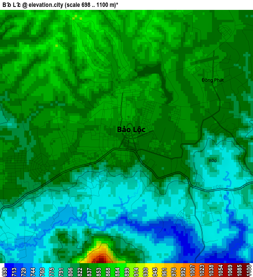
Below is the Elevation map of Bảo Lộc, which displays elevation range with different colors. Scale of the first map is from 698 to 1100 m (2290 to 3609 ft) with average elevation of 818.7 meters (=2686 ft) [note 1]
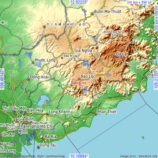
These maps also provides idea of topography and contour of this city, they are displayed at different zoom levels. More info about maps, scale and edge coordinates you can find below images.
| \ | Map #1 | Map #2 | Topo.Map |
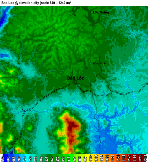
| Scale [m] | 698..1100 m | 640..1242 m | × |
| Scale [ft] | 2290..3609 ft | 2100..4075 ft | × |
| Average | 818.7 m = 2686 ft | 819.4 m = 2688 ft | × |
| Width | 9.57 km = 5.9 mi | 19.15 km = 11.9 mi | 306.4 km = 190.4 mi |
| Height | 9.57 km = 5.9 mi | 19.15 km = 11.9 mi | 306.4 km = 190.4 mi |
| ↑Max Latitude | 11.591032° | 11.634078° | 12.92225° |
| Latitude at center | 11.54798° | 11.54798° | 11.54798° |
| ↓Min Latitude | 11.504921° | 11.461855° | 10.16694° |
| ← Min Longitude | 107.763775° | 107.719829° | 106.40147° |
| Longitude center | 107.80772° | 107.80772° | 107.80772° |
| →Max Longitude | 107.851665° | 107.895611° | 109.21397° |
Nearby cities:
Cities around Bảo Lộc sort by population:
• Đưc Trọng elevation 939 m
65 km,  71°
71°
• Đinh Văn 848 m
54.3 km,  60°
60°
• Ma Lâm 31 m
63.4 km,  146°
146°
• Tánh Linh 133 m
53.4 km,  195°
195°
• Gia Nghĩa 616 m
52.3 km,  345°
345°
• Tân Phú 136 m
50.8 km,  232°
232°
• Võ Xu 123 m
48.4 km,  213°
213°
• Đồng Nai 140 m
48.3 km,  274°
274°
• Đạ Tẻh 138 m
34.8 km,  263°
263°
• Ma Đa Gui 160 m
34.7 km,  238°
238°
• Di Linh 978 m
29.5 km,  82°
82°
• Lộc Thắng 856 m
9.4 km,  18°
18°
Multilingual:
 En español:
Bảo Lộc elevación 841 m.
 En France:
Bảo Lộc élévation 841 m.


Sources and notes:
- [note 1] Map square and city borders are not equal. Map elevation data is calculated only from area inside that square.
- [src 1] Elevation data from geonames database provided with same terms of usage.
- [src 2] The elevation map of Bảo Lộc is generated using elevation data from NASA's 3 arcsec (90m) resolution SRTM data.
- [src 3] Base (background) map © OpenStreetMap contributors tiles are generated by Geofabrik and OpenTopoMap.
Copyright & License:
This Bảo Lộc Elevation Map is licensed under CC BY-SA. You may reuse any part from this page, if you give a proper credit by linking to this URL:
 More info on terms of use page.