Buôn Ma Thuột elevation
Buôn Ma Thuột (Đắk Lắk), Vietnam elevation is 459 meters and Buôn Ma Thuột elevation in feet is 1506 ft above sea level [src 1]. Buôn Ma Thuột is a seat of a first-order administrative division (feature code) with elevation that is 331 meters (1086 ft) bigger than average city elevation in Vietnam.
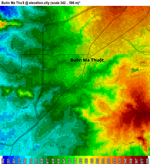
Below is the Elevation map of Buôn Ma Thuột, which displays elevation range with different colors. Scale of the first map is from 342 to 586 m (1122 to 1923 ft) with average elevation of 453.4 meters (=1488 ft) [note 1]
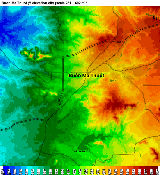
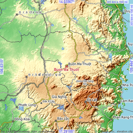
These maps also provides idea of topography and contour of this city, they are displayed at different zoom levels. More info about maps, scale and edge coordinates you can find below images.
| \ | Map #1 | Map #2 | Topo.Map |
| Scale [m] | 342..586 m | 281..602 m | × |
| Scale [ft] | 1122..1923 ft | 922..1975 ft | × |
| Average | 453.4 m = 1488 ft | 437.6 m = 1436 ft | × |
| Width | 9.53 km = 5.9 mi | 19.07 km = 11.8 mi | 305.1 km = 189.6 mi |
| Height | 9.53 km = 5.9 mi | 19.07 km = 11.8 mi | 305.1 km = 189.6 mi |
| ↑Max Latitude | 12.710342° | 12.753207° | 14.03567° |
| Latitude at center | 12.66747° | 12.66747° | 12.66747° |
| ↓Min Latitude | 12.624591° | 12.581704° | 11.29188° |
| ← Min Longitude | 107.993805° | 107.949859° | 106.6315° |
| Longitude center | 108.03775° | 108.03775° | 108.03775° |
| →Max Longitude | 108.081695° | 108.125641° | 109.444° |
Nearby cities:
Cities around Buôn Ma Thuột sort by population:
• Ea Drăng elevation 585 m
62.6 km,  17°
17°
• Tram de Dak Mil 743 m
51.2 km,  241°
241°
• Ea Súp 208 m
47.3 km,  339°
339°
• Ea Kar 490 m
47.3 km,  70°
70°
• Krông Năng 701 m
45.9 km,  46°
46°
• Krông Kmar 464 m
36.8 km,  119°
119°
• Lắk 429 m
32.3 km,  152°
152°
• Đắk Mâm 419 m
30.1 km,  219°
219°
• Phước An 526 m
29.1 km,  79°
79°
• Buôn Trấp 431 m
20.3 km,  182°
182°
• Ea T’ling 349 m
17.7 km, 240°
• Quảng Phú 462 m
17.5 km,  14°
14°
Multilingual:
 En español:
Buôn Ma Thuột elevación 459 m.
 En France:
Buôn Ma Thuột élévation 459 m.
 Auf Deutsch:
Buôn Ma Thuột höhe über dem Meeresspiegel ist 459 m.

Sources and notes:
- [note 1] Map square and city borders are not equal. Map elevation data is calculated only from area inside that square.
- [src 1] Elevation data from geonames database provided with same terms of usage.
- [src 2] The elevation map of Buôn Ma Thuột is generated using elevation data from NASA's 3 arcsec (90m) resolution SRTM data.
- [src 3] Base (background) map © OpenStreetMap contributors tiles are generated by Geofabrik and OpenTopoMap.
Copyright & License:
This Buôn Ma Thuột Elevation Map is licensed under CC BY-SA. You may reuse any part from this page, if you give a proper credit by linking to this URL:
 More info on terms of use page.