Haiphong elevation
Haiphong, Vietnam elevation is 12 meters and Haiphong elevation in feet is 39 ft above sea level [src 1]. Haiphong is a seat of a first-order administrative division (feature code) with elevation that is 116 meters (381 ft) smaller than average city elevation in Vietnam.
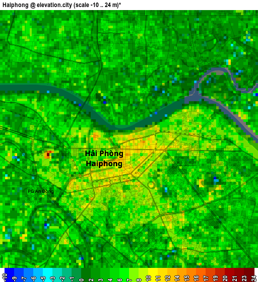
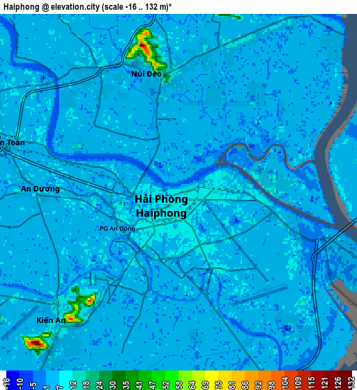
Below is the Elevation map of Haiphong, which displays elevation range with different colors. Scale of the first map is from -10 to 24 m (-33 to 79 ft) with average elevation of 4.7 meters (=15 ft) [note 1]
These maps also provides idea of topography and contour of this city, they are displayed at different zoom levels. More info about maps, scale and edge coordinates you can find below images.
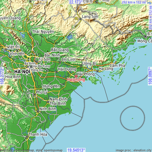
| \ | Map #1 | Map #2 | Topo.Map |
| Scale [m] | -10..24 m | -16..132 m | × |
| Scale [ft] | -33..79 ft | -52..433 ft | × |
| Average | 4.7 m = 15 ft | 4.8 m = 16 ft | × |
| Width | 9.13 km = 5.7 mi | 18.26 km = 11.3 mi | 292.2 km = 181.6 mi |
| Height | 9.13 km = 5.7 mi | 18.26 km = 11.3 mi | 292.2 km = 181.6 mi |
| ↑Max Latitude | 20.905868° | 20.946915° | 22.173° |
| Latitude at center | 20.86481° | 20.86481° | 20.86481° |
| ↓Min Latitude | 20.823741° | 20.782661° | 19.54513° |
| ← Min Longitude | 106.639505° | 106.595559° | 105.2772° |
| Longitude center | 106.68345° | 106.68345° | 106.68345° |
| →Max Longitude | 106.727395° | 106.771341° | 108.0897° |
Nearby cities:
Cities around Haiphong sort by population:
• Thành Phố Uông Bí elevation 11 m
20.9 km,  25°
25°
• Ninh Giang 6 m
33.2 km,  243°
243°
• Tứ Kỳ 5 m
29.2 km,  259°
259°
• Thanh Hà 8 m
27 km,  277°
277°
• Phú Thái 6 m
21.1 km,  301°
301°
• Tiên Lãng 8 m
20.6 km,  220°
220°
• Kinh Môn 6 m
19.2 km,  316°
316°
• Quảng Yên 9 m
15.1 km,  55°
55°
• An Lão 5 m
14.1 km,  250°
250°
• Núi Đối 5 m
12.8 km,  186°
186°
• An Dương 5 m
7.3 km,  269°
269°
• Núi Đèo 6 m
5.7 km,  350°
350°
Multilingual:
 En español:
Haiphong elevación 12 m.
 En France:
Hải Phòng élévation 12 m.


Sources and notes:
- [note 1] Map square and city borders are not equal. Map elevation data is calculated only from area inside that square.
- [src 1] Elevation data from geonames database provided with same terms of usage.
- [src 2] The elevation map of Haiphong is generated using elevation data from NASA's 3 arcsec (90m) resolution SRTM data.
- [src 3] Base (background) map © OpenStreetMap contributors tiles are generated by Geofabrik and OpenTopoMap.
Copyright & License:
This Haiphong Elevation Map is licensed under CC BY-SA. You may reuse any part from this page, if you give a proper credit by linking to this URL:
 More info on terms of use page.