Phú Khương elevation
Phú Khương (Tây Ninh Province), Vietnam elevation is 18 meters and Phú Khương elevation in feet is 59 ft above sea level [src 1]. Phú Khương is a populated place (feature code) with elevation that is 110 meters (361 ft) smaller than average city elevation in Vietnam.
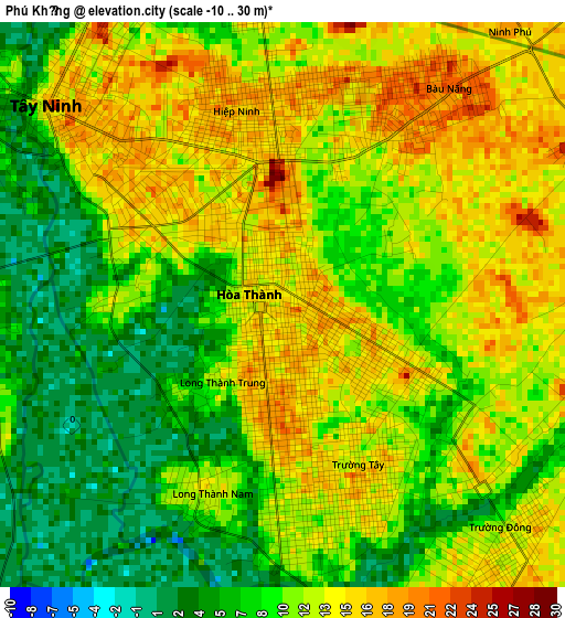
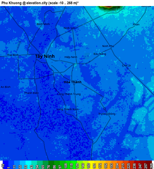
Below is the Elevation map of Phú Khương, which displays elevation range with different colors. Scale of the first map is from -10 to 30 m (-33 to 98 ft) with average elevation of 10.8 meters (=35 ft) [note 1]
These maps also provides idea of topography and contour of this city, they are displayed at different zoom levels. More info about maps, scale and edge coordinates you can find below images.
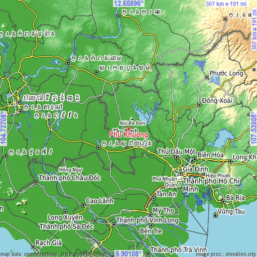
| \ | Map #1 | Map #2 | Topo.Map |
| Scale [m] | -10..30 m | -10..268 m | × |
| Scale [ft] | -33..98 ft | -33..879 ft | × |
| Average | 10.8 m = 35 ft | 12.3 m = 40 ft | × |
| Width | 9.58 km = 6 mi | 19.17 km = 11.9 mi | 306.6 km = 190.5 mi |
| Height | 9.58 km = 6 mi | 19.17 km = 11.9 mi | 306.7 km = 190.6 mi |
| ↑Max Latitude | 11.326423° | 11.369509° | 12.65896° |
| Latitude at center | 11.28333° | 11.28333° | 11.28333° |
| ↓Min Latitude | 11.240231° | 11.197125° | 9.90108° |
| ← Min Longitude | 106.089385° | 106.045439° | 104.72708° |
| Longitude center | 106.13333° | 106.13333° | 106.13333° |
| →Max Longitude | 106.177275° | 106.221221° | 107.53958° |
Nearby cities:
Cities around Phú Khương sort by population:
• Tây Ninh elevation 18 m
4.8 km,  307°
307°
• Hậu Nghĩa 6 m
51.9 km,  146°
146°
• Đông Thành 4 m
47.4 km,  156°
156°
• Trảng Bàng 9 m
37.3 km,  139°
139°
• Tân Biên 18 m
31.9 km,  335°
335°
• Tân Châu 27 m
30.2 km,  8°
8°
• Gò Dầu 9 m
25.9 km, 146°
• Dầu Tiếng 21 m
24.6 km,  92°
92°
• Bến Cầu 7 m
19.9 km,  165°
165°
• Dương Minh Châu 23 m
15.4 km,  43°
43°
• Châu Thành 12 m
11.8 km,  285°
285°
• Hòa Thành 12 m
0.6 km, 312°
Multilingual:
 En español:
Phú Khương elevación 18 m.
 En France:
Phú Khương élévation 18 m.
 Auf Deutsch:
Phú Khương höhe über dem Meeresspiegel ist 18 m.

Sources and notes:
- [note 1] Map square and city borders are not equal. Map elevation data is calculated only from area inside that square.
- [src 1] Elevation data from geonames database provided with same terms of usage.
- [src 2] The elevation map of Phú Khương is generated using elevation data from NASA's 3 arcsec (90m) resolution SRTM data.
- [src 3] Base (background) map © OpenStreetMap contributors tiles are generated by Geofabrik and OpenTopoMap.
Copyright & License:
This Phú Khương Elevation Map is licensed under CC BY-SA. You may reuse any part from this page, if you give a proper credit by linking to this URL:
 More info on terms of use page.