Vĩnh Yên elevation
Vĩnh Yên (Vĩnh Phúc), Vietnam elevation is 19 meters and Vĩnh Yên elevation in feet is 62 ft above sea level [src 1]. Vĩnh Yên is a seat of a first-order administrative division (feature code) with elevation that is 109 meters (358 ft) smaller than average city elevation in Vietnam.
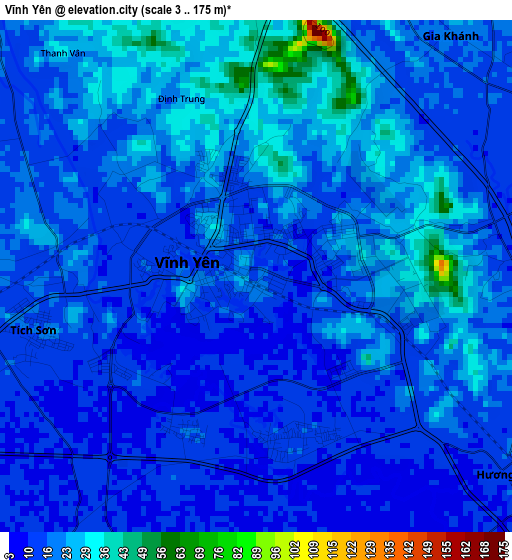
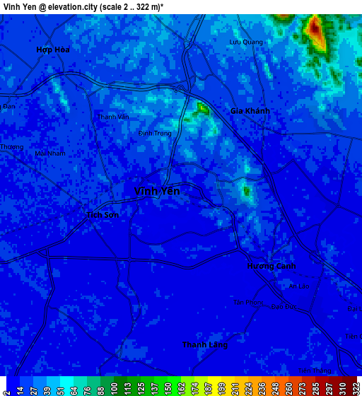
Below is the Elevation map of Vĩnh Yên, which displays elevation range with different colors. Scale of the first map is from 3 to 175 m (10 to 574 ft) with average elevation of 18 meters (=59 ft) [note 1]
These maps also provides idea of topography and contour of this city, they are displayed at different zoom levels. More info about maps, scale and edge coordinates you can find below images.
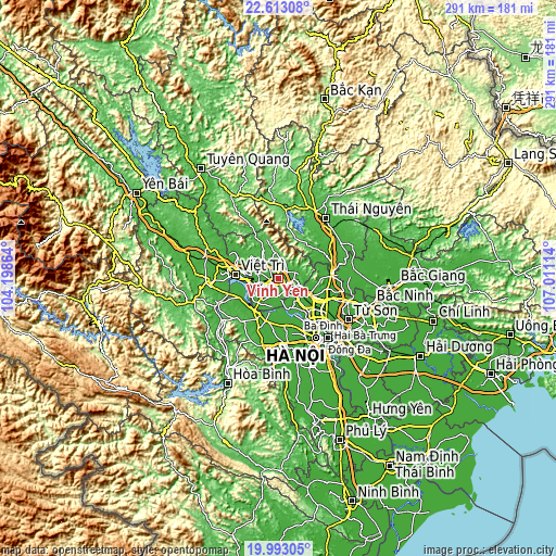
| \ | Map #1 | Map #2 | Topo.Map |
| Scale [m] | 3..175 m | 2..322 m | × |
| Scale [ft] | 10..574 ft | 7..1056 ft | × |
| Average | 18 m = 59 ft | 20.1 m = 66 ft | × |
| Width | 9.1 km = 5.7 mi | 18.21 km = 11.3 mi | 291.3 km = 181 mi |
| Height | 9.1 km = 5.7 mi | 18.21 km = 11.3 mi | 291.3 km = 181 mi |
| ↑Max Latitude | 21.349845° | 21.390769° | 22.61308° |
| Latitude at center | 21.30891° | 21.30891° | 21.30891° |
| ↓Min Latitude | 21.267963° | 21.227005° | 19.99305° |
| ← Min Longitude | 105.560945° | 105.516999° | 104.19864° |
| Longitude center | 105.60489° | 105.60489° | 105.60489° |
| →Max Longitude | 105.648835° | 105.692781° | 107.01114° |
Nearby cities:
Cities around Vĩnh Yên sort by population:
• Việt Trì elevation 25 m
21.1 km,  274°
274°
• Sơn Tây 16 m
21.3 km,  208°
208°
• Phúc Thọ 17 m
23.7 km,  195°
195°
• Tây Đằng 19 m
22.6 km,  236°
236°
• Lập Thạch 30 m
19 km,  308°
308°
• Mê Linh 11 m
18.4 km,  139°
139°
• Vĩnh Tường 14 m
14 km,  222°
222°
• Phúc Yên 20 m
13.1 km,  127°
127°
• Hợp Hòa 21 m
9.8 km,  318°
318°
• Trai Ngau 52 m
9.4 km,  6°
6°
• Yên Lạc 15 m
8.7 km, 202°
• Hương Canh 15 m
5.5 km, 127°
Multilingual:
 En español:
Vĩnh Yên elevación 19 m.
 En France:
Vĩnh Yên élévation 19 m.


Sources and notes:
- [note 1] Map square and city borders are not equal. Map elevation data is calculated only from area inside that square.
- [src 1] Elevation data from geonames database provided with same terms of usage.
- [src 2] The elevation map of Vĩnh Yên is generated using elevation data from NASA's 3 arcsec (90m) resolution SRTM data.
- [src 3] Base (background) map © OpenStreetMap contributors tiles are generated by Geofabrik and OpenTopoMap.
Copyright & License:
This Vĩnh Yên Elevation Map is licensed under CC BY-SA. You may reuse any part from this page, if you give a proper credit by linking to this URL:
 More info on terms of use page.