Coro elevation
Coro (Falcón), Venezuela elevation is 27 meters and Coro elevation in feet is 89 ft above sea level [src 1]. Coro is a seat of a first-order administrative division (feature code) with elevation that is 354 meters (1161 ft) smaller than average city elevation in Venezuela.
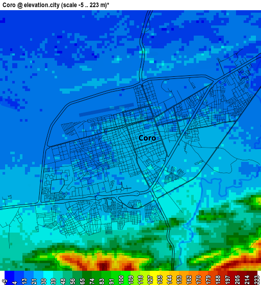
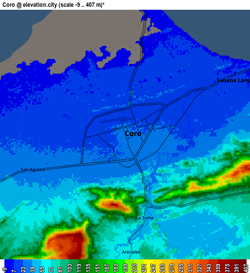
Below is the Elevation map of Coro, which displays elevation range with different colors. Scale of the first map is from -5 to 223 m (-16 to 732 ft) with average elevation of 30.4 meters (=100 ft) [note 1]
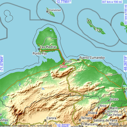
These maps also provides idea of topography and contour of this city, they are displayed at different zoom levels. More info about maps, scale and edge coordinates you can find below images.
| \ | Map #1 | Map #2 | Topo.Map |
| Scale [m] | -5..223 m | -9..407 m | × |
| Scale [ft] | -16..732 ft | -30..1335 ft | × |
| Average | 30.4 m = 100 ft | 53.9 m = 177 ft | × |
| Width | 9.58 km = 6 mi | 19.16 km = 11.9 mi | 306.5 km = 190.4 mi |
| Height | 9.58 km = 6 mi | 19.16 km = 11.9 mi | 306.5 km = 190.4 mi |
| ↑Max Latitude | 11.447574° | 11.490642° | 12.77951° |
| Latitude at center | 11.4045° | 11.4045° | 11.4045° |
| ↓Min Latitude | 11.361419° | 11.318332° | 10.0228° |
| ← Min Longitude | -69.717385° | -69.761331° | -71.07969° |
| Longitude center | -69.67344° | -69.67344° | -69.67344° |
| →Max Longitude | -69.629495° | -69.585549° | -68.26719° |
Nearby cities:
Cities around Coro sort by population:
• Punto Fijo elevation 5 m
65.6 km,  299°
299°
• Punta Cardón 34 m
65.4 km, 295°
• Urumaco 92 m
67.4 km,  250°
250°
• Pueblo Nuevo 85 m
66.3 km,  335°
335°
• Pedregal 178 m
64.8 km,  228°
228°
• Píritu 249 m
58.5 km,  94°
94°
• Tocópero 166 m
46.4 km,  76°
76°
• La Cruz de Taratara 304 m
38.2 km,  186°
186°
• Puerto Cumarebo 18 m
36.1 km, 75°
• San Luis 744 m
31.6 km,  182°
182°
• Cabure 630 m
29.6 km,  166°
166°
• La Vela de Coro 10 m
13.3 km,  61°
61°
Multilingual:
 En español:
Coro elevación 27 m.
 En France:
Coro élévation 27 m.


Sources and notes:
- [note 1] Map square and city borders are not equal. Map elevation data is calculated only from area inside that square.
- [src 1] Elevation data from geonames database provided with same terms of usage.
- [src 2] The elevation map of Coro is generated using elevation data from NASA's 3 arcsec (90m) resolution SRTM data.
- [src 3] Base (background) map © OpenStreetMap contributors tiles are generated by Geofabrik and OpenTopoMap.
Copyright & License:
This Coro Elevation Map is licensed under CC BY-SA. You may reuse any part from this page, if you give a proper credit by linking to this URL:
 More info on terms of use page.