La Villa del Rosario elevation
La Villa del Rosario (Zulia, Municipio Rosario de Perijá), Venezuela elevation is 83 meters and La Villa del Rosario elevation in feet is 272 ft above sea level [src 1]. La Villa del Rosario is a seat of a second-order administrative division (feature code) with elevation that is 298 meters (978 ft) smaller than average city elevation in Venezuela.
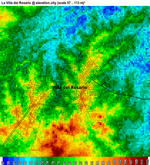
Below is the Elevation map of La Villa del Rosario, which displays elevation range with different colors. Scale of the first map is from 57 to 113 m (187 to 371 ft) with average elevation of 79.2 meters (=260 ft) [note 1]
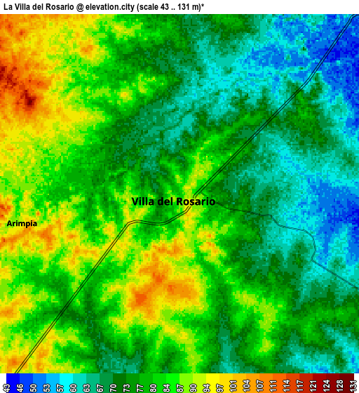
These maps also provides idea of topography and contour of this city, they are displayed at different zoom levels. More info about maps, scale and edge coordinates you can find below images.
| \ | Map #1 | Map #2 | Topo.Map |
| Scale [m] | 57..113 m | 43..131 m | × |
| Scale [ft] | 187..371 ft | 141..430 ft | × |
| Average | 79.2 m = 260 ft | 77.9 m = 256 ft | × |
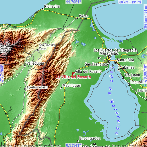
| Width | 9.61 km = 6 mi | 19.23 km = 11.9 mi | 307.6 km = 191.1 mi |
| Height | 9.61 km = 6 mi | 19.23 km = 11.9 mi | 307.7 km = 191.2 mi |
| ↑Max Latitude | 10.369031° | 10.412255° | 11.7061° |
| Latitude at center | 10.3258° | 10.3258° | 10.3258° |
| ↓Min Latitude | 10.282563° | 10.239321° | 8.93941° |
| ← Min Longitude | -72.357375° | -72.401321° | -73.71968° |
| Longitude center | -72.31343° | -72.31343° | -72.31343° |
| →Max Longitude | -72.269485° | -72.225539° | -70.90718° |
Nearby cities:
Cities around La Villa del Rosario sort by population:
• Maracaibo elevation 40 m
85.5 km,  63°
63°
• Cabimas 5 m
94.6 km,  85°
85°
• Machiques 99 m
39.4 km,  221°
221°
• Santa Rita 9 m
90.8 km,  75°
75°
• Tía Juana 1 m
104.2 km, 94°
• El Toro 3 m
100.8 km,  46°
46°
• Sinamaica 0 m
98.3 km,  30°
30°
• Los Puertos de Altagracia 17 m
96.8 km, 63°
• Concepción 61 m
79.7 km, 48°
• San Francisco 54 m
71.3 km,  69°
69°
• Concepción 2 m
68.9 km, 82°
• La Concepción 75 m
61.4 km, 57°
Multilingual:
 En español:
La Villa del Rosario elevación 83 m.
 En France:
La Villa del Rosario élévation 83 m.
 Auf Deutsch:
La Villa del Rosario höhe über dem Meeresspiegel ist 83 m.

Sources and notes:
- [note 1] Map square and city borders are not equal. Map elevation data is calculated only from area inside that square.
- [src 1] Elevation data from geonames database provided with same terms of usage.
- [src 2] The elevation map of La Villa del Rosario is generated using elevation data from NASA's 3 arcsec (90m) resolution SRTM data.
- [src 3] Base (background) map © OpenStreetMap contributors tiles are generated by Geofabrik and OpenTopoMap.
Copyright & License:
This La Villa del Rosario Elevation Map is licensed under CC BY-SA. You may reuse any part from this page, if you give a proper credit by linking to this URL:
 More info on terms of use page.