Cardona elevation
Cardona (Soriano), Uruguay elevation is 170 meters and Cardona elevation in feet is 558 ft above sea level [src 1]. Cardona is a populated place (feature code) with elevation that is 99 meters (325 ft) bigger than average city elevation in Uruguay.
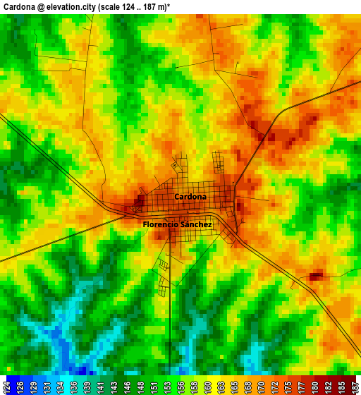
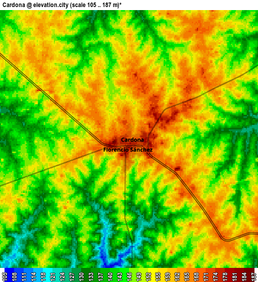
Below is the Elevation map of Cardona, which displays elevation range with different colors. Scale of the first map is from 124 to 187 m (407 to 614 ft) with average elevation of 158.2 meters (=519 ft) [note 1]
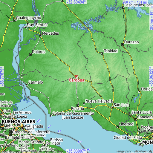
These maps also provides idea of topography and contour of this city, they are displayed at different zoom levels. More info about maps, scale and edge coordinates you can find below images.
| \ | Map #1 | Map #2 | Topo.Map |
| Scale [m] | 124..187 m | 105..187 m | × |
| Scale [ft] | 407..614 ft | 344..614 ft | × |
| Average | 158.2 m = 519 ft | 149.8 m = 491 ft | × |
| Width | 8.11 km = 5 mi | 16.23 km = 10.1 mi | 259.6 km = 161.3 mi |
| Height | 8.11 km = 5 mi | 16.23 km = 10.1 mi | 259.6 km = 161.3 mi |
| ↑Max Latitude | -33.833994° | -33.797483° | -32.69494° |
| Latitude at center | -33.87049° | -33.87049° | -33.87049° |
| ↓Min Latitude | -33.90697° | -33.943434° | -35.03007° |
| ← Min Longitude | -57.413485° | -57.457431° | -58.77579° |
| Longitude center | -57.36954° | -57.36954° | -57.36954° |
| →Max Longitude | -57.325595° | -57.281649° | -55.96329° |
Nearby cities:
Cities around Cardona sort by population:
• Colonia del Sacramento elevation 30 m
78.8 km,  213°
213°
• Trinidad 142 m
58.6 km,  47°
47°
• Juan L. Lacaze 15 m
61.5 km,  187°
187°
• Nueva Helvecia 52 m
49.4 km,  165°
165°
• Rosario 26 m
49.6 km,  177°
177°
• Tarariras 92 m
49.6 km, 207°
• Florencio Sánchez 177 m
0.8 km, 193°
• Ombúes de Lavalle 110 m
41.3 km,  259°
259°
• Ecilda Paullier 74 m
61.7 km,  151°
151°
• José Enrique Rodó 140 m
24.5 km,  322°
322°
• Palmitas 90 m
56.8 km, 315°
• Santa Catalina 153 m
14.1 km,  308°
308°
Multilingual:
 En español:
Cardona elevación 170 m.
 En France:
Cardona élévation 170 m.


Sources and notes:
- [note 1] Map square and city borders are not equal. Map elevation data is calculated only from area inside that square.
- [src 1] Elevation data from geonames database provided with same terms of usage.
- [src 2] The elevation map of Cardona is generated using elevation data from NASA's 3 arcsec (90m) resolution SRTM data.
- [src 3] Base (background) map © OpenStreetMap contributors tiles are generated by Geofabrik and OpenTopoMap.
Copyright & License:
This Cardona Elevation Map is licensed under CC BY-SA. You may reuse any part from this page, if you give a proper credit by linking to this URL:
 More info on terms of use page.