La Paz elevation
La Paz (Canelones), Uruguay elevation is 57 meters and La Paz elevation in feet is 187 ft above sea level [src 1]. La Paz is a populated place (feature code) with elevation that is 14 meters (46 ft) smaller than average city elevation in Uruguay.
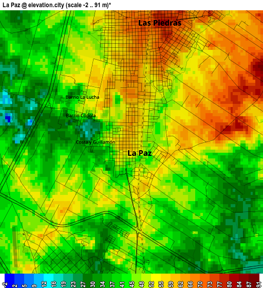
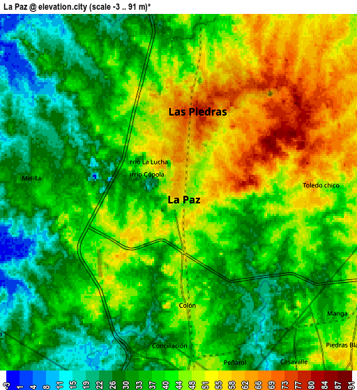
Below is the Elevation map of La Paz, which displays elevation range with different colors. Scale of the first map is from -2 to 91 m (-7 to 299 ft) with average elevation of 47.4 meters (=156 ft) [note 1]
These maps also provides idea of topography and contour of this city, they are displayed at different zoom levels. More info about maps, scale and edge coordinates you can find below images.
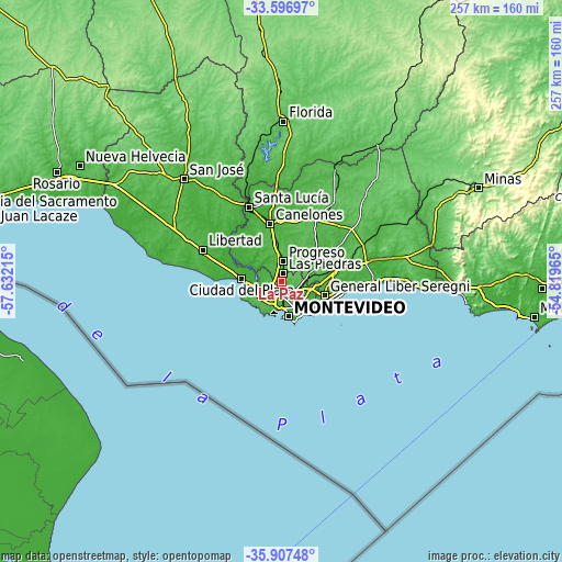
| \ | Map #1 | Map #2 | Topo.Map |
| Scale [m] | -2..91 m | -3..91 m | × |
| Scale [ft] | -7..299 ft | -10..299 ft | × |
| Average | 47.4 m = 156 ft | 40.5 m = 133 ft | × |
| Width | 8.03 km = 5 mi | 16.06 km = 10 mi | 256.9 km = 159.6 mi |
| Height | 8.03 km = 5 mi | 16.06 km = 10 mi | 256.9 km = 159.6 mi |
| ↑Max Latitude | -34.724199° | -34.688072° | -33.59697° |
| Latitude at center | -34.76031° | -34.76031° | -34.76031° |
| ↓Min Latitude | -34.796405° | -34.832484° | -35.90748° |
| ← Min Longitude | -56.269845° | -56.313791° | -57.63215° |
| Longitude center | -56.2259° | -56.2259° | -56.2259° |
| →Max Longitude | -56.181955° | -56.138009° | -54.81965° |
Nearby cities:
Cities around La Paz sort by population:
• Montevideo elevation 34 m
16.3 km,  167°
167°
• Las Piedras 72 m
3.4 km,  10°
10°
• Delta del Tigre 5 m
12.7 km,  267°
267°
• Progreso 56 m
10.4 km,  4°
4°
• Paso de Carrasco 9 m
19.4 km,  125°
125°
• Colonia Nicolich 16 m
19.4 km,  108°
108°
• Joaquín Suárez 58 m
17.7 km,  80°
80°
• Sauce 52 m
19.1 km,  50°
50°
• Toledo 64 m
12.2 km, 78°
• Pajas Blancas 24 m
10.9 km,  245°
245°
• Santiago Vázquez 13 m
11.8 km, 253°
• Juanicó 43 m
18.6 km,  352°
352°
Multilingual:
 En español:
La Paz elevación 57 m.
 En France:
La Paz élévation 57 m.


Sources and notes:
- [note 1] Map square and city borders are not equal. Map elevation data is calculated only from area inside that square.
- [src 1] Elevation data from geonames database provided with same terms of usage.
- [src 2] The elevation map of La Paz is generated using elevation data from NASA's 3 arcsec (90m) resolution SRTM data.
- [src 3] Base (background) map © OpenStreetMap contributors tiles are generated by Geofabrik and OpenTopoMap.
Copyright & License:
This La Paz Elevation Map is licensed under CC BY-SA. You may reuse any part from this page, if you give a proper credit by linking to this URL:
 More info on terms of use page.