Tala elevation
Tala (Canelones), Uruguay elevation is 84 meters and Tala elevation in feet is 276 ft above sea level [src 1]. Tala is a populated place (feature code) with elevation that is 13 meters (43 ft) bigger than average city elevation in Uruguay.
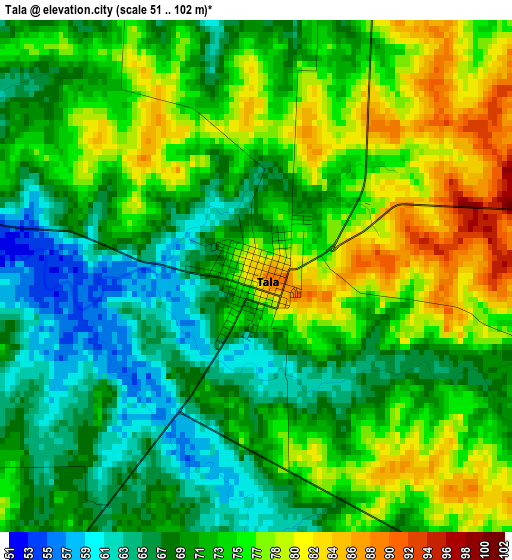
Below is the Elevation map of Tala, which displays elevation range with different colors. Scale of the first map is from 51 to 102 m (167 to 335 ft) with average elevation of 72.2 meters (=237 ft) [note 1]
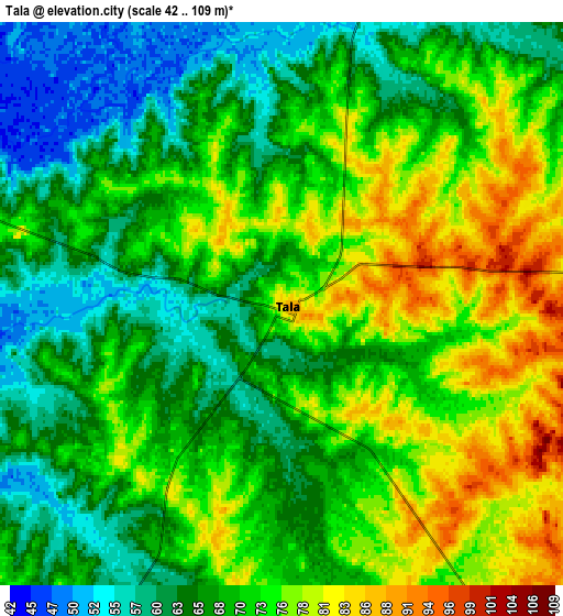
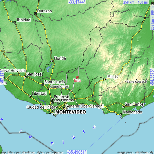
These maps also provides idea of topography and contour of this city, they are displayed at different zoom levels. More info about maps, scale and edge coordinates you can find below images.
| \ | Map #1 | Map #2 | Topo.Map |
| Scale [m] | 51..102 m | 42..109 m | × |
| Scale [ft] | 167..335 ft | 138..358 ft | × |
| Average | 72.2 m = 237 ft | 70.1 m = 230 ft | × |
| Width | 8.07 km = 5 mi | 16.14 km = 10 mi | 258.2 km = 160.4 mi |
| Height | 8.07 km = 5 mi | 16.14 km = 10 mi | 258.2 km = 160.4 mi |
| ↑Max Latitude | -34.307198° | -34.27089° | -33.1744° |
| Latitude at center | -34.34349° | -34.34349° | -34.34349° |
| ↓Min Latitude | -34.379766° | -34.416027° | -35.49651° |
| ← Min Longitude | -55.807695° | -55.851641° | -57.17° |
| Longitude center | -55.76375° | -55.76375° | -55.76375° |
| →Max Longitude | -55.719805° | -55.675859° | -54.3575° |
Nearby cities:
Cities around Tala sort by population:
• San Ramón elevation 44 m
18.6 km,  288°
288°
• Empalme Olmos 39 m
41.1 km,  196°
196°
• San Jacinto 61 m
24.5 km, 203°
• Santa Rosa 58 m
30.5 km,  235°
235°
• Solís de Mataojo 40 m
39.3 km,  136°
136°
• Casupá 125 m
29.1 km,  21°
21°
• Las Toscas 2 m
43.6 km,  174°
174°
• Migues 79 m
20.3 km, 142°
• San Bautista 74 m
20.9 km, 238°
• Soca 11 m
38.3 km, 171°
• Montes 39 m
24.9 km,  132°
132°
• San Antonio 52 m
31.4 km,  247°
247°
Multilingual:
 En español:
Tala elevación 84 m.
 En France:
Tala élévation 84 m.


Sources and notes:
- [note 1] Map square and city borders are not equal. Map elevation data is calculated only from area inside that square.
- [src 1] Elevation data from geonames database provided with same terms of usage.
- [src 2] The elevation map of Tala is generated using elevation data from NASA's 3 arcsec (90m) resolution SRTM data.
- [src 3] Base (background) map © OpenStreetMap contributors tiles are generated by Geofabrik and OpenTopoMap.
Copyright & License:
This Tala Elevation Map is licensed under CC BY-SA. You may reuse any part from this page, if you give a proper credit by linking to this URL:
 More info on terms of use page.