Oleksandrivka elevation
Oleksandrivka (Mykolaiv), Ukraine elevation is 37 meters and Oleksandrivka elevation in feet is 121 ft above sea level [src 1]. Oleksandrivka is a populated place (feature code) with elevation that is 120 meters (394 ft) smaller than average city elevation in Ukraine.
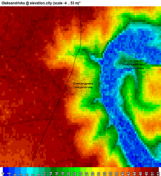
Below is the Elevation map of Oleksandrivka, which displays elevation range with different colors. Scale of the first map is from -4 to 53 m (-13 to 174 ft) with average elevation of 32.9 meters (=108 ft) [note 1]
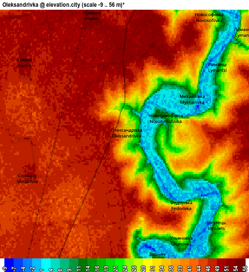
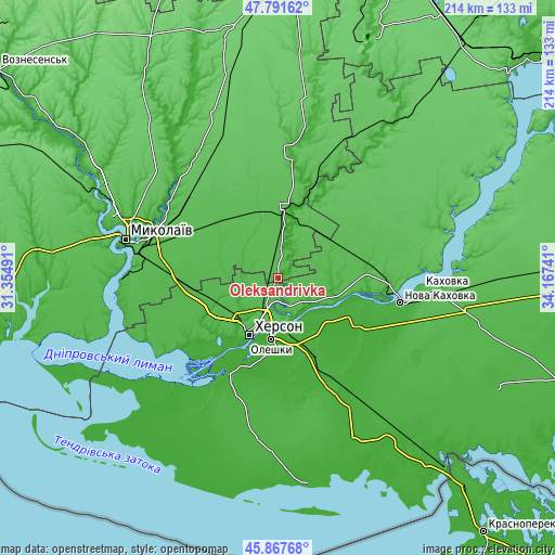
These maps also provides idea of topography and contour of this city, they are displayed at different zoom levels. More info about maps, scale and edge coordinates you can find below images.
| \ | Map #1 | Map #2 | Topo.Map |
| Scale [m] | -4..53 m | -9..56 m | × |
| Scale [ft] | -13..174 ft | -30..184 ft | × |
| Average | 32.9 m = 108 ft | 37.5 m = 123 ft | × |
| Width | 6.68 km = 4.2 mi | 13.37 km = 8.3 mi | 213.9 km = 132.9 mi |
| Height | 6.69 km = 4.2 mi | 13.37 km = 8.3 mi | 213.9 km = 132.9 mi |
| ↑Max Latitude | 46.868313° | 46.898349° | 47.79162° |
| Latitude at center | 46.83826° | 46.83826° | 46.83826° |
| ↓Min Latitude | 46.80819° | 46.778104° | 45.86768° |
| ← Min Longitude | 32.717215° | 32.673269° | 31.35491° |
| Longitude center | 32.76116° | 32.76116° | 32.76116° |
| →Max Longitude | 32.805105° | 32.849051° | 34.16741° |
Nearby cities:
Cities around Oleksandrivka sort by population:
• Kherson elevation 51 m
23 km,  208°
208°
• Tsyurupyns’k 9 m
24.7 km,  187°
187°
• Hola Prystan’ 0 m
39 km, 207°
• Snihurivka 51 m
26.6 km,  7°
7°
• Bilozerka 18 m
34 km,  225°
225°
• Chornobayivka 19 m
22.5 km,  224°
224°
• Komyshany 23 m
29.6 km, 220°
• Velyki Kopani 11 m
42.3 km,  157°
157°
• Dnipryany 23 m
40.3 km,  104°
104°
• Radens’k 14 m
34.6 km, 158°
• Kozachi Laheri 16 m
22.3 km,  132°
132°
• Shevchenkove 44 m
42.5 km,  273°
273°
Multilingual:
 En español:
Oleksandrivka elevación 37 m.
 En France:
Oleksandrivka élévation 37 m.
 Auf Deutsch:
Oleksandrivka höhe über dem Meeresspiegel ist 37 m.

Sources and notes:
- [note 1] Map square and city borders are not equal. Map elevation data is calculated only from area inside that square.
- [src 1] Elevation data from geonames database provided with same terms of usage.
- [src 2] The elevation map of Oleksandrivka is generated using elevation data from NASA's 3 arcsec (90m) resolution SRTM data.
- [src 3] Base (background) map © OpenStreetMap contributors tiles are generated by Geofabrik and OpenTopoMap.
Copyright & License:
This Oleksandrivka Elevation Map is licensed under CC BY-SA. You may reuse any part from this page, if you give a proper credit by linking to this URL:
 More info on terms of use page.