Bilohirsk elevation
Bilohirsk (Republic of Crimea, Belogorskiy rayon), Ukraine elevation is 182 meters and Bilohirsk elevation in feet is 597 ft above sea level [src 1]. Bilohirsk is a seat of a second-order administrative division (feature code) with elevation that is 25 meters (82 ft) bigger than average city elevation in Ukraine.
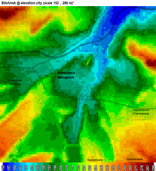
Below is the Elevation map of Bilohirsk, which displays elevation range with different colors. Scale of the first map is from 152 to 286 m (499 to 938 ft) with average elevation of 208.9 meters (=685 ft) [note 1]
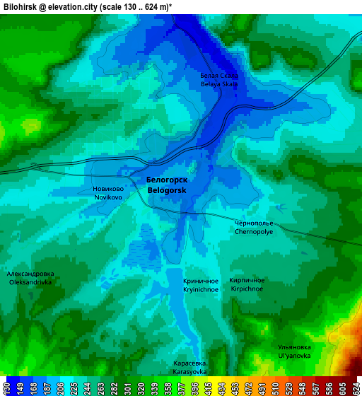
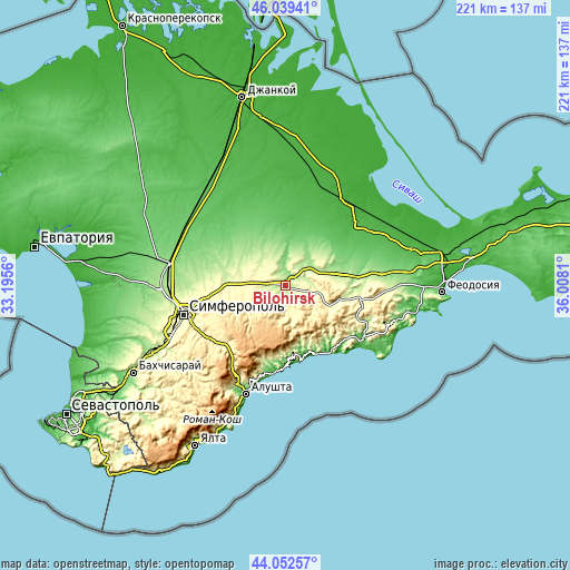
These maps also provides idea of topography and contour of this city, they are displayed at different zoom levels. More info about maps, scale and edge coordinates you can find below images.
| \ | Map #1 | Map #2 | Topo.Map |
| Scale [m] | 152..286 m | 130..624 m | × |
| Scale [ft] | 499..938 ft | 427..2047 ft | × |
| Average | 208.9 m = 685 ft | 250.2 m = 821 ft | × |
| Width | 6.9 km = 4.3 mi | 13.81 km = 8.6 mi | 220.9 km = 137.3 mi |
| Height | 6.9 km = 4.3 mi | 13.81 km = 8.6 mi | 220.9 km = 137.3 mi |
| ↑Max Latitude | 45.085656° | 45.116675° | 46.03941° |
| Latitude at center | 45.05462° | 45.05462° | 45.05462° |
| ↓Min Latitude | 45.023567° | 44.992498° | 44.05257° |
| ← Min Longitude | 34.557905° | 34.513959° | 33.1956° |
| Longitude center | 34.60185° | 34.60185° | 34.60185° |
| →Max Longitude | 34.645795° | 34.689741° | 36.0081° |
Nearby cities:
Cities around Bilohirsk sort by population:
• Tsvetochnoye elevation 249 m
17.4 km,  281°
281°
• Zelenogorskoye 298 m
11.5 km,  245°
245°
• Aromatnoye 318 m
16 km,  262°
262°
• Krymskaya Roza 293 m
19.3 km,  271°
271°
• Vishennoye 141 m
10.1 km,  357°
357°
• Vasilyevka 169 m
13.4 km,  45°
45°
• Chernopolye 227 m
3.2 km,  111°
111°
• Bogatoye 286 m
13.3 km,  102°
102°
• Rusakovka 240 m
12.6 km,  307°
307°
• Krinichnoye 234 m
3.5 km,  166°
166°
• Muromskoye 213 m
19.8 km,  78°
78°
• Michurinskoye 231 m
8.5 km, 75°
Multilingual:
 En español:
Bilohirsk elevación 182 m.
 En France:
Bilohirsk élévation 182 m.
 Auf Deutsch:
Bilohirsk höhe über dem Meeresspiegel ist 182 m.
 На русском:
Карасубаза́р, Белогорск высота над уровнем моря 182 м
Sources and notes:
- [note 1] Map square and city borders are not equal. Map elevation data is calculated only from area inside that square.
- [src 1] Elevation data from geonames database provided with same terms of usage.
- [src 2] The elevation map of Bilohirsk is generated using elevation data from NASA's 3 arcsec (90m) resolution SRTM data.
- [src 3] Base (background) map © OpenStreetMap contributors tiles are generated by Geofabrik and OpenTopoMap.
Copyright & License:
This Bilohirsk Elevation Map is licensed under CC BY-SA. You may reuse any part from this page, if you give a proper credit by linking to this URL:
 More info on terms of use page.