Berehove elevation
Berehove (Transcarpathia), Ukraine elevation is 117 meters and Berehove elevation in feet is 384 ft above sea level [src 1]. Berehove is a seat of a second-order administrative division (feature code) with elevation that is 40 meters (131 ft) smaller than average city elevation in Ukraine.
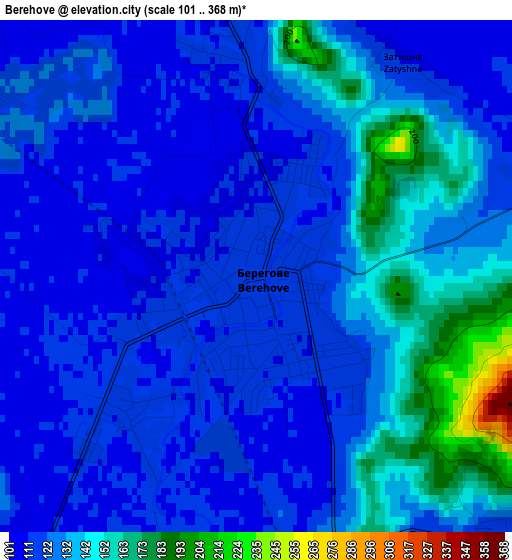
Below is the Elevation map of Berehove, which displays elevation range with different colors. Scale of the first map is from 101 to 368 m (331 to 1207 ft) with average elevation of 128.3 meters (=421 ft) [note 1]
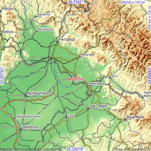
These maps also provides idea of topography and contour of this city, they are displayed at different zoom levels. More info about maps, scale and edge coordinates you can find below images.
| \ | Map #1 | Map #2 | Topo.Map |
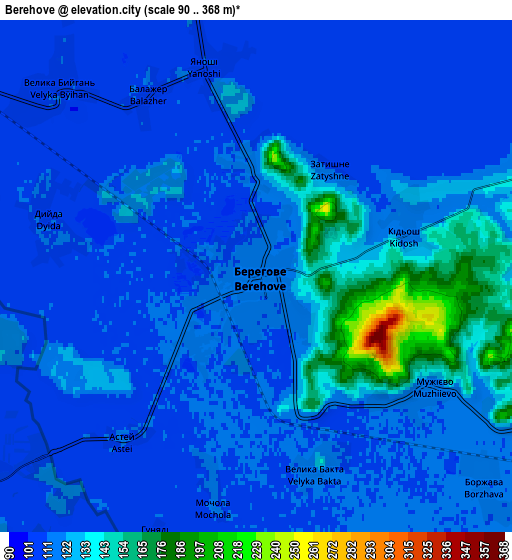
| Scale [m] | 101..368 m | 90..368 m | × |
| Scale [ft] | 331..1207 ft | 295..1207 ft | × |
| Average | 128.3 m = 421 ft | 120.7 m = 396 ft | × |
| Width | 6.51 km = 4 mi | 13.03 km = 8.1 mi | 208.4 km = 129.5 mi |
| Height | 6.51 km = 4 mi | 13.03 km = 8.1 mi | 208.4 km = 129.5 mi |
| ↑Max Latitude | 48.234829° | 48.264092° | 49.1342° |
| Latitude at center | 48.20555° | 48.20555° | 48.20555° |
| ↓Min Latitude | 48.176254° | 48.146941° | 47.25976° |
| ← Min Longitude | 22.600235° | 22.556289° | 21.23793° |
| Longitude center | 22.64418° | 22.64418° | 22.64418° |
| →Max Longitude | 22.688125° | 22.732071° | 24.05043° |
Nearby cities:
Cities around Berehove sort by population:
• Mukacheve elevation 126 m
26.5 km,  11°
11°
• Oleshnyk 125 m
24 km,  101°
101°
• Pidvynohradiv 129 m
25.4 km,  106°
106°
• Nove Davydkovo 115 m
26.3 km,  356°
356°
• Vylok 117 m
18 km,  126°
126°
• Strabychovo 106 m
22.1 km,  340°
340°
• Batiovo 106 m
25.1 km,  313°
313°
• Vary 113 m
10.6 km,  151°
151°
• Velyki Berehy 117 m
8.1 km,  68°
68°
• Koson’ 106 m
15 km,  291°
291°
• Bobovo 120 m
23.9 km, 128°
• Muzhiyevo 118 m
5 km, 125°
Multilingual:
 En español:
Berehove elevación 117 m.
 En France:
Berehove élévation 117 m.
 Auf Deutsch:
Berehowe höhe über dem Meeresspiegel ist 117 m.

Sources and notes:
- [note 1] Map square and city borders are not equal. Map elevation data is calculated only from area inside that square.
- [src 1] Elevation data from geonames database provided with same terms of usage.
- [src 2] The elevation map of Berehove is generated using elevation data from NASA's 3 arcsec (90m) resolution SRTM data.
- [src 3] Base (background) map © OpenStreetMap contributors tiles are generated by Geofabrik and OpenTopoMap.
Copyright & License:
This Berehove Elevation Map is licensed under CC BY-SA. You may reuse any part from this page, if you give a proper credit by linking to this URL:
 More info on terms of use page.