Bilhorod-Dnistrovskyi elevation
Bilhorod-Dnistrovskyi (Odesa), Ukraine elevation is 20 meters and Bilhorod-Dnistrovskyi elevation in feet is 66 ft above sea level [src 1]. Bilhorod-Dnistrovskyi is a seat of a second-order administrative division (feature code) with elevation that is 137 meters (449 ft) smaller than average city elevation in Ukraine.
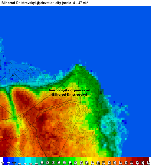
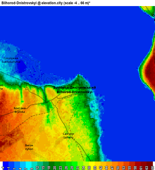
Below is the Elevation map of Bilhorod-Dnistrovskyi, which displays elevation range with different colors. Scale of the first map is from -4 to 47 m (-13 to 154 ft) with average elevation of 10.8 meters (=35 ft) [note 1]
These maps also provides idea of topography and contour of this city, they are displayed at different zoom levels. More info about maps, scale and edge coordinates you can find below images.
| \ | Map #1 | Map #2 | Topo.Map |
| Scale [m] | -4..47 m | -4..66 m | × |
| Scale [ft] | -13..154 ft | -13..217 ft | × |
| Average | 10.8 m = 35 ft | 13.3 m = 44 ft | × |
| Width | 6.76 km = 4.2 mi | 13.53 km = 8.4 mi | 216.5 km = 134.5 mi |
| Height | 6.76 km = 4.2 mi | 13.53 km = 8.4 mi | 216.5 km = 134.5 mi |
| ↑Max Latitude | 46.225611° | 46.256005° | 47.16° |
| Latitude at center | 46.1952° | 46.1952° | 46.1952° |
| ↓Min Latitude | 46.164772° | 46.134328° | 45.21316° |
| ← Min Longitude | 30.305435° | 30.261489° | 28.94313° |
| Longitude center | 30.34938° | 30.34938° | 30.34938° |
| →Max Longitude | 30.393325° | 30.437271° | 31.75563° |
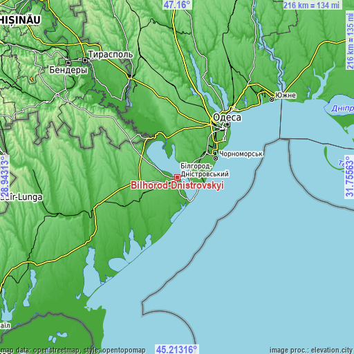
Nearby cities:
Cities around Bilhorod-Dnistrovskyi sort by population:
• Chornomors’k elevation 26 m
26.5 km,  62°
62°
• Bilyayivka 7 m
33.6 km,  342°
342°
• Ovidiopol 19 m
9.3 km,  49°
49°
• Shabo 15 m
7.5 km,  157°
157°
• Mayaky 16 m
25.4 km,  346°
346°
• Starokozache 78 m
32.1 km,  299°
299°
• Serhiyivka 13 m
18.8 km,  173°
173°
• Oleksandrivka 30 m
26.5 km, 55°
• Karolino-Buhaz 22 m
14.7 km,  112°
112°
• Tayirove 19 m
29.6 km, 50°
• Zatoka 3 m
16.3 km,  146°
146°
• Salhany 35 m
5.2 km,  182°
182°
Multilingual:
 En español:
Bilhorod-Dnistrovskyi elevación 20 m.
 En France:
Bilhorod-Dnistrovskyi élévation 20 m.
 Auf Deutsch:
Bilhorod-Dnistrovskyi höhe über dem Meeresspiegel ist 20 m.
 На русском:
Белгород-Днестровский, Аккерман высота над уровнем моря 20 м
Sources and notes:
- [note 1] Map square and city borders are not equal. Map elevation data is calculated only from area inside that square.
- [src 1] Elevation data from geonames database provided with same terms of usage.
- [src 2] The elevation map of Bilhorod-Dnistrovskyi is generated using elevation data from NASA's 3 arcsec (90m) resolution SRTM data.
- [src 3] Base (background) map © OpenStreetMap contributors tiles are generated by Geofabrik and OpenTopoMap.
Copyright & License:
This Bilhorod-Dnistrovskyi Elevation Map is licensed under CC BY-SA. You may reuse any part from this page, if you give a proper credit by linking to this URL:
 More info on terms of use page.