Fastiv elevation
Fastiv (Kyiv, Fastiv Raion), Ukraine elevation is 208 meters and Fastiv elevation in feet is 682 ft above sea level [src 1]. Fastiv is a seat of a second-order administrative division (feature code) with elevation that is 51 meters (167 ft) bigger than average city elevation in Ukraine.
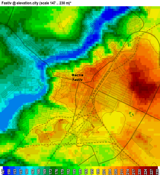
Below is the Elevation map of Fastiv, which displays elevation range with different colors. Scale of the first map is from 147 to 230 m (482 to 755 ft) with average elevation of 189.1 meters (=620 ft) [note 1]
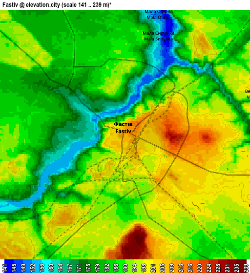
These maps also provides idea of topography and contour of this city, they are displayed at different zoom levels. More info about maps, scale and edge coordinates you can find below images.
| \ | Map #1 | Map #2 | Topo.Map |
| Scale [m] | 147..230 m | 141..239 m | × |
| Scale [ft] | 482..755 ft | 463..784 ft | × |
| Average | 189.1 m = 620 ft | 188.9 m = 620 ft | × |
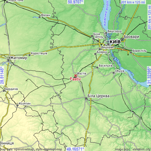
| Width | 6.27 km = 3.9 mi | 12.54 km = 7.8 mi | 200.7 km = 124.7 mi |
| Height | 6.27 km = 3.9 mi | 12.54 km = 7.8 mi | 200.7 km = 124.7 mi |
| ↑Max Latitude | 50.104894° | 50.133072° | 50.9707° |
| Latitude at center | 50.0767° | 50.0767° | 50.0767° |
| ↓Min Latitude | 50.048489° | 50.020262° | 49.16571° |
| ← Min Longitude | 29.873755° | 29.829809° | 28.51145° |
| Longitude center | 29.9177° | 29.9177° | 29.9177° |
| →Max Longitude | 29.961645° | 30.005591° | 31.32395° |
Nearby cities:
Cities around Fastiv sort by population:
• Bila Tserkva elevation 178 m
32.8 km,  154°
154°
• Vasylkiv 164 m
30.8 km,  66°
66°
• Boyarka 181 m
38.2 km,  45°
45°
• Skvyra 201 m
42.4 km,  205°
205°
• Makariv 168 m
43.7 km,  350°
350°
• Hlevakha 188 m
36.5 km, 53°
• Borova 162 m
17.3 km, 50°
• Popilnia 206 m
36 km,  247°
247°
• Brusyliv 166 m
36.2 km,  309°
309°
• Motovylivka 184 m
14.4 km, 50°
• Kornyn 198 m
27.3 km,  274°
274°
• Kozhanka 181 m
16 km,  223°
223°
Multilingual:
 En español:
Fastiv elevación 208 m.
 En France:
Fastiv élévation 208 m.


Sources and notes:
- [note 1] Map square and city borders are not equal. Map elevation data is calculated only from area inside that square.
- [src 1] Elevation data from geonames database provided with same terms of usage.
- [src 2] The elevation map of Fastiv is generated using elevation data from NASA's 3 arcsec (90m) resolution SRTM data.
- [src 3] Base (background) map © OpenStreetMap contributors tiles are generated by Geofabrik and OpenTopoMap.
Copyright & License:
This Fastiv Elevation Map is licensed under CC BY-SA. You may reuse any part from this page, if you give a proper credit by linking to this URL:
 More info on terms of use page.