Hayvoron elevation
Hayvoron (Kirovohrad), Ukraine elevation is 151 meters and Hayvoron elevation in feet is 495 ft above sea level [src 1]. Hayvoron is a seat of a second-order administrative division (feature code) with elevation that is 6 meters (20 ft) smaller than average city elevation in Ukraine.
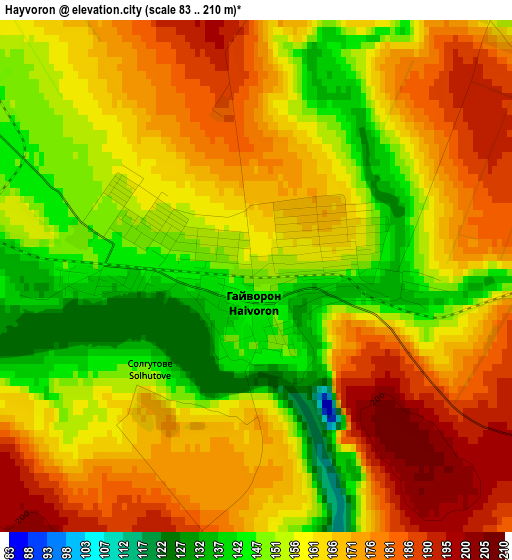
Below is the Elevation map of Hayvoron, which displays elevation range with different colors. Scale of the first map is from 83 to 210 m (272 to 689 ft) with average elevation of 162.8 meters (=534 ft) [note 1]
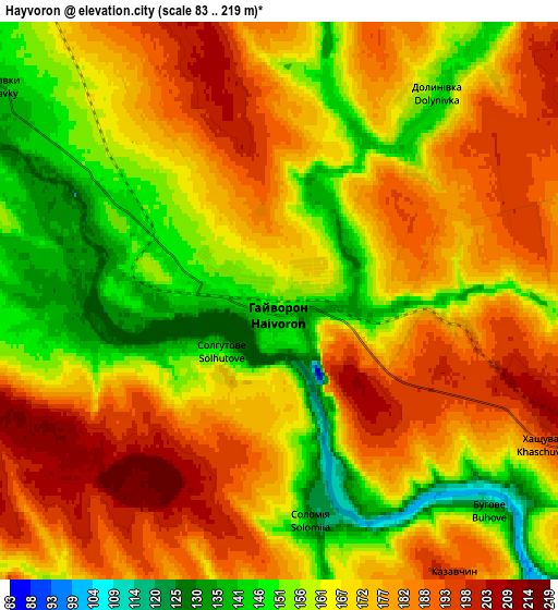
These maps also provides idea of topography and contour of this city, they are displayed at different zoom levels. More info about maps, scale and edge coordinates you can find below images.
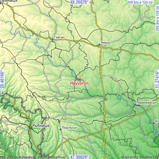
| \ | Map #1 | Map #2 | Topo.Map |
| Scale [m] | 83..210 m | 83..219 m | × |
| Scale [ft] | 272..689 ft | 272..719 ft | × |
| Average | 162.8 m = 534 ft | 169.9 m = 557 ft | × |
| Width | 6.5 km = 4 mi | 12.99 km = 8.1 mi | 207.9 km = 129.2 mi |
| Height | 6.5 km = 4 mi | 12.99 km = 8.1 mi | 207.9 km = 129.2 mi |
| ↑Max Latitude | 48.368783° | 48.397969° | 49.26578° |
| Latitude at center | 48.33958° | 48.33958° | 48.33958° |
| ↓Min Latitude | 48.310361° | 48.281124° | 47.39625° |
| ← Min Longitude | 29.823965° | 29.780019° | 28.46166° |
| Longitude center | 29.86791° | 29.86791° | 29.86791° |
| →Max Longitude | 29.911855° | 29.955801° | 31.27416° |
Nearby cities:
Cities around Hayvoron sort by population:
• Balta elevation 123 m
48.6 km,  202°
202°
• Savran 94 m
28 km,  145°
145°
• Teplyk 201 m
37.4 km,  345°
345°
• Chechelnyk 168 m
39.5 km,  249°
249°
• Zavallya 145 m
17.8 km,  142°
142°
• Viytivka 185 m
25.9 km,  291°
291°
• Obodivka 185 m
46.4 km,  279°
279°
• Peschana 114 m
25.5 km, 203°
• Trostyanets’ 196 m
50.4 km, 292°
• Holovanivs’k 174 m
44.1 km,  83°
83°
• Blahovishchens’ke 125 m
26.6 km,  92°
92°
• Bershad 171 m
26.1 km, 276°
Multilingual:
 En español:
Hayvoron elevación 151 m.
 En France:
Hayvoron élévation 151 m.
 Auf Deutsch:
Hayvoron höhe über dem Meeresspiegel ist 151 m.

Sources and notes:
- [note 1] Map square and city borders are not equal. Map elevation data is calculated only from area inside that square.
- [src 1] Elevation data from geonames database provided with same terms of usage.
- [src 2] The elevation map of Hayvoron is generated using elevation data from NASA's 3 arcsec (90m) resolution SRTM data.
- [src 3] Base (background) map © OpenStreetMap contributors tiles are generated by Geofabrik and OpenTopoMap.
Copyright & License:
This Hayvoron Elevation Map is licensed under CC BY-SA. You may reuse any part from this page, if you give a proper credit by linking to this URL:
 More info on terms of use page.