Khartsyz’k elevation
Khartsyz’k (Donetsk), Ukraine elevation is 241 meters and Khartsyz’k elevation in feet is 791 ft above sea level [src 1]. Khartsyz’k is a populated place (feature code) with elevation that is 84 meters (276 ft) bigger than average city elevation in Ukraine.
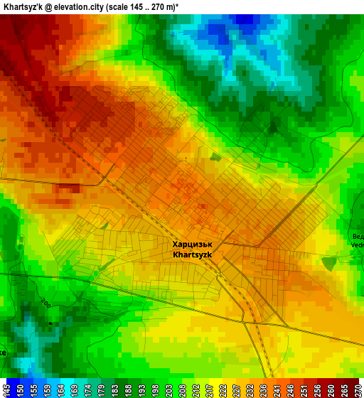
Below is the Elevation map of Khartsyz’k, which displays elevation range with different colors. Scale of the first map is from 145 to 270 m (476 to 886 ft) with average elevation of 216.3 meters (=710 ft) [note 1]
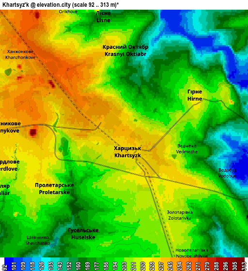
These maps also provides idea of topography and contour of this city, they are displayed at different zoom levels. More info about maps, scale and edge coordinates you can find below images.
| \ | Map #1 | Map #2 | Topo.Map |
| Scale [m] | 145..270 m | 92..313 m | × |
| Scale [ft] | 476..886 ft | 302..1027 ft | × |
| Average | 216.3 m = 710 ft | 198.9 m = 653 ft | × |
| Width | 6.53 km = 4.1 mi | 13.07 km = 8.1 mi | 209.1 km = 129.9 mi |
| Height | 6.53 km = 4.1 mi | 13.07 km = 8.1 mi | 209.1 km = 129.9 mi |
| ↑Max Latitude | 48.071803° | 48.101158° | 48.97405° |
| Latitude at center | 48.04243° | 48.04243° | 48.04243° |
| ↓Min Latitude | 48.013041° | 47.983635° | 47.09365° |
| ← Min Longitude | 38.103335° | 38.059389° | 36.74103° |
| Longitude center | 38.14728° | 38.14728° | 38.14728° |
| →Max Longitude | 38.191225° | 38.235171° | 39.55353° |
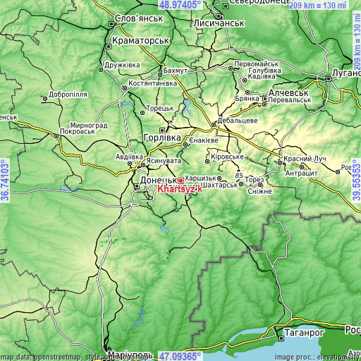
Nearby cities:
Cities around Khartsyz’k sort by population:
• Donetsk elevation 223 m
25.7 km,  265°
265°
• Makiyivka 223 m
16.5 km, 272°
• Yenakiyeve 208 m
21.8 km,  12°
12°
• Shakhtars’k 227 m
21.7 km,  85°
85°
• Yasynuvata 263 m
23.5 km,  294°
294°
• Zuhres 115 m
9.4 km,  111°
111°
• Ilovays’k 194 m
13.7 km,  162°
162°
• Nyzhnya Krynka 173 m
8 km, 7°
• Mospyne 140 m
18 km,  200°
200°
• Krinichnaya 240 m
13.2 km,  316°
316°
• P'yatypill'ya 212 m
4.6 km,  230°
230°
• Shyroke 144 m
11.4 km,  146°
146°
Multilingual:
 En español:
Khartsyz’k elevación 241 m.
 En France:
Khartsyz’k élévation 241 m.
 Auf Deutsch:
Khartsyz’k höhe über dem Meeresspiegel ist 241 m.

Sources and notes:
- [note 1] Map square and city borders are not equal. Map elevation data is calculated only from area inside that square.
- [src 1] Elevation data from geonames database provided with same terms of usage.
- [src 2] The elevation map of Khartsyz’k is generated using elevation data from NASA's 3 arcsec (90m) resolution SRTM data.
- [src 3] Base (background) map © OpenStreetMap contributors tiles are generated by Geofabrik and OpenTopoMap.
Copyright & License:
This Khartsyz’k Elevation Map is licensed under CC BY-SA. You may reuse any part from this page, if you give a proper credit by linking to this URL:
 More info on terms of use page.