Khotiv elevation
Khotiv (Kyiv), Ukraine elevation is 128 meters and Khotiv elevation in feet is 420 ft above sea level [src 1]. Khotiv is a populated place (feature code) with elevation that is 29 meters (95 ft) smaller than average city elevation in Ukraine.
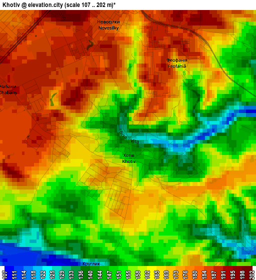
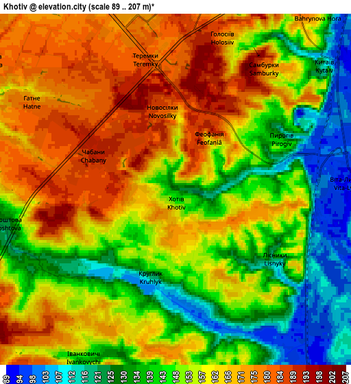
Below is the Elevation map of Khotiv, which displays elevation range with different colors. Scale of the first map is from 107 to 202 m (351 to 663 ft) with average elevation of 163.1 meters (=535 ft) [note 1]
These maps also provides idea of topography and contour of this city, they are displayed at different zoom levels. More info about maps, scale and edge coordinates you can find below images.
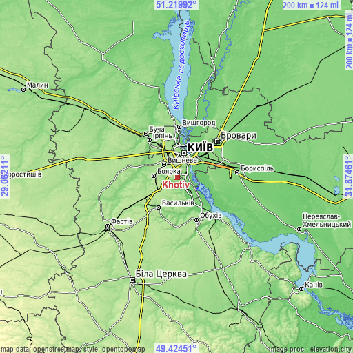
| \ | Map #1 | Map #2 | Topo.Map |
| Scale [m] | 107..202 m | 89..207 m | × |
| Scale [ft] | 351..663 ft | 292..679 ft | × |
| Average | 163.1 m = 535 ft | 154.4 m = 507 ft | × |
| Width | 6.24 km = 3.9 mi | 12.48 km = 7.8 mi | 199.6 km = 124 mi |
| Height | 6.24 km = 3.9 mi | 12.48 km = 7.8 mi | 199.6 km = 124 mi |
| ↑Max Latitude | 50.358734° | 50.386762° | 51.21992° |
| Latitude at center | 50.33069° | 50.33069° | 50.33069° |
| ↓Min Latitude | 50.302629° | 50.274551° | 49.42451° |
| ← Min Longitude | 30.424415° | 30.380469° | 29.06211° |
| Longitude center | 30.46836° | 30.46836° | 30.46836° |
| →Max Longitude | 30.512305° | 30.556251° | 31.87461° |
Nearby cities:
Cities around Khotiv sort by population:
• Kyiv elevation 187 m
14.3 km,  15°
15°
• Irpin 121 m
26.3 km,  324°
324°
• Vasylkiv 164 m
19.4 km,  214°
214°
• Boyarka 181 m
12.2 km,  263°
263°
• Vyshneve 176 m
9.5 km,  313°
313°
• Kotsyubyns’ke 156 m
20.1 km,  330°
330°
• Hlevakha 188 m
11.8 km,  237°
237°
• Chabany 188 m
3.4 km,  289°
289°
• Sofiyivska Borschagivka 163 m
11.4 km, 320°
• Hnidyn 93 m
17.2 km,  90°
90°
• Kriukivschina 177 m
8.4 km,  302°
302°
• Prolisky 129 m
23.1 km,  73°
73°
Multilingual:
 En español:
Khotiv elevación 128 m.
 En France:
Khotiv élévation 128 m.


Sources and notes:
- [note 1] Map square and city borders are not equal. Map elevation data is calculated only from area inside that square.
- [src 1] Elevation data from geonames database provided with same terms of usage.
- [src 2] The elevation map of Khotiv is generated using elevation data from NASA's 3 arcsec (90m) resolution SRTM data.
- [src 3] Base (background) map © OpenStreetMap contributors tiles are generated by Geofabrik and OpenTopoMap.
Copyright & License:
This Khotiv Elevation Map is licensed under CC BY-SA. You may reuse any part from this page, if you give a proper credit by linking to this URL:
 More info on terms of use page.