Kropyvnytskyi elevation
Kropyvnytskyi (Kirovohrad, Kirovohrads’ka Mis’krada), Ukraine elevation is 114 meters and Kropyvnytskyi elevation in feet is 374 ft above sea level [src 1]. Kropyvnytskyi is a seat of a first-order administrative division (feature code) with elevation that is 43 meters (141 ft) smaller than average city elevation in Ukraine.
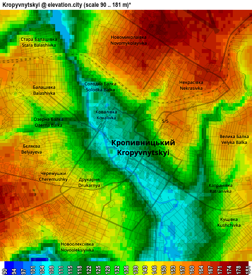
Below is the Elevation map of Kropyvnytskyi, which displays elevation range with different colors. Scale of the first map is from 90 to 181 m (295 to 594 ft) with average elevation of 140.3 meters (=460 ft) [note 1]
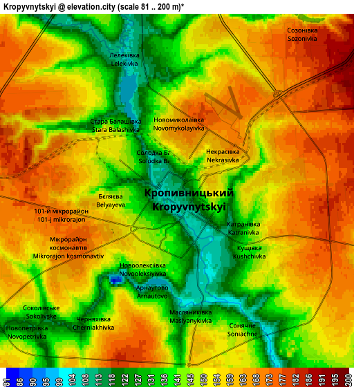
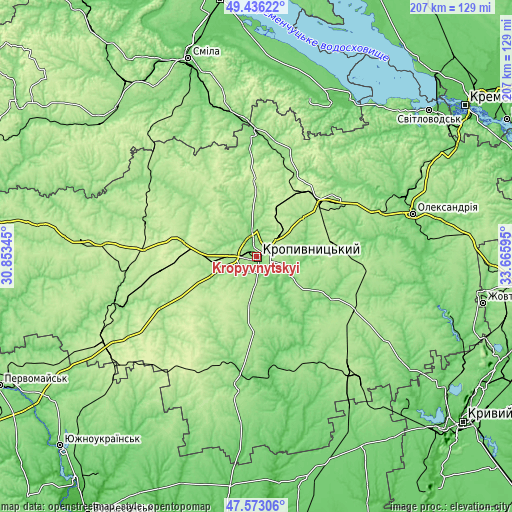
These maps also provides idea of topography and contour of this city, they are displayed at different zoom levels. More info about maps, scale and edge coordinates you can find below images.
| \ | Map #1 | Map #2 | Topo.Map |
| Scale [m] | 90..181 m | 81..200 m | × |
| Scale [ft] | 295..594 ft | 266..656 ft | × |
| Average | 140.3 m = 460 ft | 151 m = 495 ft | × |
| Width | 6.47 km = 4 mi | 12.95 km = 8 mi | 207.2 km = 128.7 mi |
| Height | 6.47 km = 4 mi | 12.95 km = 8 mi | 207.1 km = 128.7 mi |
| ↑Max Latitude | 48.542303° | 48.571389° | 49.43622° |
| Latitude at center | 48.5132° | 48.5132° | 48.5132° |
| ↓Min Latitude | 48.48408° | 48.454944° | 47.57306° |
| ← Min Longitude | 32.215755° | 32.171809° | 30.85345° |
| Longitude center | 32.2597° | 32.2597° | 32.2597° |
| →Max Longitude | 32.303645° | 32.347591° | 33.66595° |
Nearby cities:
Cities around Kropyvnytskyi sort by population:
• Znomenka elevation 202 m
37.1 km,  53°
53°
• Mala Vyska 185 m
48.1 km,  287°
287°
• Nova Praha 107 m
47.7 km,  82°
82°
• Novhorodka 114 m
33.7 km,  119°
119°
• Rivne 151 m
47.6 km,  231°
231°
• Kompaniyivka 154 m
29.4 km,  187°
187°
• Dmytrivka 123 m
46 km, 46°
• Adzhamka 120 m
20.6 km, 80°
• Subottsi 170 m
24.9 km, 50°
• Pantayivka 182 m
49.3 km,  68°
68°
• Yelyzavethradka 161 m
34 km,  18°
18°
• Molodizhne 154 m
47.7 km,  141°
141°
Multilingual:
 En español:
Kirovogrado elevación 114 m.
 En France:
Kropyvnytskyi élévation 114 m.
 Auf Deutsch:
Kropywnyzkyj höhe über dem Meeresspiegel ist 114 m.

Sources and notes:
- [note 1] Map square and city borders are not equal. Map elevation data is calculated only from area inside that square.
- [src 1] Elevation data from geonames database provided with same terms of usage.
- [src 2] The elevation map of Kropyvnytskyi is generated using elevation data from NASA's 3 arcsec (90m) resolution SRTM data.
- [src 3] Base (background) map © OpenStreetMap contributors tiles are generated by Geofabrik and OpenTopoMap.
Copyright & License:
This Kropyvnytskyi Elevation Map is licensed under CC BY-SA. You may reuse any part from this page, if you give a proper credit by linking to this URL:
 More info on terms of use page.