Kirovskoye elevation
Kirovskoye (Republic of Crimea, Chernomorskiy rayon), Ukraine elevation is 58 meters and Kirovskoye elevation in feet is 190 ft above sea level [src 1]. Kirovskoye is a seat of a third-order administrative division (feature code) with elevation that is 99 meters (325 ft) smaller than average city elevation in Ukraine.
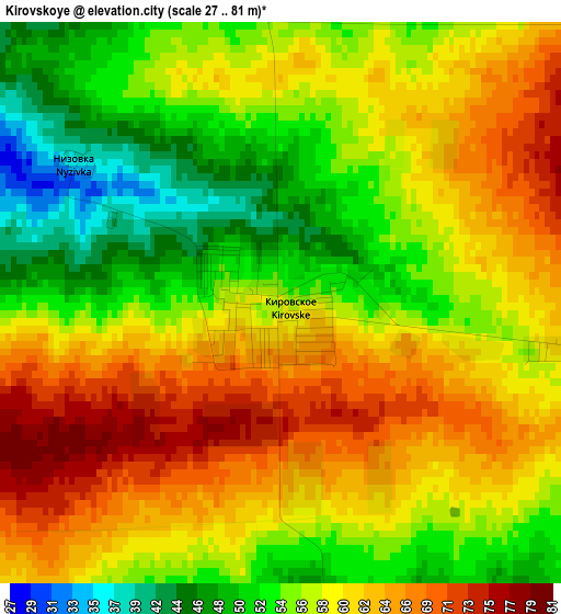
Below is the Elevation map of Kirovskoye, which displays elevation range with different colors. Scale of the first map is from 27 to 81 m (89 to 266 ft) with average elevation of 58.5 meters (=192 ft) [note 1]
These maps also provides idea of topography and contour of this city, they are displayed at different zoom levels. More info about maps, scale and edge coordinates you can find below images.
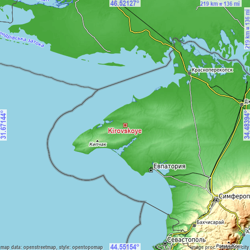
| \ | Map #1 | Topo.Map |
| Scale [m] | 27..81 m | × |
| Scale [ft] | 89..266 ft | × |
| Average | 58.5 m = 192 ft | × |
| Width | 6.84 km = 4.3 mi | 219 km = 136.1 mi |
| Height | 6.84 km = 4.3 mi | 219 km = 136.1 mi |
| ↑Max Latitude | 45.575799° | 46.52127° |
| Latitude at center | 45.54503° | 45.54503° |
| ↓Min Latitude | 45.514245° | 44.55154° |
| ← Min Longitude | 33.033745° | 31.67144° |
| Longitude center | 33.07769° | 33.07769° |
| →Max Longitude | 33.121635° | 34.48394° |
Nearby cities:
Cities around Kirovskoye sort by population:
• Novoozyornoye elevation 16 m
18.3 km,  170°
170°
• Mirny 5 m
26.6 km,  187°
187°
• Mezhvodnoye 11 m
18.7 km,  284°
284°
• Medvedevo 29 m
18.6 km,  197°
197°
• Veselovka 52 m
21.5 km,  150°
150°
• Berezovka 52 m
21 km,  80°
80°
• Vorobyovo 59 m
27.4 km, 151°
• Krasnaya Polyana 58 m
12.9 km,  237°
237°
• Slavnoye 12 m
23.2 km,  32°
32°
• Novoivanovka 83 m
10.8 km, 171°
• Dalekoye 37 m
12.8 km,  1°
1°
• Krasnoyarskoye 21 m
15.3 km,  106°
106°
Multilingual:
 En español:
Kirovskoye elevación 58 m.
 En France:
Kirovskoye élévation 58 m.
 Auf Deutsch:
Kirovskoye höhe über dem Meeresspiegel ist 58 m.

Sources and notes:
- [note 1] Map square and city borders are not equal. Map elevation data is calculated only from area inside that square.
- [src 1] Elevation data from geonames database provided with same terms of usage.
- [src 2] The elevation map of Kirovskoye is generated using elevation data from NASA's 3 arcsec (90m) resolution SRTM data.
- [src 3] Base (background) map © OpenStreetMap contributors tiles are generated by Geofabrik and OpenTopoMap.
Copyright & License:
This Kirovskoye Elevation Map is licensed under CC BY-SA. You may reuse any part from this page, if you give a proper credit by linking to this URL:
 More info on terms of use page.