Kol’chugino elevation
Kol’chugino (Republic of Crimea, Simferopol Raion), Ukraine elevation is 80 meters and Kol’chugino elevation in feet is 262 ft above sea level [src 1]. Kol’chugino is a seat of a third-order administrative division (feature code) with elevation that is 77 meters (253 ft) smaller than average city elevation in Ukraine.
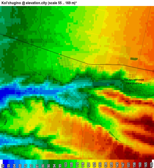
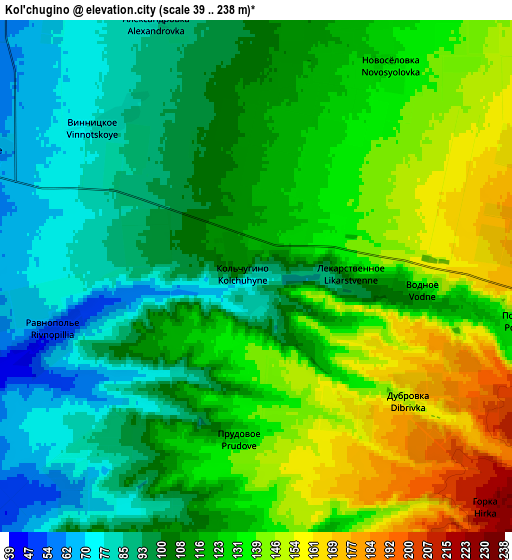
Below is the Elevation map of Kol’chugino, which displays elevation range with different colors. Scale of the first map is from 55 to 169 m (180 to 554 ft) with average elevation of 114.2 meters (=375 ft) [note 1]
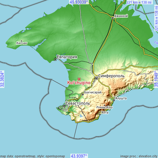
These maps also provides idea of topography and contour of this city, they are displayed at different zoom levels. More info about maps, scale and edge coordinates you can find below images.
| \ | Map #1 | Map #2 | Topo.Map |
| Scale [m] | 55..169 m | 39..238 m | × |
| Scale [ft] | 180..554 ft | 128..781 ft | × |
| Average | 114.2 m = 375 ft | 116.9 m = 384 ft | × |
| Width | 6.92 km = 4.3 mi | 13.83 km = 8.6 mi | 221.3 km = 137.5 mi |
| Height | 6.92 km = 4.3 mi | 13.83 km = 8.6 mi | 221.3 km = 137.5 mi |
| ↑Max Latitude | 44.974766° | 45.005845° | 45.93039° |
| Latitude at center | 44.94367° | 44.94367° | 44.94367° |
| ↓Min Latitude | 44.912557° | 44.881427° | 43.9397° |
| ← Min Longitude | 33.744705° | 33.700759° | 32.3824° |
| Longitude center | 33.78865° | 33.78865° | 33.78865° |
| →Max Longitude | 33.832595° | 33.876541° | 35.1949° |
Nearby cities:
Cities around Kol’chugino sort by population:
• Vilino elevation 34 m
14.3 km,  220°
220°
• Nikolayevka 12 m
14.2 km,  278°
278°
• Skvortsovo 57 m
14.9 km,  9°
9°
• Teplovka 46 m
12.3 km,  323°
323°
• Tabachnoye 46 m
10 km,  242°
242°
• Pozharskoye 134 m
6.6 km,  97°
97°
• Novosyolovka 132 m
6.7 km,  33°
33°
• Lekarstvennoye 100 m
2.7 km,  94°
94°
• Plodovoye 119 m
9.6 km,  146°
146°
• Vinnitskoye 82 m
5.7 km, 317°
• Prudovoye 122 m
4.4 km,  187°
187°
• Kashtany 84 m
8.5 km,  179°
179°
Multilingual:
 En español:
Kol’chugino elevación 80 m.
 En France:
Kol’chugino élévation 80 m.
 Auf Deutsch:
Kol’chugino höhe über dem Meeresspiegel ist 80 m.

Sources and notes:
- [note 1] Map square and city borders are not equal. Map elevation data is calculated only from area inside that square.
- [src 1] Elevation data from geonames database provided with same terms of usage.
- [src 2] The elevation map of Kol’chugino is generated using elevation data from NASA's 3 arcsec (90m) resolution SRTM data.
- [src 3] Base (background) map © OpenStreetMap contributors tiles are generated by Geofabrik and OpenTopoMap.
Copyright & License:
This Kol’chugino Elevation Map is licensed under CC BY-SA. You may reuse any part from this page, if you give a proper credit by linking to this URL:
 More info on terms of use page.