Podil’s’k elevation
Podil’s’k (Odesa), Ukraine elevation is 241 meters and Podil’s’k elevation in feet is 791 ft above sea level [src 1]. Podil’s’k is a seat of a second-order administrative division (feature code) with elevation that is 84 meters (276 ft) bigger than average city elevation in Ukraine.
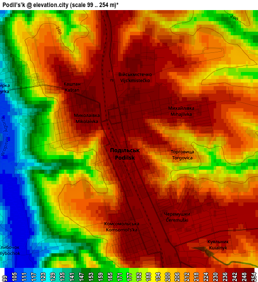
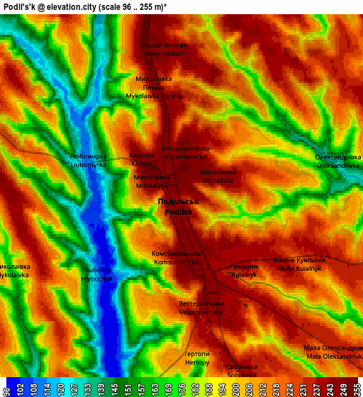
Below is the Elevation map of Podil’s’k, which displays elevation range with different colors. Scale of the first map is from 99 to 254 m (325 to 833 ft) with average elevation of 205.6 meters (=675 ft) [note 1]
These maps also provides idea of topography and contour of this city, they are displayed at different zoom levels. More info about maps, scale and edge coordinates you can find below images.
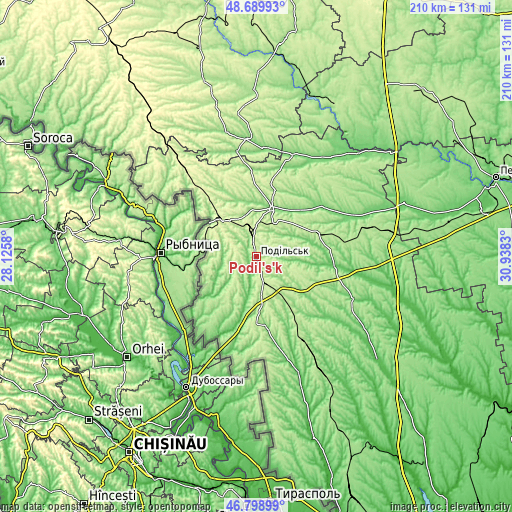
| \ | Map #1 | Map #2 | Topo.Map |
| Scale [m] | 99..254 m | 96..255 m | × |
| Scale [ft] | 325..833 ft | 315..837 ft | × |
| Average | 205.6 m = 675 ft | 198.8 m = 652 ft | × |
| Width | 6.57 km = 4.1 mi | 13.14 km = 8.2 mi | 210.3 km = 130.7 mi |
| Height | 6.57 km = 4.1 mi | 13.14 km = 8.2 mi | 210.2 km = 130.6 mi |
| ↑Max Latitude | 47.782587° | 47.812108° | 48.68993° |
| Latitude at center | 47.75305° | 47.75305° | 47.75305° |
| ↓Min Latitude | 47.723496° | 47.693925° | 46.79899° |
| ← Min Longitude | 29.488105° | 29.444159° | 28.1258° |
| Longitude center | 29.53205° | 29.53205° | 29.53205° |
| →Max Longitude | 29.575995° | 29.619941° | 30.9383° |
Nearby cities:
Cities around Podil’s’k sort by population:
• Balta elevation 123 m
21.3 km,  17°
17°
• Lyubashivka 176 m
55.2 km,  80°
80°
• Kodyma 289 m
49 km,  321°
321°
• Savran 94 m
58.8 km,  44°
44°
• Okny 93 m
24.2 km,  192°
192°
• Chechelnyk 168 m
52.8 km,  346°
346°
• Zakharivka 68 m
49.8 km,  159°
159°
• Zagnitkiv 222 m
57.9 km,  304°
304°
• Zatyshshya 176 m
53.2 km,  151°
151°
• Peschana 114 m
44.4 km, 19°
• Slobidka 258 m
20.4 km, 317°
• Ananyiv Pershyi 82 m
31.1 km,  96°
96°
Multilingual:
 En español:
Podil’s’k elevación 241 m.
 En France:
Podil’s’k élévation 241 m.
 Auf Deutsch:
Podil’s’k höhe über dem Meeresspiegel ist 241 m.

Sources and notes:
- [note 1] Map square and city borders are not equal. Map elevation data is calculated only from area inside that square.
- [src 1] Elevation data from geonames database provided with same terms of usage.
- [src 2] The elevation map of Podil’s’k is generated using elevation data from NASA's 3 arcsec (90m) resolution SRTM data.
- [src 3] Base (background) map © OpenStreetMap contributors tiles are generated by Geofabrik and OpenTopoMap.
Copyright & License:
This Podil’s’k Elevation Map is licensed under CC BY-SA. You may reuse any part from this page, if you give a proper credit by linking to this URL:
 More info on terms of use page.