Pivdenne elevation
Pivdenne (Kharkiv), Ukraine elevation is 180 meters and Pivdenne elevation in feet is 591 ft above sea level [src 1]. Pivdenne is a populated place (feature code) with elevation that is 23 meters (75 ft) bigger than average city elevation in Ukraine.
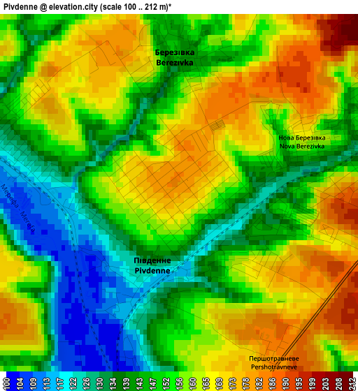
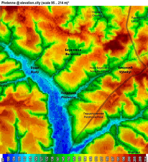
Below is the Elevation map of Pivdenne, which displays elevation range with different colors. Scale of the first map is from 100 to 212 m (328 to 696 ft) with average elevation of 153.8 meters (=505 ft) [note 1]
These maps also provides idea of topography and contour of this city, they are displayed at different zoom levels. More info about maps, scale and edge coordinates you can find below images.
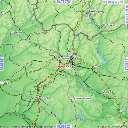
| \ | Map #1 | Map #2 | Topo.Map |
| Scale [m] | 100..212 m | 95..214 m | × |
| Scale [ft] | 328..696 ft | 312..702 ft | × |
| Average | 153.8 m = 505 ft | 161.5 m = 530 ft | × |
| Width | 6.3 km = 3.9 mi | 12.59 km = 7.8 mi | 201.5 km = 125.2 mi |
| Height | 6.3 km = 3.9 mi | 12.59 km = 7.8 mi | 201.5 km = 125.2 mi |
| ↑Max Latitude | 49.911458° | 49.939749° | 50.78078° |
| Latitude at center | 49.88315° | 49.88315° | 49.88315° |
| ↓Min Latitude | 49.854826° | 49.826485° | 48.96852° |
| ← Min Longitude | 36.023905° | 35.979959° | 34.6616° |
| Longitude center | 36.06785° | 36.06785° | 36.06785° |
| →Max Longitude | 36.111795° | 36.155741° | 37.4741° |
Nearby cities:
Cities around Pivdenne sort by population:
• Kharkiv elevation 113 m
17.1 km,  50°
50°
• Merefa 102 m
6.8 km,  190°
190°
• Lyubotyn 182 m
12.2 km,  305°
305°
• Solonytsivka 118 m
12.9 km,  349°
349°
• Vysokyy 154 m
4 km,  76°
76°
• Pokotylivka 153 m
8.4 km,  66°
66°
• Bezlyudivka 105 m
14.2 km,  93°
93°
• Peresichna 121 m
17 km,  337°
337°
• Budy 122 m
3.5 km,  285°
285°
• Korotych 138 m
7.5 km, 343°
• Khorosheve 127 m
11.2 km,  106°
106°
• Utkivka 98 m
10.8 km,  177°
177°
Multilingual:
 En español:
Pivdenne elevación 180 m.
 En France:
Pivdenne élévation 180 m.
 Auf Deutsch:
Pivdenne höhe über dem Meeresspiegel ist 180 m.

Sources and notes:
- [note 1] Map square and city borders are not equal. Map elevation data is calculated only from area inside that square.
- [src 1] Elevation data from geonames database provided with same terms of usage.
- [src 2] The elevation map of Pivdenne is generated using elevation data from NASA's 3 arcsec (90m) resolution SRTM data.
- [src 3] Base (background) map © OpenStreetMap contributors tiles are generated by Geofabrik and OpenTopoMap.
Copyright & License:
This Pivdenne Elevation Map is licensed under CC BY-SA. You may reuse any part from this page, if you give a proper credit by linking to this URL:
 More info on terms of use page.