Staryy Saltiv elevation
Staryy Saltiv (Kharkiv), Ukraine elevation is 107 meters and Staryy Saltiv elevation in feet is 351 ft above sea level [src 1]. Staryy Saltiv is a populated place (feature code) with elevation that is 50 meters (164 ft) smaller than average city elevation in Ukraine.
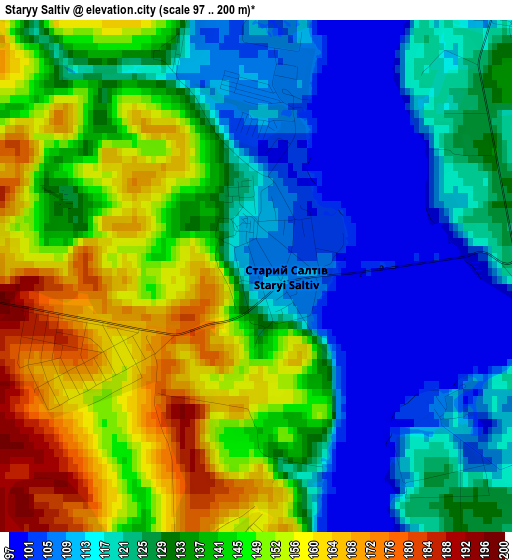
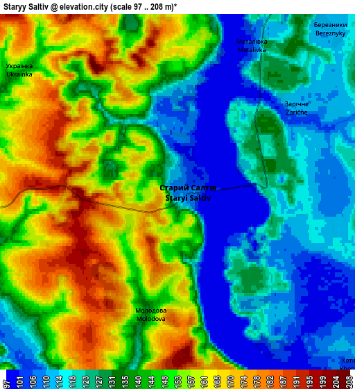
Below is the Elevation map of Staryy Saltiv, which displays elevation range with different colors. Scale of the first map is from 97 to 200 m (318 to 656 ft) with average elevation of 133.4 meters (=438 ft) [note 1]
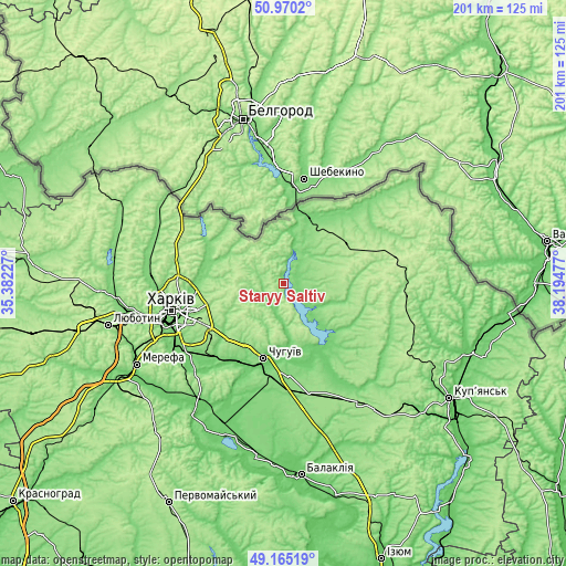
These maps also provides idea of topography and contour of this city, they are displayed at different zoom levels. More info about maps, scale and edge coordinates you can find below images.
| \ | Map #1 | Map #2 | Topo.Map |
| Scale [m] | 97..200 m | 97..208 m | × |
| Scale [ft] | 318..656 ft | 318..682 ft | × |
| Average | 133.4 m = 438 ft | 138.3 m = 454 ft | × |
| Width | 6.27 km = 3.9 mi | 12.54 km = 7.8 mi | 200.7 km = 124.7 mi |
| Height | 6.27 km = 3.9 mi | 12.54 km = 7.8 mi | 200.7 km = 124.7 mi |
| ↑Max Latitude | 50.104384° | 50.132562° | 50.9702° |
| Latitude at center | 50.07619° | 50.07619° | 50.07619° |
| ↓Min Latitude | 50.047979° | 50.019751° | 49.16519° |
| ← Min Longitude | 36.744575° | 36.700629° | 35.38227° |
| Longitude center | 36.78852° | 36.78852° | 36.78852° |
| →Max Longitude | 36.832465° | 36.876411° | 38.19477° |
Nearby cities:
Cities around Staryy Saltiv sort by population:
• Kharkiv elevation 113 m
39.7 km,  254°
254°
• Chuhuyiv 133 m
27.7 km,  195°
195°
• Vovchans’k 111 m
26.2 km,  24°
24°
• Malynivka 100 m
29.1 km,  187°
187°
• Eskhar 120 m
34.2 km, 204°
• Novopokrovka 96 m
32 km,  212°
212°
• Velykyy Burluk 147 m
42.5 km,  92°
92°
• Kochetok 151 m
22.1 km, 189°
• Kulynychi 144 m
30.8 km, 250°
• Vvedenka 97 m
34.7 km,  216°
216°
• Prykolotne 213 m
40.8 km,  76°
76°
• Pechenihy 95 m
25 km,  155°
155°
Multilingual:
 En español:
Staryy Saltiv elevación 107 m.
 En France:
Staryy Saltiv élévation 107 m.
 Auf Deutsch:
Staryy Saltiv höhe über dem Meeresspiegel ist 107 m.

Sources and notes:
- [note 1] Map square and city borders are not equal. Map elevation data is calculated only from area inside that square.
- [src 1] Elevation data from geonames database provided with same terms of usage.
- [src 2] The elevation map of Staryy Saltiv is generated using elevation data from NASA's 3 arcsec (90m) resolution SRTM data.
- [src 3] Base (background) map © OpenStreetMap contributors tiles are generated by Geofabrik and OpenTopoMap.
Copyright & License:
This Staryy Saltiv Elevation Map is licensed under CC BY-SA. You may reuse any part from this page, if you give a proper credit by linking to this URL:
 More info on terms of use page.