Krasnokamenka elevation
Krasnokamenka (Republic of Crimea, Gorodskoy okrug Feodosiya), Ukraine elevation is 230 meters and Krasnokamenka elevation in feet is 755 ft above sea level [src 1]. Krasnokamenka is a populated place (feature code) with elevation that is 73 meters (240 ft) bigger than average city elevation in Ukraine.
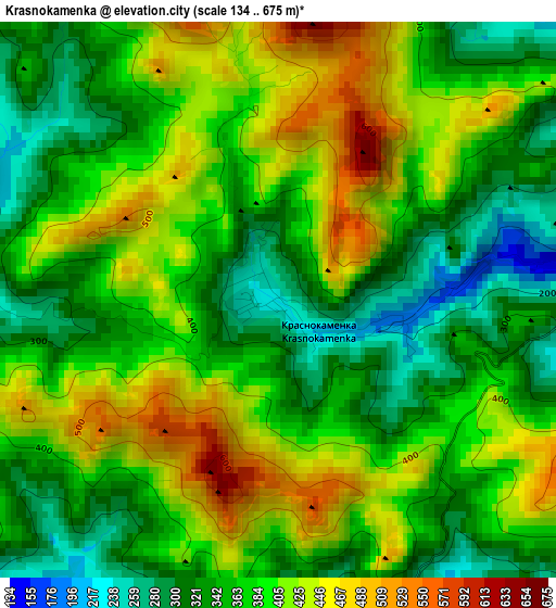
Below is the Elevation map of Krasnokamenka, which displays elevation range with different colors. Scale of the first map is from 134 to 675 m (440 to 2215 ft) with average elevation of 378 meters (=1240 ft) [note 1]
These maps also provides idea of topography and contour of this city, they are displayed at different zoom levels. More info about maps, scale and edge coordinates you can find below images.
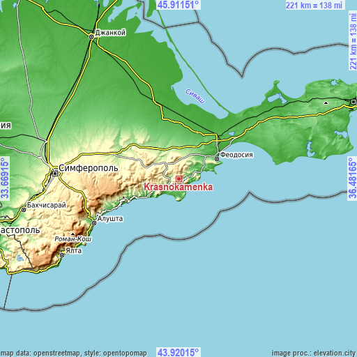
| \ | Map #1 | Topo.Map |
| Scale [m] | 134..675 m | × |
| Scale [ft] | 440..2215 ft | × |
| Average | 378 m = 1240 ft | × |
| Width | 6.92 km = 4.3 mi | 221.4 km = 137.6 mi |
| Height | 6.92 km = 4.3 mi | 221.4 km = 137.6 mi |
| ↑Max Latitude | 44.955567° | 45.91151° |
| Latitude at center | 44.92446° | 44.92446° |
| ↓Min Latitude | 44.893337° | 43.92015° |
| ← Min Longitude | 35.031455° | 33.66915° |
| Longitude center | 35.0754° | 35.0754° |
| →Max Longitude | 35.119345° | 36.48165° |
Nearby cities:
Cities around Krasnokamenka sort by population:
• Sudak elevation 33 m
11.5 km,  223°
223°
• Stary Krym 336 m
11.7 km,  6°
6°
• Shchebetovka 77 m
6.7 km,  76°
76°
• Pervomayskoye 179 m
16.8 km,  24°
24°
• Koktebel 9 m
14.1 km,  72°
72°
• Dachnoye 82 m
8.5 km,  238°
238°
• Grushevka 243 m
13.6 km,  323°
323°
• Vesele 148 m
17.1 km, 244°
• Solnechnaya Dolina 80 m
6.3 km,  157°
157°
• Novy Svet 39 m
16.5 km,  230°
230°
• Kurskoye 211 m
16 km, 316°
• Izyumovka 220 m
14.2 km, 20°
Multilingual:
 En español:
Krasnokamenka elevación 230 m.
 En France:
Krasnokamenka élévation 230 m.
 Auf Deutsch:
Krasnokamenka höhe über dem Meeresspiegel ist 230 m.

Sources and notes:
- [note 1] Map square and city borders are not equal. Map elevation data is calculated only from area inside that square.
- [src 1] Elevation data from geonames database provided with same terms of usage.
- [src 2] The elevation map of Krasnokamenka is generated using elevation data from NASA's 3 arcsec (90m) resolution SRTM data.
- [src 3] Base (background) map © OpenStreetMap contributors tiles are generated by Geofabrik and OpenTopoMap.
Copyright & License:
This Krasnokamenka Elevation Map is licensed under CC BY-SA. You may reuse any part from this page, if you give a proper credit by linking to this URL:
 More info on terms of use page.