Bariadi elevation
Bariadi (Simiyu), Tanzania elevation is 1282 meters and Bariadi elevation in feet is 4206 ft above sea level [src 1]. Bariadi is a seat of a third-order administrative division (feature code) with elevation that is 339 meters (1112 ft) bigger than average city elevation in Tanzania.
Below is the Elevation map of Bariadi, which displays elevation range with different colors. Scale of the first map is from 1255 to 1340 m (4117 to 4396 ft) with average elevation of 1291.5 meters (=4237 ft) [note 1]
These maps also provides idea of topography and contour of this city, they are displayed at different zoom levels. More info about maps, scale and edge coordinates you can find below images.
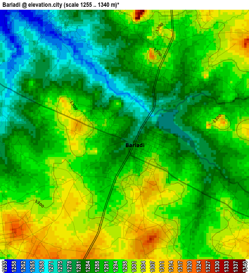
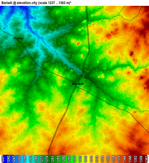
| \ | Map #1 | Map #2 | Topo.Map |
| Scale [m] | 1255..1340 m | 1237..1363 m | × |
| Scale [ft] | 4117..4396 ft | 4058..4472 ft | × |
| Average | 1291.5 m = 4237 ft | 1301.4 m = 4270 ft | × |
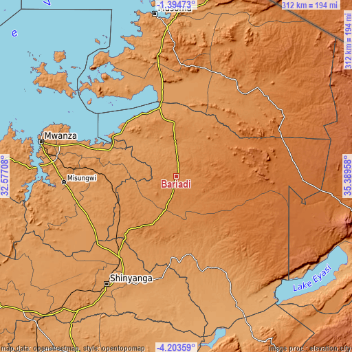
| Width | 9.76 km = 6.1 mi | 19.52 km = 12.1 mi | 312.3 km = 194.1 mi |
| Height | 9.76 km = 6.1 mi | 19.52 km = 12.1 mi | 312.3 km = 194.1 mi |
| ↑Max Latitude | -2.756106° | -2.712211° | -1.39473° |
| Latitude at center | -2.8° | -2.8° | -2.8° |
| ↓Min Latitude | -2.843892° | -2.887782° | -4.20359° |
| ← Min Longitude | 33.939385° | 33.895439° | 32.57708° |
| Longitude center | 33.98333° | 33.98333° | 33.98333° |
| →Max Longitude | 34.027275° | 34.071221° | 35.38958° |
Nearby cities:
Cities around Bariadi sort by population:
• Bunda elevation 1174 m
84.4 km,  351°
351°
• Somanda 1208 m
63.1 km,  183°
183°
• Kisesa 1351 m
36.5 km,  149°
149°
• Nyalikungu 1354 m
48.1 km,  207°
207°
• Ngudu 1246 m
74.5 km,  255°
255°
• Lalago 1176 m
72.4 km, 182°
• Maswa 1310 m
13 km,  0°
0°
• Kihangara 1186 m
74.4 km,  288°
288°
• Nyakabindi 1295 m
18.5 km, 0°
• Malampaka 1250 m
62.2 km,  233°
233°
• Malya 1245 m
55.7 km,  248°
248°
• Matonga 1281 m
47.6 km,  13°
13°
Multilingual:
 En español:
Bariadi elevación 1282 m.
 En France:
Bariadi élévation 1282 m.
 Auf Deutsch:
Bariadi höhe über dem Meeresspiegel ist 1282 m.

Sources and notes:
- [note 1] Map square and city borders are not equal. Map elevation data is calculated only from area inside that square.
- [src 1] Elevation data from geonames database provided with same terms of usage.
- [src 2] The elevation map of Bariadi is generated using elevation data from NASA's 3 arcsec (90m) resolution SRTM data.
- [src 3] Base (background) map © OpenStreetMap contributors tiles are generated by Geofabrik and OpenTopoMap.
Copyright & License:
This Bariadi Elevation Map is licensed under CC BY-SA. You may reuse any part from this page, if you give a proper credit by linking to this URL:
 More info on terms of use page.