Keelung elevation
Keelung (Taiwan), Taiwan elevation is 17 meters and Keelung elevation in feet is 56 ft above sea level [src 1]. Keelung is a seat of a second-order administrative division (feature code) with elevation that is 62 meters (203 ft) smaller than average city elevation in Taiwan.
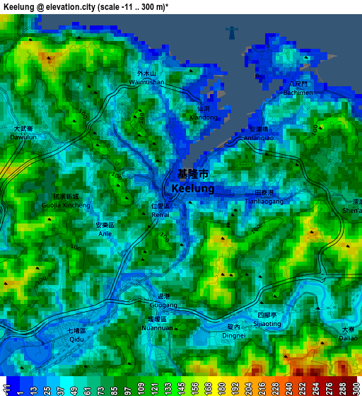
Below is the Elevation map of Keelung, which displays elevation range with different colors. Scale of the first map is from -11 to 300 m (-36 to 984 ft) with average elevation of 76.1 meters (=250 ft) [note 1]
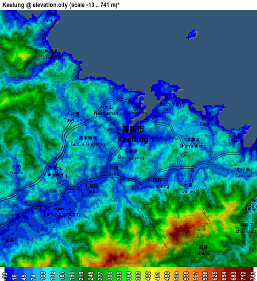
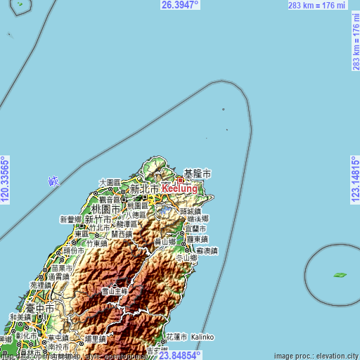
These maps also provides idea of topography and contour of this city, they are displayed at different zoom levels. More info about maps, scale and edge coordinates you can find below images.
| \ | Map #1 | Map #2 | Topo.Map |
| Scale [m] | -11..300 m | -13..741 m | × |
| Scale [ft] | -36..984 ft | -43..2431 ft | × |
| Average | 76.1 m = 250 ft | 160 m = 525 ft | × |
| Width | 8.85 km = 5.5 mi | 17.7 km = 11 mi | 283.1 km = 175.9 mi |
| Height | 8.85 km = 5.5 mi | 17.7 km = 11 mi | 283.1 km = 175.9 mi |
| ↑Max Latitude | 25.16803° | 25.207797° | 26.3947° |
| Latitude at center | 25.12825° | 25.12825° | 25.12825° |
| ↓Min Latitude | 25.088457° | 25.048651° | 23.84854° |
| ← Min Longitude | 121.697955° | 121.654009° | 120.33565° |
| Longitude center | 121.7419° | 121.7419° | 121.7419° |
| →Max Longitude | 121.785845° | 121.829791° | 123.14815° |
Nearby cities:
Cities around Keelung sort by population:
• Taipei elevation 10 m
23 km,  247°
247°
• Banqiao 12 m
30.4 km, 245°
• Hsinchu 22 m
85.9 km, 245°
• Taoyuan City 103 m
47.2 km, 251°
• Hualien City 13 m
128.8 km,  186°
186°
• Yilan 15 m
41.3 km,  178°
178°
• Daxi 125 m
53 km,  239°
239°
• Jiufen 287 m
10.5 km,  101°
101°
• Miaoli 53 m
111.9 km, 235°
• Zhubei 30 m
80.7 km, 246°
• Taoyuan 103 m
45.3 km, 250°
• Xindian 31 m
27.7 km,  227°
227°
Multilingual:
 En español:
Keelung elevación 17 m.
 En France:
Chilung élévation 17 m.


Sources and notes:
- [note 1] Map square and city borders are not equal. Map elevation data is calculated only from area inside that square.
- [src 1] Elevation data from geonames database provided with same terms of usage.
- [src 2] The elevation map of Keelung is generated using elevation data from NASA's 3 arcsec (90m) resolution SRTM data.
- [src 3] Base (background) map © OpenStreetMap contributors tiles are generated by Geofabrik and OpenTopoMap.
Copyright & License:
This Keelung Elevation Map is licensed under CC BY-SA. You may reuse any part from this page, if you give a proper credit by linking to this URL:
 More info on terms of use page.