Laventille elevation
Laventille (San Juan/Laventille), Trinidad and Tobago elevation is 28 meters and Laventille elevation in feet is 92 ft above sea level [src 1]. Laventille is a seat of a first-order administrative division (feature code) with elevation that is 9 meters (30 ft) smaller than average city elevation in Trinidad and Tobago.
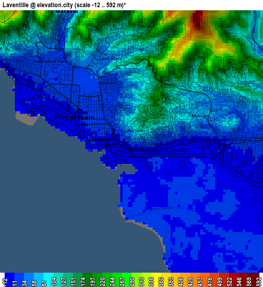
Below is the Elevation map of Laventille, which displays elevation range with different colors. Scale of the first map is from -12 to 592 m (-39 to 1942 ft) with average elevation of 77.7 meters (=255 ft) [note 1]
These maps also provides idea of topography and contour of this city, they are displayed at different zoom levels. More info about maps, scale and edge coordinates you can find below images.
| \ | Map #1 | Map #2 | Topo.Map |
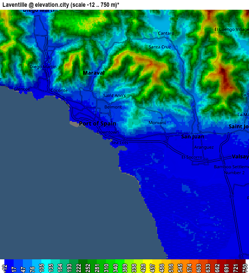
| Scale [m] | -12..592 m | -12..750 m | × |
| Scale [ft] | -39..1942 ft | -39..2461 ft | × |
| Average | 77.7 m = 255 ft | 128.9 m = 423 ft | × |
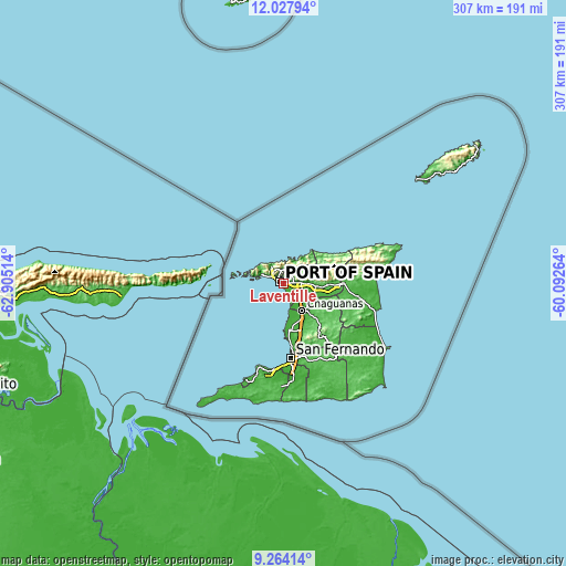
| Width | 9.6 km = 6 mi | 19.21 km = 11.9 mi | 307.3 km = 190.9 mi |
| Height | 9.6 km = 6 mi | 19.21 km = 11.9 mi | 307.3 km = 190.9 mi |
| ↑Max Latitude | 10.692355° | 10.735535° | 12.02794° |
| Latitude at center | 10.64917° | 10.64917° | 10.64917° |
| ↓Min Latitude | 10.605978° | 10.562781° | 9.26414° |
| ← Min Longitude | -61.542835° | -61.586781° | -62.90514° |
| Longitude center | -61.49889° | -61.49889° | -61.49889° |
| →Max Longitude | -61.454945° | -61.410999° | -60.09264° |
Nearby cities:
Cities around Laventille sort by population:
• Chaguanas elevation 18 m
17.3 km,  148°
148°
• Port of Spain 21 m
2.9 km,  311°
311°
• Arima 62 m
23.7 km,  93°
93°
• Marabella 7 m
38.6 km,  171°
171°
• Tunapuna 55 m
12 km, 88°
• Paradise 77 m
14.9 km, 88°
• Arouca 31 m
18.1 km,  97°
97°
• Petit Valley 66 m
7.7 km,  316°
316°
• Couva 15 m
25.4 km, 172°
• Mucurapo 3 m
4.4 km,  289°
289°
• Tabaquite 100 m
36.5 km,  142°
142°
• Diego Martin 61 m
10.8 km, 317°
Multilingual:
 En español:
Laventille elevación 28 m.
 En France:
Laventille élévation 28 m.
 Auf Deutsch:
Laventille höhe über dem Meeresspiegel ist 28 m.

Sources and notes:
- [note 1] Map square and city borders are not equal. Map elevation data is calculated only from area inside that square.
- [src 1] Elevation data from geonames database provided with same terms of usage.
- [src 2] The elevation map of Laventille is generated using elevation data from NASA's 3 arcsec (90m) resolution SRTM data.
- [src 3] Base (background) map © OpenStreetMap contributors tiles are generated by Geofabrik and OpenTopoMap.
Copyright & License:
This Laventille Elevation Map is licensed under CC BY-SA. You may reuse any part from this page, if you give a proper credit by linking to this URL:
 More info on terms of use page.