Seïada elevation
Seïada (Al Munastīr, Sayada Lamta Bouhjar), Tunisia elevation is 13 meters and Seïada elevation in feet is 43 ft above sea level [src 1]. Seïada is a populated place (feature code) with elevation that is 136 meters (446 ft) smaller than average city elevation in Tunisia.
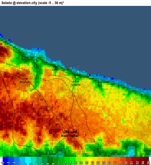
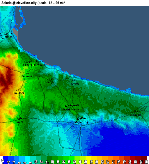
Below is the Elevation map of Seïada, which displays elevation range with different colors. Scale of the first map is from -5 to 36 m (-16 to 118 ft) with average elevation of 20.7 meters (=68 ft) [note 1]
These maps also provides idea of topography and contour of this city, they are displayed at different zoom levels. More info about maps, scale and edge coordinates you can find below images.
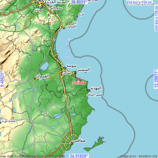
| \ | Map #1 | Map #2 | Topo.Map |
| Scale [m] | -5..36 m | -12..96 m | × |
| Scale [ft] | -16..118 ft | -39..315 ft | × |
| Average | 20.7 m = 68 ft | 19.9 m = 65 ft | × |
| Width | 7.94 km = 4.9 mi | 15.88 km = 9.9 mi | 254 km = 157.8 mi |
| Height | 7.94 km = 4.9 mi | 15.88 km = 9.9 mi | 254 km = 157.8 mi |
| ↑Max Latitude | 35.704563° | 35.74024° | 36.8031° |
| Latitude at center | 35.66887° | 35.66887° | 35.66887° |
| ↓Min Latitude | 35.633161° | 35.597436° | 34.51829° |
| ← Min Longitude | 10.848515° | 10.804569° | 9.48621° |
| Longitude center | 10.89246° | 10.89246° | 10.89246° |
| →Max Longitude | 10.936405° | 10.980351° | 12.29871° |
Nearby cities:
Cities around Seïada sort by population:
• Monastir elevation 20 m
13.5 km,  333°
333°
• Skanes 26 m
15.2 km, 326°
• Djemmal 30 m
13.3 km,  247°
247°
• Ksar Hellal 27 m
2.4 km,  184°
184°
• Bekalta 3 m
10.9 km,  121°
121°
• Banbalah 20 m
9 km,  292°
292°
• Ksibet el Mediouni 31 m
4.9 km, 292°
• Beni Hassane 51 m
13.6 km,  213°
213°
• Touza 35 m
7 km,  237°
237°
• Lemta 22 m
0.9 km, 253°
• Sidi Ben Nour 9 m
15.2 km,  171°
171°
• Mesdour 21 m
15 km,  275°
275°
Multilingual:
 En español:
Seïada elevación 13 m.
 En France:
Sayada élévation 13 m.


Sources and notes:
- [note 1] Map square and city borders are not equal. Map elevation data is calculated only from area inside that square.
- [src 1] Elevation data from geonames database provided with same terms of usage.
- [src 2] The elevation map of Seïada is generated using elevation data from NASA's 3 arcsec (90m) resolution SRTM data.
- [src 3] Base (background) map © OpenStreetMap contributors tiles are generated by Geofabrik and OpenTopoMap.
Copyright & License:
This Seïada Elevation Map is licensed under CC BY-SA. You may reuse any part from this page, if you give a proper credit by linking to this URL:
 More info on terms of use page.