Gharavŭtí elevation
Gharavŭtí (Khatlon), Tajikistan elevation is 393 meters and Gharavŭtí elevation in feet is 1289 ft above sea level [src 1]. Gharavŭtí is a populated place (feature code) with elevation that is 561 meters (1841 ft) smaller than average city elevation in Tajikistan.
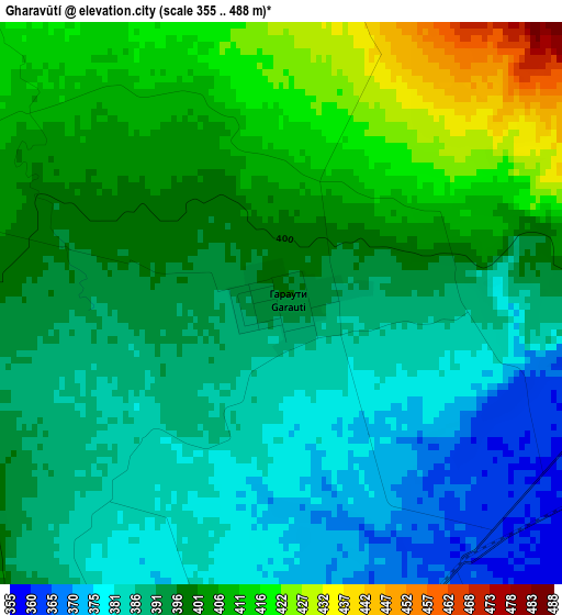
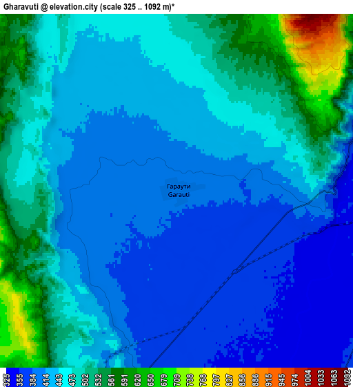
Below is the Elevation map of Gharavŭtí, which displays elevation range with different colors. Scale of the first map is from 355 to 488 m (1165 to 1601 ft) with average elevation of 395.6 meters (=1298 ft) [note 1]
These maps also provides idea of topography and contour of this city, they are displayed at different zoom levels. More info about maps, scale and edge coordinates you can find below images.
| \ | Map #1 | Map #2 | Topo.Map |
| Scale [m] | 355..488 m | 325..1092 m | × |
| Scale [ft] | 1165..1601 ft | 1066..3583 ft | × |
| Average | 395.6 m = 1298 ft | 452.6 m = 1485 ft | × |
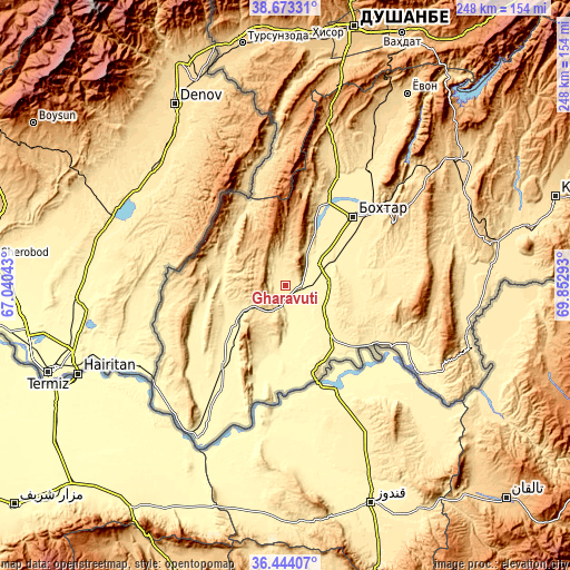
| Width | 7.75 km = 4.8 mi | 15.49 km = 9.6 mi | 247.9 km = 154 mi |
| Height | 7.75 km = 4.8 mi | 15.49 km = 9.6 mi | 247.9 km = 154 mi |
| ↑Max Latitude | 37.601855° | 37.636663° | 38.67331° |
| Latitude at center | 37.56703° | 37.56703° | 37.56703° |
| ↓Min Latitude | 37.532189° | 37.497332° | 36.44407° |
| ← Min Longitude | 68.402735° | 68.358789° | 67.04043° |
| Longitude center | 68.44668° | 68.44668° | 68.44668° |
| →Max Longitude | 68.490625° | 68.534571° | 69.85293° |
Nearby cities:
Cities around Gharavŭtí sort by population:
• Qŭrghonteppa elevation 430 m
41.8 km,  44°
44°
• Moskovskiy 368 m
12.7 km,  68°
68°
• Kolkhozobod 393 m
18.8 km,  82°
82°
• Vakhsh 431 m
37.9 km,  64°
64°
• Shahritus 367 m
43.5 km,  218°
218°
• Dŭstí 387 m
31 km,  141°
141°
• Orzu 415 m
32.9 km,  91°
91°
• Jilikŭl 353 m
11.2 km, 138°
• Boshchorbogh 427 m
28.6 km,  259°
259°
• Tartiki 436 m
27.7 km,  273°
273°
• Ismoili Somoní 423 m
38.3 km,  54°
54°
• Qubodiyon 402 m
28.9 km,  232°
232°
Multilingual:
 En español:
Gharavŭtí elevación 393 m.
 En France:
Gharavŭtí élévation 393 m.
 Auf Deutsch:
Gharavŭtí höhe über dem Meeresspiegel ist 393 m.

Sources and notes:
- [note 1] Map square and city borders are not equal. Map elevation data is calculated only from area inside that square.
- [src 1] Elevation data from geonames database provided with same terms of usage.
- [src 2] The elevation map of Gharavŭtí is generated using elevation data from NASA's 3 arcsec (90m) resolution SRTM data.
- [src 3] Base (background) map © OpenStreetMap contributors tiles are generated by Geofabrik and OpenTopoMap.
Copyright & License:
This Gharavŭtí Elevation Map is licensed under CC BY-SA. You may reuse any part from this page, if you give a proper credit by linking to this URL:
 More info on terms of use page.