Bueng Kan elevation
Bueng Kan (Changwat Bueng Kan), Thailand elevation is 160 meters and Bueng Kan elevation in feet is 525 ft above sea level [src 1]. Bueng Kan is a seat of a first-order administrative division (feature code) with elevation that is 35 meters (115 ft) bigger than average city elevation in Thailand.
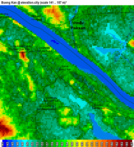
Below is the Elevation map of Bueng Kan, which displays elevation range with different colors. Scale of the first map is from 141 to 187 m (463 to 614 ft) with average elevation of 155.8 meters (=511 ft) [note 1]
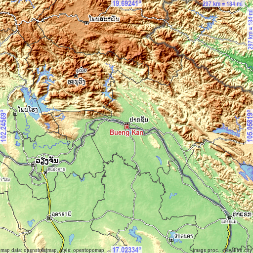
These maps also provides idea of topography and contour of this city, they are displayed at different zoom levels. More info about maps, scale and edge coordinates you can find below images.
| \ | Map #1 | Map #2 | Topo.Map |
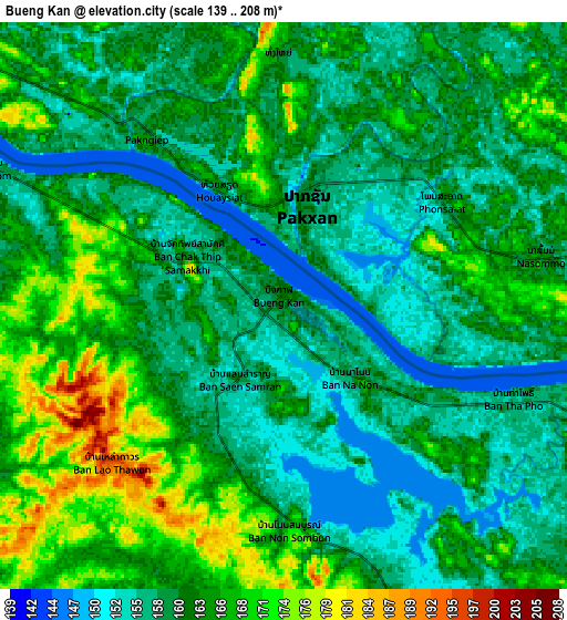
| Scale [m] | 141..187 m | 139..208 m | × |
| Scale [ft] | 463..614 ft | 456..682 ft | × |
| Average | 155.8 m = 511 ft | 161.6 m = 530 ft | × |
| Width | 9.27 km = 5.8 mi | 18.55 km = 11.5 mi | 296.8 km = 184.4 mi |
| Height | 9.27 km = 5.8 mi | 18.55 km = 11.5 mi | 296.8 km = 184.4 mi |
| ↑Max Latitude | 18.404733° | 18.446425° | 19.69241° |
| Latitude at center | 18.36303° | 18.36303° | 18.36303° |
| ↓Min Latitude | 18.321317° | 18.279595° | 17.02334° |
| ← Min Longitude | 103.607995° | 103.564049° | 102.24569° |
| Longitude center | 103.65194° | 103.65194° | 103.65194° |
| →Max Longitude | 103.695885° | 103.739831° | 105.05819° |
Nearby cities:
Cities around Bueng Kan sort by population:
• Seka elevation 158 m
58 km,  146°
146°
• Bueng Khong Long 181 m
61.1 km,  136°
136°
• Kham Ta Kla 165 m
57.9 km,  168°
168°
• Ban Muang 161 m
57.6 km,  188°
188°
• Fao Rai 186 m
53.1 km,  223°
223°
• Rattanawapi 178 m
52.6 km,  251°
251°
• So Phisai 173 m
38.7 km,  214°
214°
• Phon Charoen 167 m
37.4 km, 170°
• Pak Khat 166 m
37.2 km,  260°
260°
• Pakkhat 173 m
37.1 km, 258°
• Bung Khla 155 m
34.7 km,  101°
101°
• Si Wilai 175 m
22.5 km, 153°
Multilingual:
 En español:
Bueng Kan elevación 160 m.
 En France:
Bueng Kan élévation 160 m.
 Auf Deutsch:
Bueng Kan höhe über dem Meeresspiegel ist 160 m.

Sources and notes:
- [note 1] Map square and city borders are not equal. Map elevation data is calculated only from area inside that square.
- [src 1] Elevation data from geonames database provided with same terms of usage.
- [src 2] The elevation map of Bueng Kan is generated using elevation data from NASA's 3 arcsec (90m) resolution SRTM data.
- [src 3] Base (background) map © OpenStreetMap contributors tiles are generated by Geofabrik and OpenTopoMap.
Copyright & License:
This Bueng Kan Elevation Map is licensed under CC BY-SA. You may reuse any part from this page, if you give a proper credit by linking to this URL:
 More info on terms of use page.